Whether the road is a highway or a dirt track, driving tours are one of the most popular ways to experience our incredible National Forests. Thanks to support from Ford’s Bronco Wild Fund, the NFF is helping ensure our National Forests stay beautiful and healthy for all users of our public lands. Through this blog series, we’re highlighting just a few of the incredible routes Bronco owners and all drivers can take to connect with their National Forests. Remember to know before you go by checking with local managing agencies for updates and restrictions. When going off-highway, keep to designated OHV routes to limit impacts on water resources and wildlife habitat. And consider planting trees with the NFF to help offset the carbon footprint of your trip: planting two trees can mitigate 1 ton of CO2 over the trees’ lifetime!
About the Route
Route Distance: ~27 miles
Suggested Duration: 1.5-2 hours
Nearest Cities: Sault Ste. Marie, MI, Detroit, MI;
Starting Point: Where Lakeshore Drive begins at Brimley State Park.
Ending Point: Intersection with M-123 outside Paradise
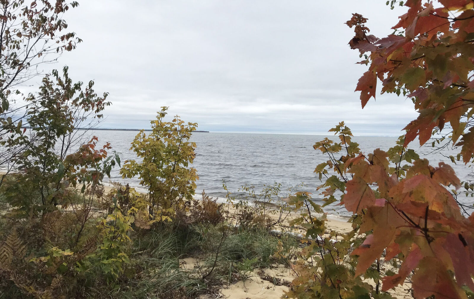
This two-lane road along the shore of Lake Superior in Michigan’s Upper Peninsula is considered one of the prettiest drives in the state, no matter the season. The Whitefish Bay National Forest Scenic Byway leads westward through the Hiawatha National Forest’s birch woodlands mixed with cedar and white pines, past the sandy beaches of Whitefish Bay. It passes close to other Upper Peninsula sights worth stopping for, and runs parallel to the great North Country National Scenic Trail. At 4,700 miles, it’s the longest in the National Trails System, traversing eight states from North Dakota all the way to Vermont.
First established in the 1930s, the Hiawatha National Forest continually upgrades the road, which now boasts plenty of turnouts and parking to stop for a swim or hike.
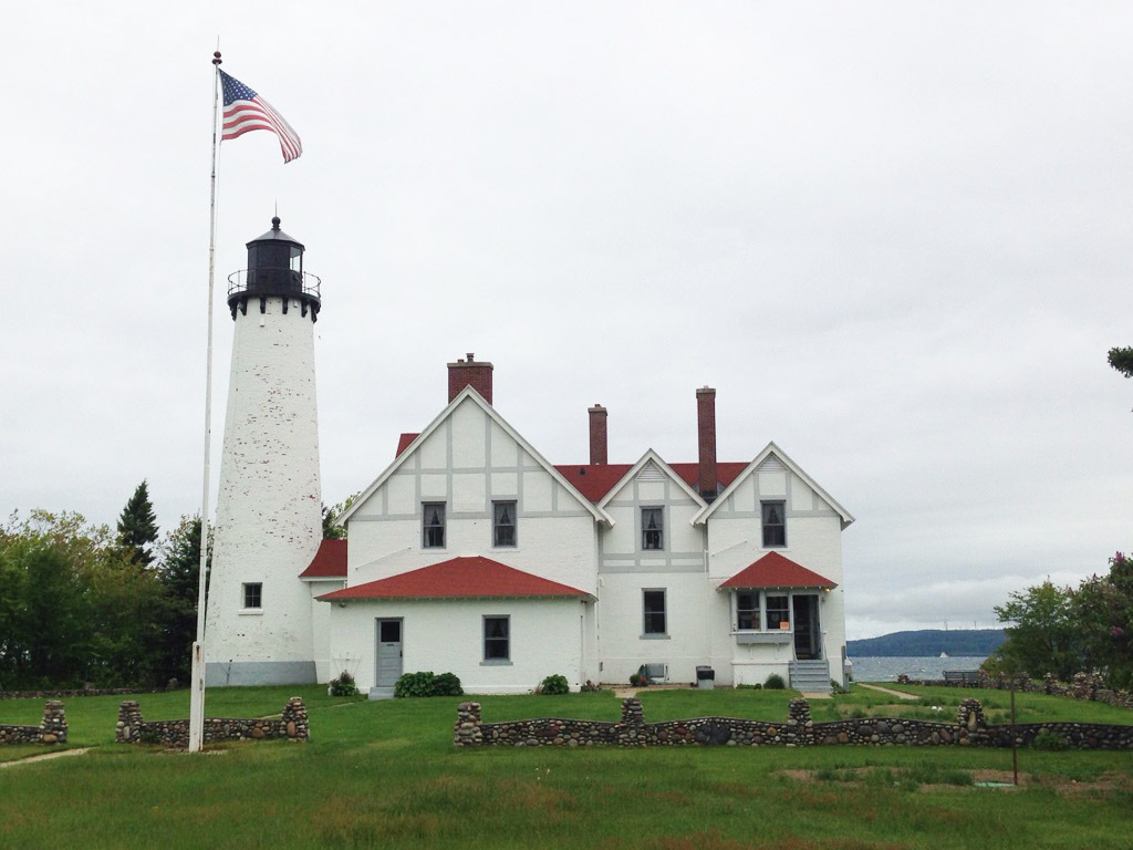
Point Iroquois Lighthouse
Since 1620, when the first recorded white men came to the area, the point became an important landmark to French explorers, fur trappers and missionaries who established the first white settlement, Sault Ste. Marie, in what became known as Michigan. The Point Iroquois Lighthouse, with views toward Lake Superior’s Canadian shore, was built in 1870 to mark the division between Whitefish Bay and the Saint Mary’s River, guiding boats in and out of the Soo Locks, known as “the lynchpin of the Great Lakes”, for over a century. It gained its name from the Iroquois warriors massacred on this site by the Ojibwe in 1662. The 65-foot tall tower no longer operates, but as a site on the National Register of Historic Places, it’s open to the public for tours.
Bay View
This rustic campground, eight miles beyond Brimley along the byway, offers a sandy beach with opportunities for fishing, boating, swimming, birding, and hiking, along with single-family campsites.
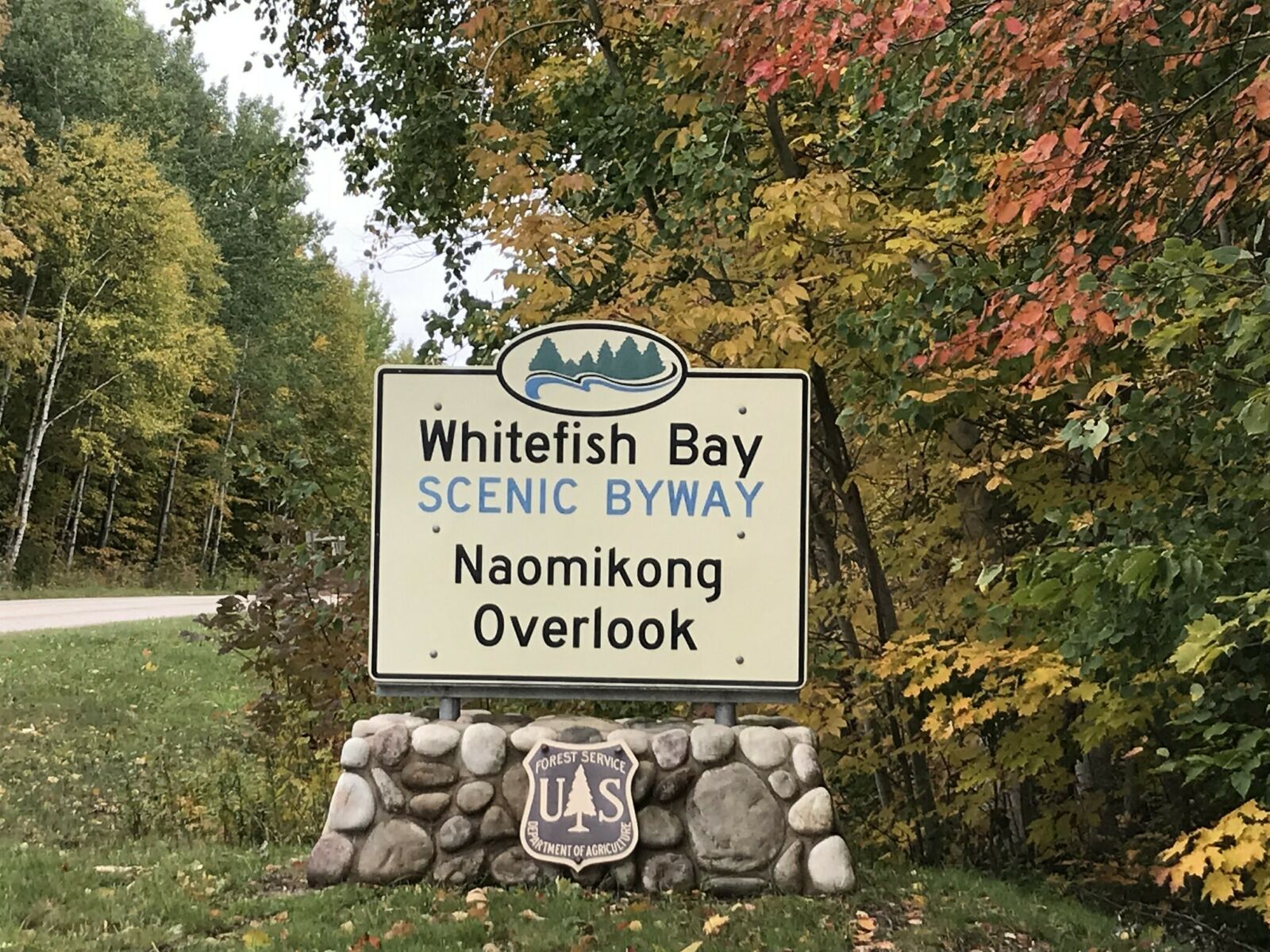
Naomikong Point
Stretch your legs with this 3.4-mile-long trail that connects to the North Country National Scenic Trail, although it’s less trafficked. It features a suspension bridge over Naomikong Creek and heads to an overlook of Lake Superior. The parking area also includes a lovely picnic spot.
Tahquamenon Falls
Although the Whitefish Bay National Forest Scenic Byway officially ends just outside of Paradise, it’s worth driving another 15 minutes to Tahquamenon Falls. Tahquamenon, in the eastern part of Michigan’s Upper Peninsula, is Michigan’s second-largest state park, encompassing five separate campgrounds with over 350 campsites and 22 miles of hiking trails—including a portion of the North Country National Scenic Trail. Tahquamenon Falls, with upper and lower falls, are sometimes called “Root Beer Falls” due to running brown from the tannins draining a cedar swamp upriver. They’re the most voluminous vertical waterfalls east of the Mississippi after Niagara Falls; during spring runoff, they pump 50,000 gallons per second over a 50-foot drop. They’re said to have inspired Longfellow’s poem “The Song of Hiawatha.”