The early evening winter light had faded to dusk. Snow started to fall in light fluffy flakes. John, Aaron and I huddled together under a small stand of trees. We’d spent the day skiing on the Bitterroot National Forest and were ready to get back to the car. Unfortunately, we’d pushed the day too far and the falling darkness made it impossible to tell exactly which direction we needed to go. We weren’t lost, but we weren’t con dent we knew where to go.
I pulled out my cell phone. Of course, we didn’t have reception, but I wasn’t planning to call for a rescue. My cold fingers worked the phone, and in a moment, we knew precisely where we were and how to get back to the car. A $20 app turned my phone into a sophisticated GPS unit, and an hour later we skidded to a stop at Aaron’s car.
New technologies, like GPS apps, are rapidly changing how we enjoy our public lands. From booking campsites online to apps and websites that detail hikes, runs, rides and climbs, outdoor recreation is more accessible than it has ever been.
Trick Out Your phone
Curious where to hike this weekend? Want to know how far you rode your mountain bike? Interested in that bird or plant? There’s an app for that.
GPS
One of the best ways to add some safety to your next trip outdoors is through a mapping app that turns your smart phone into a GPS unit. By downloading topographic maps in advance of your trip (while still on wifi), these apps will display your precise location, way points, tracks you’ve set and any routes you’ve uploaded on the screen’s digital map even if you don’t have cell service. One of my favorite uses is the route function which allows me to accurately plot how long a hike, ride or paddle will be well before I actually hit the trailhead or put in.
Of course, relying only on your phone as a map is foolhardy, but combining a GPS mapping app with a tried-and-true paper map can make navigation a lot easier if darkness falls or you’re navigating off trail.
Added bonus, many of the apps track elevation gain and loss and a host of other useful metrics. My favorite is Gaia (iOS and Android, $20), but there are many options.
Field Guides
I used to pack several field guides for any given hike: a guide for animal tracks, one for birds, one for plants, one for mushrooms…you get the idea. These days, lighten your load and simply download field guide apps. Some, like LeafSnap (iOS, free), allow you to snap a photo of a leaf which it will then identify.
Be sure to learn how to use the app before you’re in the field. Do you have to download specific datasets for use off‑line? Is the free version limited to just a couple dozen species? Are there social sharing options so you can let all your friends know you just saw a western tanager? Generally paid apps offer the most information and functionality.
Trails, Rides, Climbs and More
Apps like AllTrails (iOS and Android, free), MTB Project (iOS and Android, free), and Trail Run Project (iOS and Android, free) offer both curated and user-generated information on trails and other recreational pursuits. Some, like MTB Project, are sport-specific (mountain biking in this case), while others, like Bivy (iOS, Android coming soon, free), are multi-sport. Many allow you to connect with friends and other users and to comment on the trail, paddle or climb you just completed. Some also have in-app purchases, which increase functionality or allow you to download and print maps at home.
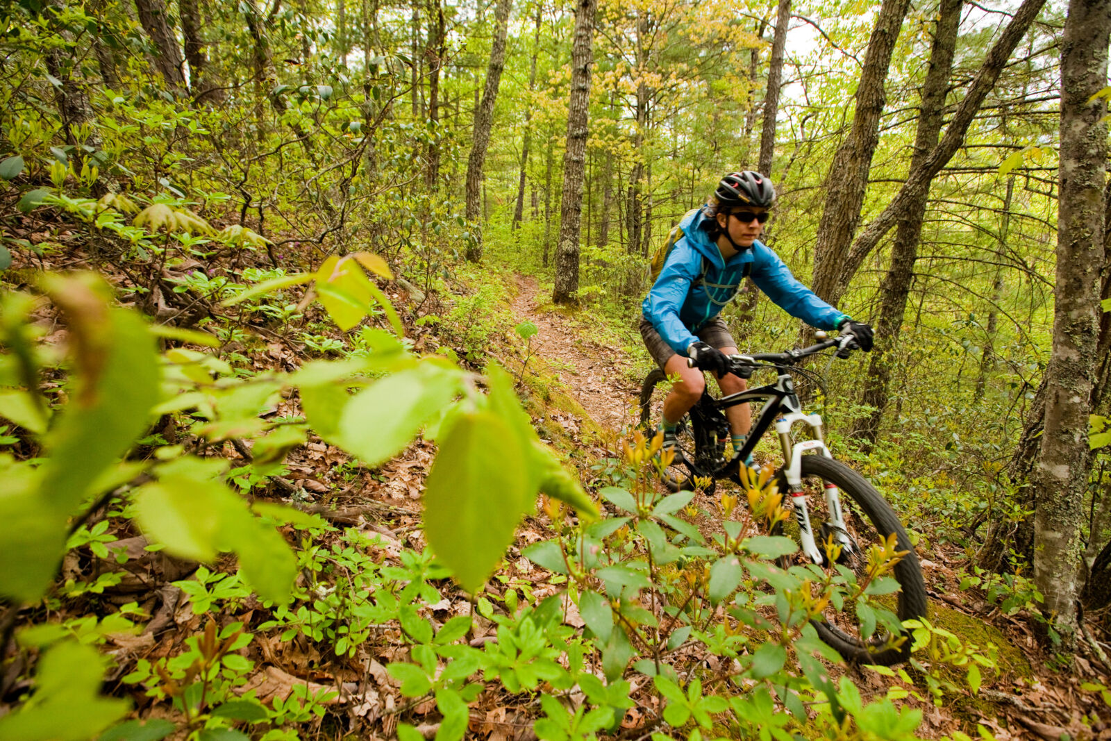
Photo courtesy of Leslie Kehmeier, IMBA
Get Social
Want to share your adventures with like-minded explorers? Apps like Yonder (iOS and Android, free) connect users to communities who share the same passions. The Outbound Collective’s app, Outbound (iOS, free), allows users to browse and save trip ideas to a list, share experiences and even submit a trip write up for others to enjoy.
These apps are useful, but they are not fail safe! It’s critical to bring extra power, fresh batteries or a solar charger if you’re going to be using these apps for long days in the field. Most importantly, none of them replaces the 10 Essentials that every outdoorist should bring on every adventure, big or small. Having an app that explains how to bandage a bad scrape isn’t very useful if you don’t have a first-aid kit with you. All this to say, have fun experimenting with these apps but use common sense and be prepared.
The World Wide Web
The internet has broadly impacted how we recreate outside. Online campsite booking sites allow you to be sure you’ll have a spot to pitch your tent for the night (if you plan in advance). Inspiration and new trip ideas are a Google search away, while YouTube and Google Earth can give you a feel for the terrain you’ll be encountering.
Get Inspired
Outdoor sites like Outdoorproject.com and RootsRated.com offer reliable and ground-truthed information from paid contributors. Gear manufacturers like Marmot and Outdoor Research have blogs that are loaded with trip stories and adventure ideas and even humorous essays like “The Ski Bro’s Guide to Dating.”
Book a Campsite
Sites like Recreation.gov and ReserveAmerica.com offer online camping reservation options for all federally managed lands (downside—there’s usually an additional fee to book online; upside— you can pull in at 9:00 pm knowing that you’ll have a site).
State parks and local public lands typically offer online booking options as well. A simple Google search should turn up all the info you need for booking your night under the stars. Hipcamp.com is a new web-based campsite finder that combs public and private campsites to give you loads of options. If you have some space and want to host campers, you can sign up on the site for that too.
Maps, Maps, Maps
The U.S. Forest Service recently updated its interactive visitor map (www.fs.fed.us/ivm/index.html), which provides a wealth of information on roads, trails, rivers, campgrounds and cabins. Through a partnership with Yonder and geo-located Forest Service Twitter feeds that automatically populate the map, you can get up-to-minute data on where you’re interested in exploring. National Geographic maps have long been the go-to choice for the outdoorsy set. This summer, the venerable organization started offering free 7.5 minute topo maps that have been formatted to print at home on standard printer paper. These are the same USGS maps that NatGeo has been selling for decades, so you know the details are as accurate as they can be. Visit natgeomaps.com/trail-maps/pdf-quads to print out maps for your next trip.
Get a Peek Before You Go
Google Earth is a great resource for learning what type of terrain you’ll be encountering, for plotting a route through said terrain, or for seeing if the road that’s on the map is actually on the forest. Recent updates to Google Earth imagery provide improved detail and function, which makes it even better for researching your next outdoor adventure.
YouTube is another great tool for researching your next trip. Even though some of the videos are poorly edited GoPro footage, they can help you pick the right line on a paddle trip or glean other snippets of info that will make your trip safer and more fun. YouTube is definitely a “buyer beware” spot for sourcing data. Just because a YouTuber labelled their video as coming from a particular place, doesn’t mean that it’s actually from that place.
Staying in Touch Means Staying Safe
Backcountry adventuring always involves risk. But today’s communications tools provide some assurance that if a real emergency strikes, you can summon life-saving help. Satellite phones have been around for a long time, but they’ve long been cost-prohibitive and bulky. Fortunately there are new technologies that make keeping in touch much easier.
DeLorme’s inReach device allows users to send up to 160-character text messages to cell phones or email addresses from anywhere in the world (text messages may vary by country, email works globally). It also allows users to send SOS messages with GPS coordinates from anywhere on earth. With additional functionality like tracking, a companion app and the ability to receive up-to-date weather forecasts, the inReach is a compelling new product that adds a significant margin of safety for backcountry explorers. Importantly, inReach does require a subscription to a satellite communication service, but there are yearly or monthly plans to provide exibility for users. The inReach starts at about $300, a bit pricey, but well below the cost of a rescue.
SPOT offers a simple and fairly inexpensive device called the SPOT GEN3 ($150) that allows users to send one-way, pre-programmed messages to cell phones or email addresses, tracks and uploads your coordinates to Google maps, and sends both emergency SOS and “assistance needed” calls to rescue agencies or friends and family. SPOT also offers a $500 satellite phone that has even more advanced capabilities. Like the inReach, the SPOT devices require a service plan, but the peace of mind these devices offers is priceless.
We’d have to devote an entire issue of Your National Forests to cover all of the apps, maps and other new resources available to outdoor enthusiasts. We aren’t endorsing any of these in particular, but we are endorsing the idea of being prepared. Build some redundancy into your plans and gear when you head out. Always let someone know your route and when you expect to be back. No amount of technology can supplant good thinking, good planning and common sense.
My ski day with Aaron and John could have turned nasty, but I had made sure to download the map layers I needed before we headed out, had monitored my battery use all day and knew how to use the app efficiently. Did we push it a bit far? Yes. Did we have the tools and resources to get home if darkness fell? We sure did.