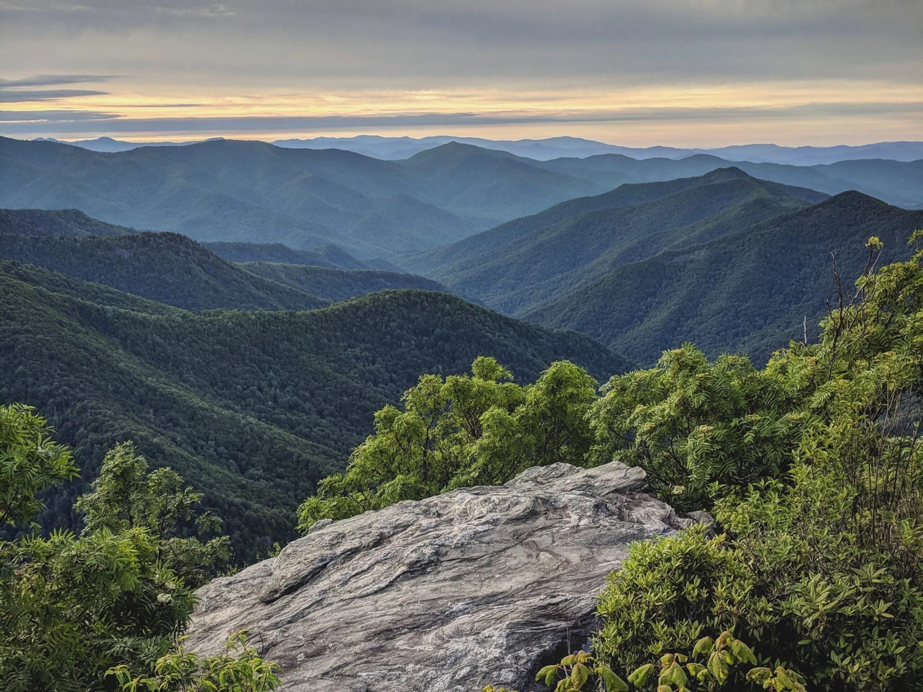
Asheville is known for its robust culinary and beer scene, but the small southern town is surrounded by the Pisgah National Forest, making it the ideal gateway community for exploring some of the area’s signature features. Here are five bucket list destinations within the Pisgah National Forest that are within an hour from Asheville.
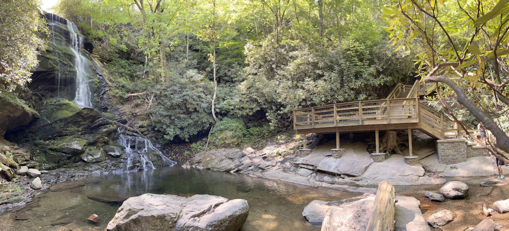
Catawba Falls, Grandfather Ranger District, Pisgah National Forest
Catawba Falls is tough to take in all at once. The multi-tiered waterfall tumbles over a lush cliff in a series of vertical drops and cascades, gathering in small pools and ledges during its 150-foot length. The heavy annual rainfall and mature forest canopy has led to a spray-cliff ecosystem at the waterfall, giving the entire scene a tropical vibe. The Catawba Falls Trail was severely impacted during Hurricane Helene in September, 2024, but the U.S. Forest Service has worked hard to reconstruct the trail leading to the falls. Show up in the summer to enjoy the Catawba River and this waterfall to its fullest.
Access: Find Catawba Falls 30 minutes east of Asheville. The three-mile out and back hike begins at the Catawba Falls Trailhead, near Old Fort. While the trail has been reconstructed, restoring access to the falls, a viewing platform that was damaged in the storm has yet to be repaired.

Looking Glass Rock, Pisgah Ranger District, Pisgah National Forest
The 3,969-foot Looking Glass Rock isn’t like other mountains in the Southern Appalachians. It’s a granite dome with a sheer, gray rock face, jutting out of the forest below like a beacon attracting hikers and rock climbers.
Hikers can climb the Looking Glass Rock Trail, which ascends 1,600 feet through a mountainside of ferns and rhododendrons to the summit, where you’ll get a long-range view of the surrounding green peaks from the edge of the sloping dome. Rock climbers have a bevy of multi-pitch routes to choose from that ascend the 400-foot rock face to the summit. Fall or Spring are the best seasons for rock climbers, but hikers will enjoy this adventure year-round.
Access: Find the Looking Glass Rock Trailhead off of FS 475, outside of Brevard. Looking Glass Rock Trail is a 6.5-mile out and back hike.
Black Balsam Knob, Pisgah Ranger District, Pisgah National Forest
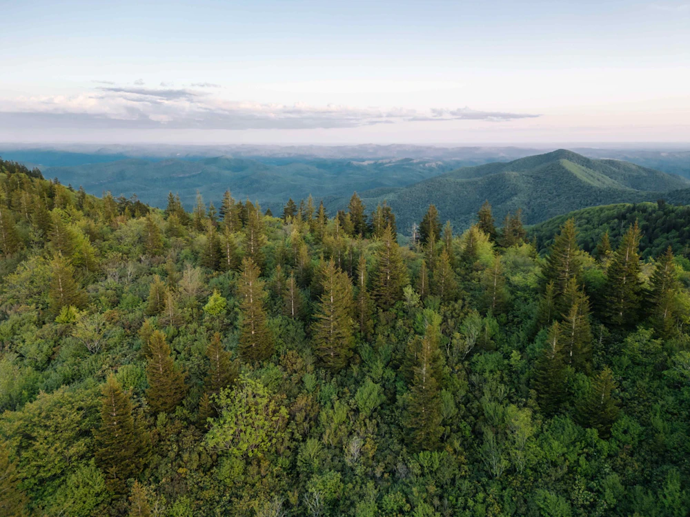
The majority of peaks in the Southern Appalachians are covered in hardwood and evergreen forests, but the summit of 6,214-foot Black Balsam Knob is completely treeless, offering 360-degree views of the surrounding area. A choice piece of the 32-mile Art Loeb Trail crosses the peak on a well-defined singletrack path through short shrubs giving hikers continuous views. Explore Black Balsam in the summer for the best weather and the chance to pick wild blueberries and blackberries in the meadows surrounding the knob.
Access: The trailhead for Black Balsam is located off of milepost 420 on the Blue Ridge Parkway. Much of the Parkway was damaged by Hurricane Helene, but the section between Highway 151 and Black Balsam is open. Pick up the Art Loeb Trail for a 1.4-mile out and back to the summit, or connect it with other trails for longer loops through the high-elevation playground.
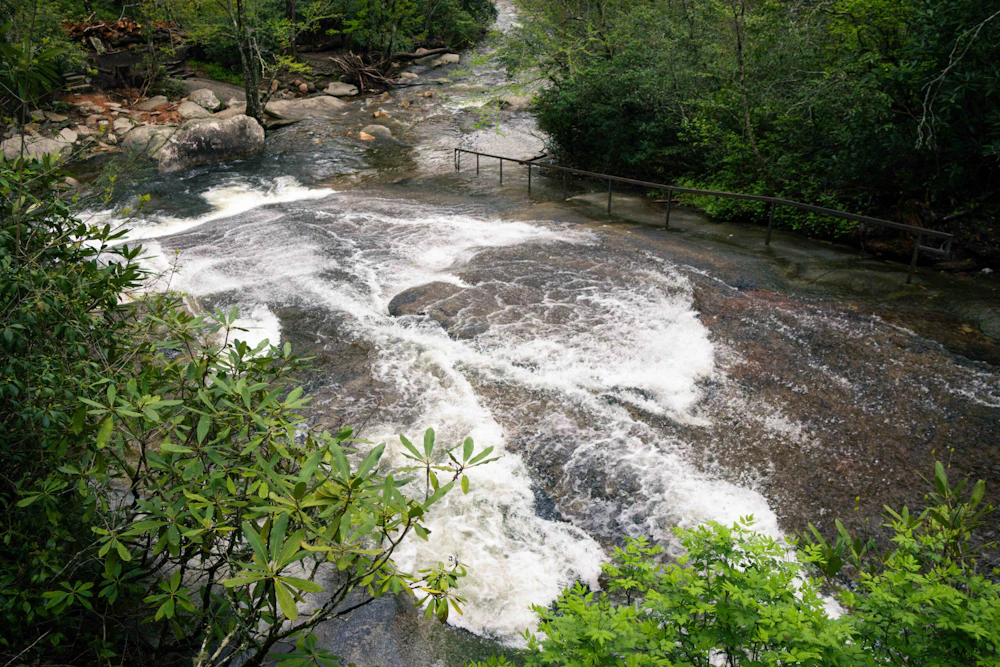
Sliding Rock Recreation Area, Pisgah Ranger District, Pisgah National Forest
There are waterfalls, and there are swimming holes, and then there’s Sliding Rock, which combines the two into one perfect summer adventure. Here, Looking Glass Creek cruises over a smooth, sloped 60-foot slab of granite before dropping into a deep pool of water, forming a natural waterslide. Obviously, you want to hit this splash zone during summer. July and August promise the hottest days, but be prepared; the water will be cold regardless of the time of year.
Access: Sliding Rock can be reached via Highway 276 between Waynesville and Brevard. The water feature is a short walk from the parking lot. There’s a $5 user fee, and a lifeguard on duty between Memorial Day and Labor Day.

Appalachian Trail and Max Patch, Appalachian District, Pisgah National Forest
The Appalachian Trail (A.T.) might be the most famous footpath in the world, running for 2,197 miles from North Georgia to Maine. A beautiful section of this long trail crosses Max Patch, a 4,629-foot grassy bald near the small town of Hot Springs, giving day hikers a chance to experience the A.T. without spending six months living on the trail. Summer is a great time to hike this short section, as Max Patch’s grassy summit is often covered in wildflowers. Or show up in the winter, and you can sled the sloping bald after heavy snowfall.
Access: Pick up the A.T. at the gravel parking lot off of Max Patch Road outside of Hot Springs. You can form a 1.5-mile loop by combining a short section of the A.T. and spur trails.
Practicing responsible recreation is important whenever you visit a National Forest, but it’s imperative when you’re exploring a bucket list destination that receives more than its fair share of attention. Stay on designated trails and don’t pick wildflowers or remove rocks as souvenirs. Pack out whatever you pack in, and be kind to others you see in the wild. We’re all out here enjoying our National Forests together.
About the Author
Graham Averill is a freelance writer living in Asheville, North Carolina. He writes regularly for Outside and Men’s Journal, among other publications. He spends as much time as he can in Pisgah National Forest, but it’s never enough.
Cover photo of the Pisgah National Forest by Jamie Nice.

Our Forests Need Us Today.
Your donation powers critical, on-the-ground conservation—from wildfire recovery to watershed restoration—protecting forests for the future.

