
Experience the San Bernardino National Forest, nearly 700,000 acres spanning desert chaparral to alpine peaks of the San Bernardino and San Jacinto mountain ranges in southern California. From 2,000 feet in the desert foothills to more than 11,000 feet at the summit of San Gorgonio Mountain, the highest peak in Southern California, the forest’s elevation range creates a patchwork of climates and vegetation zones.
The San Bernardino National Forest has eight designated Wilderness Areas: San Gorgonio, Cucamonga, Cahuilla Mountain, San Jacinto, South Fork Jacinto, Sheep Mountain, Santa Rosa, and Bighorn Mountain. Also within the forest is the Sand to Snow National Monument, centered on 11,500-foot San Gorgonio Mountain, and the Santa Rosa and San Jacinto Mountains National Monument, where mountains rise abruptly from the desert floor to an elevation of 10,834 feet at the top of Mount San Jacinto.
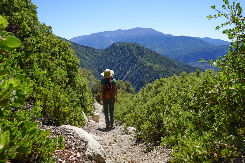
With more than 300 miles of trail for hiking and backpacking, many of which are open to biking and horseback riding, there’s no shortage of short to multiday adventures available. Whether you choose to fish along a wild trout stream or from a fully accessible pier, there are miles of streams and several reservoirs where you can cast your line. The forest is also one of the region’s best places for off-roading. In winter, Bear Mountain Ski Resort offers downhill skiing alongside the forest’s cross-country ski and snowmobile trails.
In addition to its recreational value, the San Bernardino National Forest plays a significant role in protecting watersheds that supply water to millions of Southern California residents. Its streams, springs, and reservoirs are essential resources in a region where water is often scarce.
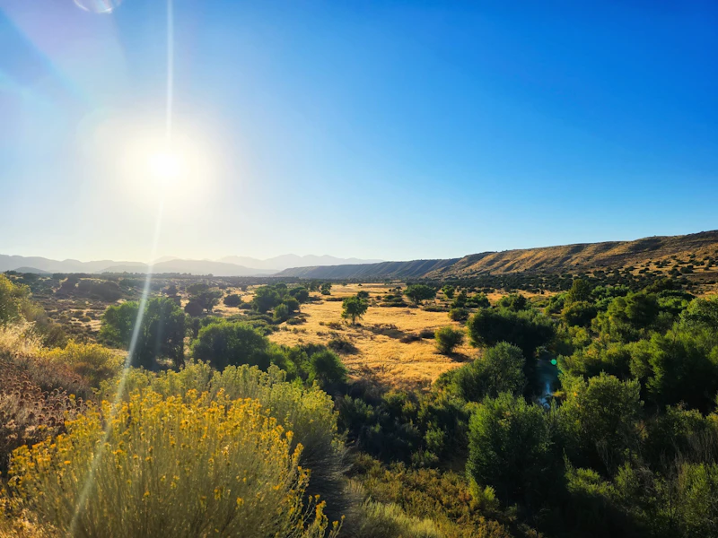 Photo by Fabiola Jordan
 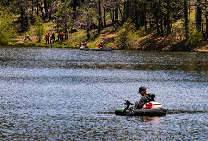 Jenks Lake. Photo by Michael Rohde
 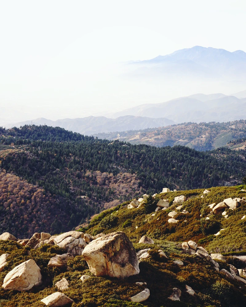 Photo by Nick Lanham
 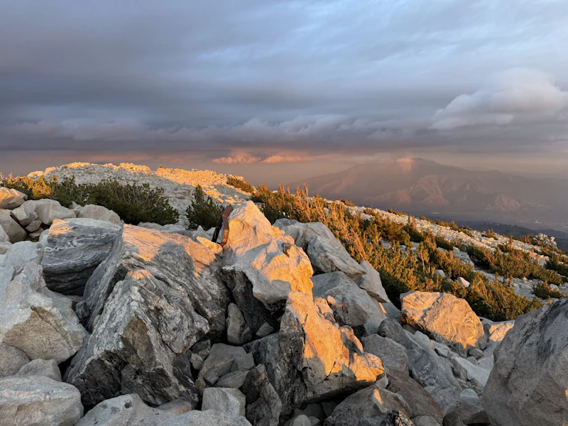 Photo by Erik Ireland
  Photo by Max Okun
 What is the History of the San Bernardino National Forest?
The 10,624-foot San Bernardino Peak provided the initial point in 1852 from which all Southern California was surveyed and subsequently mapped. Before Spanish arrival and then California’s statehood in the mid-19th century, the region was home to Native American peoples—primarily the Serrano, Cahuilla, and Luiseño tribes—whose presence in the mountains dates back thousands of years.
In 1893, President Benjamin Harrison established the San Bernardino Forest Reserve to safeguard watersheds that supplied the rapidly growing Southern California region. In 1907, the reserve officially became the San Bernardino National Forest.

How to Get to the San Bernardino National Forest
The San Bernardino National Forest is in the backyard of multiple large southern California cities, including San Bernardino, just 10 miles south.
One of the main access routes is Interstate 10, which runs east–west across the San Bernardino Valley. From I-10, Interstate 215 and State Route 210 reach mountain-bound highways such as State Route 330, which connects Running Springs, Arrowbear, and the Lake Arrowhead area.
From the south, State Route 74 or 243 lead to the southern section of the forest near Idyllwild, a popular arts community. State Route 18, also known as Rim of the World Highway, provides scenic and winding access into the higher elevations.
- San Bernardino, California: 15 minutes to 1 hour by car
- Riverside, California: Half-hour to 1 hour by car
- Pasadena, California: 1 to 1.5 hours by car
- Los Angeles, California: 1 hour to 1.5 hours by car

Winding along high ridgelines of the San Bernardino Mountains, this 110-mile route from Cajon Pass to San Gorgonio Pass offers sweeping views of valleys, forests, and distant desert basins.
These thermal pools sit in one of the most biodiverse areas of the San Bernardino National Forest, the Deep Creek drainage. Reached primarily via the Bowen Ranch or Pacific Crest Trail trails, getting to the springs require a strenuous hike with little shade. Because the area is sensitive and heavily visited, strict regulations apply: no glass, no overnight camping near the springs, and pack out all trash.
For scenic granite walls and a true backcountry feel, head to the center of the San Jacinto Wilderness, where you’ll find two world-class rock-climbing areas. Tahquitz Rock and Suicide Rock offer classic multi-pitch routes.
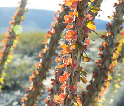 Ocotillo While it doesn’t look like much most of the time, this desert plant’s spiny stems that can reach up to 20 feet tall turn green after rains and in the spring produce red and orange flowers.
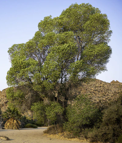 Cottonwood This riparian giant thrives along streams, rivers, and moist valleys, and is known for its heart-shaped leaves and spectacular fall foliage.
 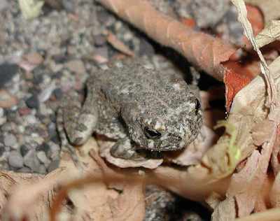 Southwestern arroyo toad This small endangered species, with dark-spotted and light-olive green skin, lives at the confluence of Deep Creek and the Mojave River.
 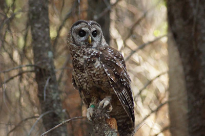 Southern spotted owl This rare and elusive nocturnal bird inhabits the old-growth conifer and mixed oak habitats and is very sensitive to habitat disturbance.
  Peninsular bighorn sheep This rare subspecies, with its curved horns, thrive in the Santa Rosa mountains, which support the largest herd of peninsular bighorn sheep in the country.
 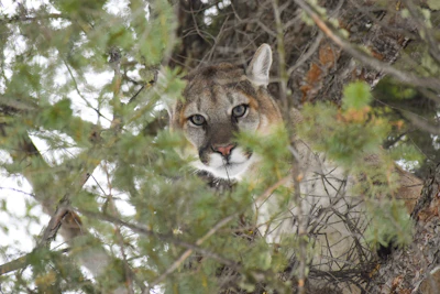 Mountain lion This big cat—also known as the cougar, puma, panther, or catamount—primarily hunts for deer at dawn and dusk and is rarely spotted.
 Related Impact
The Next Generation of Land Stewards
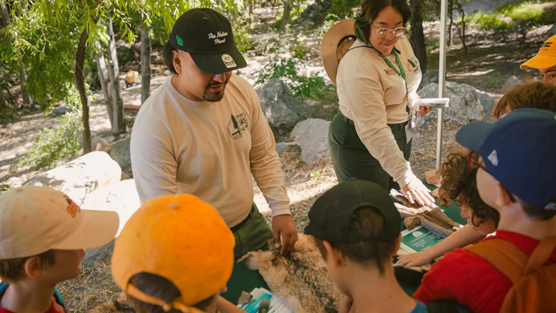
The Field Ranger Program connects communities to forests in Southern California through experiential hands-on learning and mentorship geared towards outdoor careers.
What’s the Best First-Timer’s Adventure in the San Bernardino National Forest
To reach the high elevations of the Santa Rosa and San Jacinto Mountains National Monument, take the Palm Springs Aerial Tramway, a rotating tramcar that ascends more than 8,000 feet in just a few minutes. At the top, an extensive network of trails leads to viewpoints, meadows, and the mountaintops, including San Jacinto Peak.
Where to Find More Information on the San Bernardino National Forest
For more information or questions, visit https://www.fs.usda.gov/r05/sanbernardino.
Discover how communities, volunteers, and partners are shaping the future of our National Forests and Grasslands.
Erosion and wildfire had left Arizona's historic Highline Trail rutted and unsafe. After five years of work with the Tonto…
Forest restoration near Flagstaff is reducing wildfire risk for local communities and safeguarding the water supply for millions across the…
Colorado's 14ers draw thousands of visitors each year, and the pressure on these fragile alpine landscapes is growing. Here's a…
Visitors of all ages can explore forest trails and sparkling waters, discover wildlife and underwater habitats, and connect with Tahoe’s…
A partnership-driven program connecting youth on Montana’s Flathead Reservation with hands-on conservation work, heritage education, and pathways in natural resource…
Seeing the impact first hand on the Grand Mesa, Uncompaghre and Gunnison National Forests
Seven Years of Reopening Trails After the Eagle Creek Fire
Field Ranger Program Connects Diverse Communities to Forests in Southern California
Anna's family has been planting trees for 50 years. Now she is helping build a sustainable model to meet the…
Nature-based solutions are bringing life back to streams and wetlands in the Colorado River Watershed, securing water for people, wildlife,…
Our Forests Need Us Today.
Your donation powers critical, on-the-ground conservation—from wildfire recovery to watershed restoration—protecting forests for the future.

