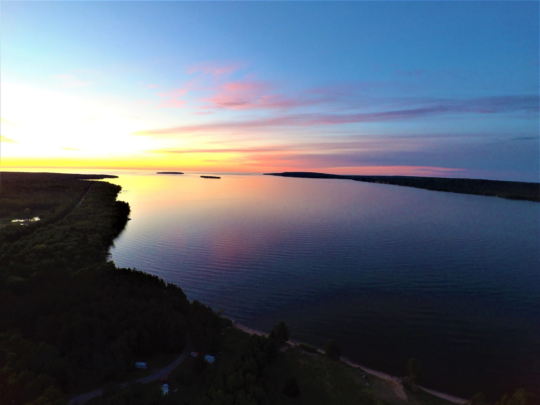
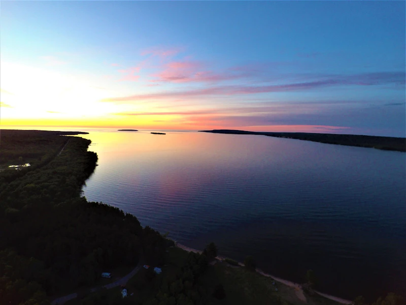
Discover the Hiawatha National Forest, which features 100 miles of shoreline along three out of five Great Lakes in Michigan’s scenic Upper Peninsula. Its 900,000 acres are split among its eastern half, consisting of the shores of Lake Michigan, Lake Huron, and Lake Superior, and its western section, from Lake Michigan to Lake Superior.
The Hiawatha, nicknamed the “Great Lakes National Forest,” is a water-lover’s playground, with waterfall hikes, canoe trails, six Wild and Scenic Rivers, and sea kayaking to remote islands. More than 75 lakes and 600 miles of streams also offer incredible fishing.
There are a variety of unique landscapes within the forest, from the sandstone cliffs of the Grand Island National Recreation Area to the rolling sand dunes of the St. Ignace Area. These special features join six designated Wilderness Areas. Hundreds of miles of trails support hiking, mountain biking, horseback riding, and off-roading. With more than 30 campgrounds, there’s also plenty of opportunity for extended adventures.
The forest is positioned in the “lake effect” snow shadows of Lakes Superior and Michigan, and some areas of the forest receive 200 inches of snowfall annually. The cross-country ski trail system offers nearly 90 miles of skating and diagonal-stride skiing of renowned quality. There are also 3,000 miles of roads and trails open for snowmobiling, with the trails connecting with the statewide system.
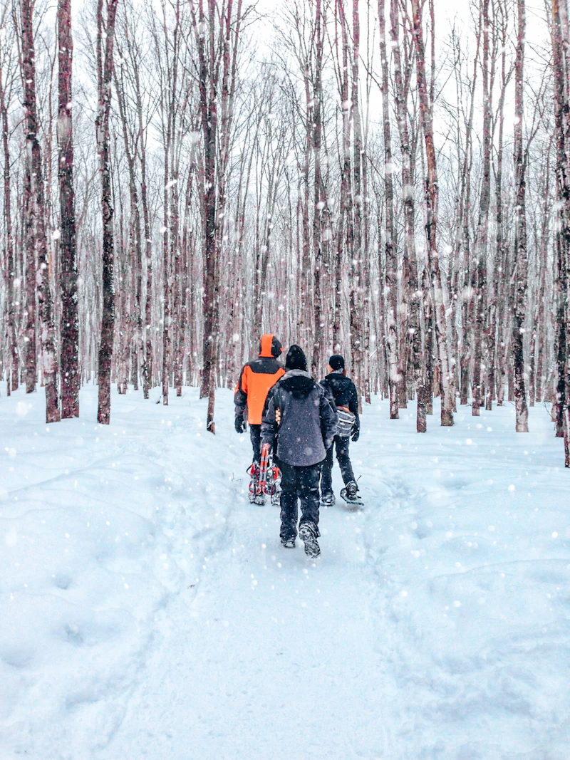 Photo by Heather Heuer
 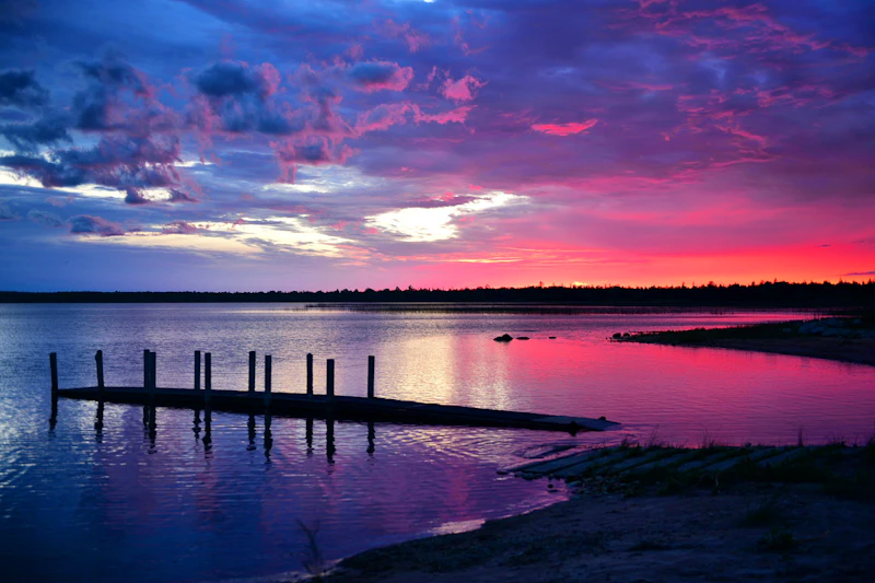 Sunset from the shores of Lake Michigan. Photo by Grace Eastman
  North Country Scenic Trail. Photo by J. Knowlton, courtesy of the U.S. Forest Service
  Photo by Jordan Van Loo
 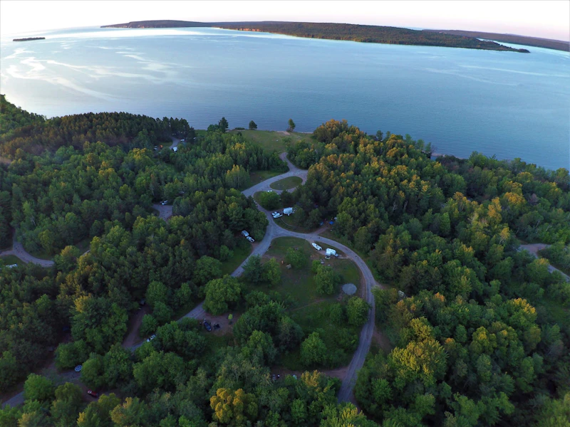 Bay Furnace Campground. Photo by David Wendel
 What is the History of the Hiawatha National Forest?
The forest’s name comes from the legendary chief of the Onondaga tribe of North American Indians, though he is more closely associated with the Iroquois Confederacy of the Northeast. He was known as a teacher of many disciplines, including medicine and agriculture, and as a leader who embodied unity and peace.
This Point Iroquois Lightstation, which stands high above the waters of Lake Superior in the Hiawatha National Forest, once served passing sailors by marking the narrow channel between the shallow sand beaches and shoals of Point Iroquois and the rocky reefs of Gros Cap on the Canadian side of Whitefish Bay.
After widespread deforestation and ecological damage from logging and mining in the 19th century, the U.S. government officially established the Hiawatha National Forest in 1931 and the Civilian Conservation Corps played a key role in restoring the land, planting trees, and building trails and facilities.

How to Get to the Hiawatha National Forest
The Hiawatha National Forest is divided into two main units: the eastern portion near the main gateway town of St. Ignace and the western near the visitor hubs of Munising and Manistique. For visitors traveling from the Lower Peninsula and visiting the eastern side, Interstate 75 connects to the U.S. Highway 2, which runs along the Lake Michigan shoreline through St. Ignace, Brevort, and Naubinway.
To reach the western part, travelers can continue along U.S. 2 or take M-28, which runs east–west across the Upper Peninsula. Munising, located on M-28 along Lake Superior, is another major entry point and provides easy access to attractions like Grand Island and the Pictured Rocks National Lakeshore. Manistique, situated on U.S. 2, offers access to the forest’s southern areas and Lake Michigan beaches.
- Grand Rapids, Michigan: 3.5 to 4 hours by car
- Green Bay, Wisconsin: 2.5 to 3 hours by car
- Milwaukee, Wisconsin: 4 to 4.5 hours by car
- Lansing, Michigan: 5 to 5.5 hours by car
- Ann Arbor, Michigan: 6 hours by car

The slow, winding Au Train River was once a logging run to Lake Superior, and now provides a relaxing four- to six-hour canoe trip filled with excellent birdwatching. Spot great blue herons, kingfishers, and various songbirds along the 10-mile trail from Au Train Lake Campground to Lake Superior.
Climb the spiral staircase to the top of the 65-foot light tower, which sits at the entry to St. Mary’s River, the only water connection between Lake Superior and the remaining Great Lakes. Observe the beauty of Canada, the lake, and the ocean-going freighters plying the river and Lake Superior as they come and go through the Soo Locks.
The Valley Spur Trail System, just west of Munising, is one of Michigan’s premier cross-country skiing destinations. It offers over 45 kilometers of groomed trails over 10 interconnected loops for both classic and skate skiing, as well as warm-up shelters and a cozy lodge at the trailhead.
 Houghton’s goldenrod The bright yellow summer blooms of this rare—and threatened—wildflower can be spotted along the sandy shores of Lake Michigan and Lake Huron.
 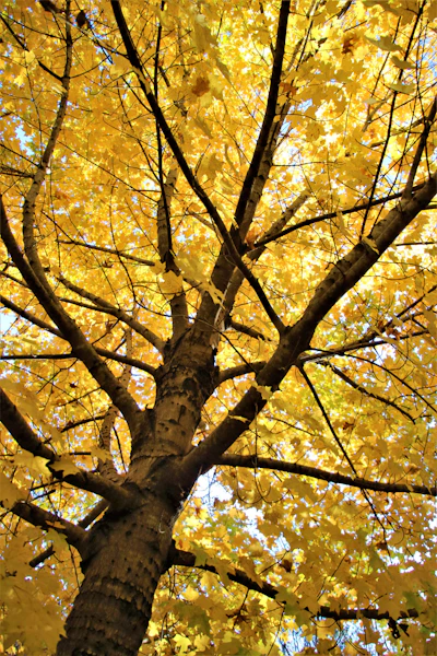 Sugar maple This iconic hardwood has brilliant fall foliage, is valued for their high-quality timber, and is the main source of maple syrup.
 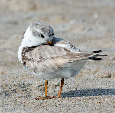 Piping plover This small endangered shorebird, recognized by its white and grey body and black ringed neck, nests on the sandy beaches along Lake Michigan.
 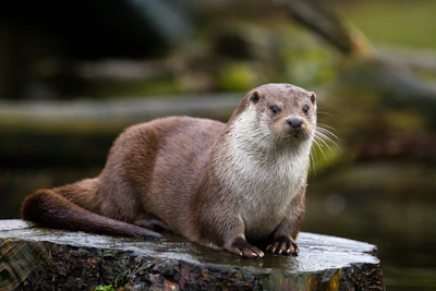 River otter This playful mammal thrives among the various wetlands of Hiawatha, hunting for fish, crayfish, and amphibians.
 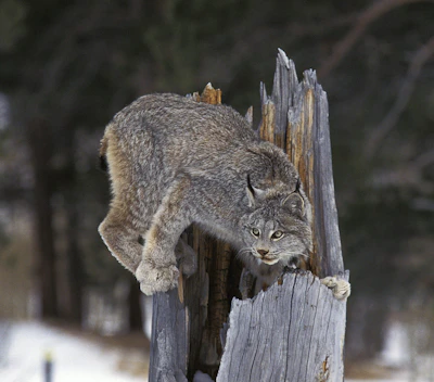 Canada lynx This elusive wild cat, known for its unique proportions—long legs and large, furry paws—rely on snowshoe hares. They are occasionally seen in the Hiawatha, but their populations have been in decline due to habitat and prey loss.
 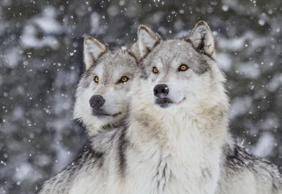 Gray wolf Once nearly eradicated from Michigan, wolves have naturally recolonized the Upper Peninsula, including parts of the Hiawatha, thanks to conservation and legal protections.
 What’s the Best First-Timer’s Adventure in the Hiawatha National Forest
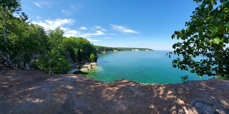
For an ideal day trip filled with quintessential UP scenery, visit Grand Island National Recreation Area. Accessible by ferry from Munising, Grand Island is part of Hiawatha National Forest and features scenic cliffs, sandy beaches and over 40 miles of trails for hiking and biking.
Where to Find More Information on the Hiawatha National Forest
For more information or questions, visit https://www.fs.usda.gov/r09/hiawatha
Discover how communities, volunteers, and partners are shaping the future of our National Forests and Grasslands.
Erosion and wildfire had left Arizona's historic Highline Trail rutted and unsafe. After five years of work with the Tonto…
Forest restoration near Flagstaff is reducing wildfire risk for local communities and safeguarding the water supply for millions across the…
Colorado's 14ers draw thousands of visitors each year, and the pressure on these fragile alpine landscapes is growing. Here's a…
Visitors of all ages can explore forest trails and sparkling waters, discover wildlife and underwater habitats, and connect with Tahoe’s…
A partnership-driven program connecting youth on Montana’s Flathead Reservation with hands-on conservation work, heritage education, and pathways in natural resource…
Seeing the impact first hand on the Grand Mesa, Uncompaghre and Gunnison National Forests
Seven Years of Reopening Trails After the Eagle Creek Fire
Field Ranger Program Connects Diverse Communities to Forests in Southern California
Anna's family has been planting trees for 50 years. Now she is helping build a sustainable model to meet the…
Nature-based solutions are bringing life back to streams and wetlands in the Colorado River Watershed, securing water for people, wildlife,…
Our Forests Need Us Today.
Your donation powers critical, on-the-ground conservation—from wildfire recovery to watershed restoration—protecting forests for the future.

