

Uncover the Mark Twain Forest, 1.5 million acres within the Ozark Highlands of southern and central Missouri. It extends from the dry rocky glades in the southwest to the prairie lands along the Missouri River to the St. Francois Mountains in the southeast, one of the oldest landforms in North America
The eastern upland oak hardwood and southern pine forests converge with the drier western bluestem prairie of the Great Plains, creating a distinctive array of open grassy woodlands and savannas. Within this diversity of landscape, the forest’s highlights include large permanent springs, caves, rocky barren glades, old volcanic mountains, and nationally recognized rivers, including 44 miles of the Eleven Point National Wild and Scenic River.
Mark Twain National Forest has seven designated Wilderness Areas: Bell Mountain, Devils Backbone, Hercules-Glades, Irish, Paddy Creek, Piney Creek, and Rockpile Mountain.
The Ozarks are home to the world’s largest collection of “first magnitude” springs, characterized by having over 65 million gallons of daily water flow. Almost 3,000 springs feed rivers and streams that flow year-round. Many of these streams are so clear that ten feet of depth appears to be only one foot. Greer Spring, the second largest spring in Missouri, is considered to be the most pristine and scenic in the state.
The Mark Twain has many beautiful rivers, lakes, and streams, offering a number of water activities, including boating, canoeing, and fishing. Many campgrounds are located beside the forest’s scenic waterways.
A wide variety of trails covers some 742 miles of the Ozarks, many of which overlap with the Ozark’s larger trail system. A few are restricted to hikers only, but many are open to mountain bikes and horses, and two areas are set aside for off-roading enthusiasts.
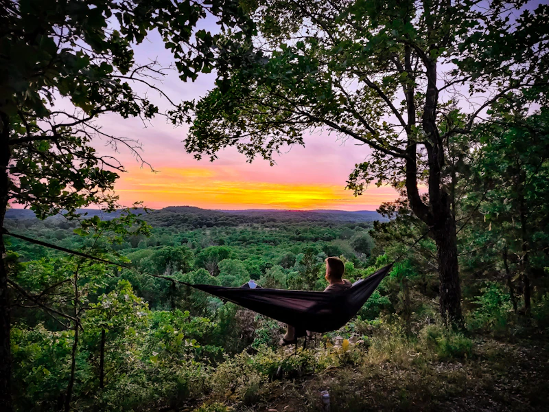 Photo by Jimmy Swint
 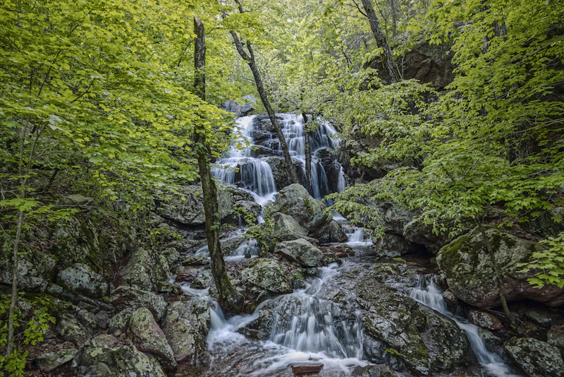 Black Mountain Waterfall. Photo by Gene Speed
  Photo by Robert Hurd, courtesy of the U.S. Forest Service
  McCormack Lake. Photo by the U.S. Forest Service
 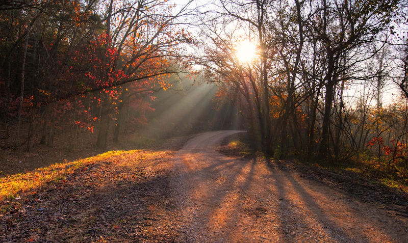 Photo by Bhanu Tadinada
 What is the History of the Mark Twain National Forest?
The history of the Mark Twain National Forest has many distinct chapters, from Native American peoples building complex societies along the area’s major rivers to Irish immigrants creating a refuge from urban life to being the site of Civil War events.
The Mississippian culture, 900–1500 CE, left behind burial mounds, pottery, and other artifacts that reveal a rich spiritual and agricultural life. By the 1700s, the Osage were the dominant tribe in the region, inhabiting vast hunting territories until the U.S. government pressured them to cede their lands through treaties in the early 19th century.
By the early 20th century, uncontrolled logging had severely depleted Missouri’s forests. The federal government responded with large-scale reforestation and conservation efforts under the Weeks Act of 1911 and later, the creation of National Forests. In 1939, the various Missouri forest tracts were consolidated into the Mark Twain National Forest, honoring the state’s most famous author.
How to Get to the Mark Twain National Forest
Because the Mark Twain National Forest encompasses such a large swath of central and southern Missouri, access points will depend on the part of the forest you plan to visit. Interstate 44 runs east–west through the forest’s northern section, connecting the cities of St. Louis and Springfield. From Interstate 44, U.S. Highway 63 serves as a major corridor into the forest’s central districts and U.S. Highway 60 and 160 cross the southern Ozarks.
The town of Rolla, located along I-44, is a northern gateway to the forest and home to the forest’s headquarters. Springfield, Missouri’s third-largest city, serves as a convenient western entry point. To the east, the towns of Salem and Van Buren offer access to popular recreation sites along the Current and Eleven Point Rivers. From the south, visitors can approach through the communities of West Plains or Poplar Bluff.
- Springfield, Missouri: 1.5 to 3 hours by car
- St. Louis, Missouri: 1.5 to 3 hours by car
- Jefferson City, Missouri: 2 to 3 hours by car
- Columbia, Missouri: 2.5 to 3.5 hours by car
- Kansas City, Kansas: 4 to 5 hours by car

For a classic summer family-friendly adventure, float the Current River. The Tuber Launch is a popular put-in, shared with outfitter and guides who provide rental tubes and shuttle services. Enjoying a five-hour float along the river with stops for picnics and cave excursions.
Located near the town of Ironton, the Bell Mountain Wilderness features a rugged 11.6-mile loop trail that climbs to one of the highest points in the Ozarks. The hike traverses rocky ridges, oak and pine forests, and sweeping glades, ending in a panoramic overlook of the St. Francois Mountains.
Designated in 1968 as one of the first eight rivers in the National Wild and Scenic Rivers System, the Eleven Point flows for 44 miles through remote Ozark landscapes. There are seven float camps on the river that allows for overnight camping for boaters.
 Spotted-sheath witchgrass This rare, perennial grass, with its delicate seed heads and purple spotted leaf sheaths can be found in open woodlands and glades.
 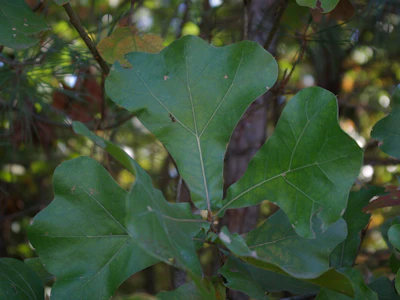 Blackjack oak This hardy oak, distinguished by its dark bark, gnarled shape, and three-lobed leaves that turn deep red in the fall, provide valuable acorns and habitat for deer and turkeys.
 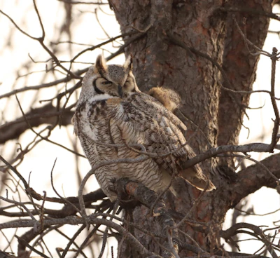 Great horned owl With tufted “horns” and large yellow eyes, this nocturnal predator hunts for rabbits, rodents, and snakes and lives in abandoned birds nests.
 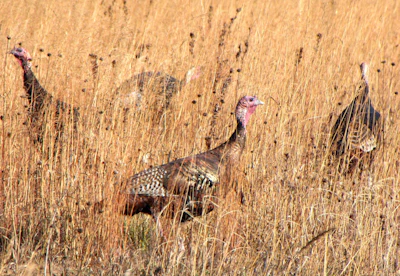 Wild turkey Once nearly eliminated in Missouri due to overhunting and habitat loss, wild turkeys made a remarkable comeback.
 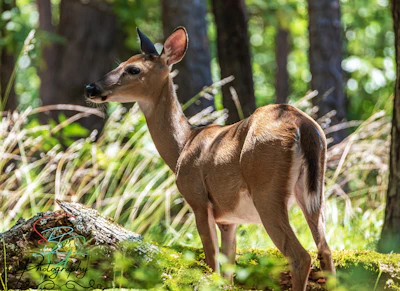 White-tailed deer With a red-brown coat that turns gray in the winter, these deer are frequently spotted throughout the forest. Bucks, or adult males, grow antlers annually, which they shed after mating season.
 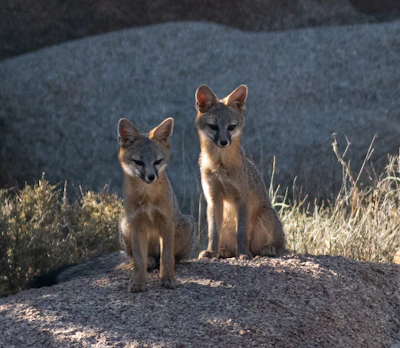 Gray fox This subspecies is an excellent climber, often retreating into trees to escape danger or search for food.
 What’s the Best First-Timer’s Adventure in the Mark Twain National Forest
If you only have time to make one stop in Mark Twain National Forest, make it Greer Spring, the second-largest—but the most pristine and scenic—spring in the state. The spring releases over 200 million gallons of crystal-clear water each day into the Eleven Point River. A mile-long one-way trail descends from the parking lot to the spring.

Where to Find More Information on the Mark Twain National Forest
For more information or questions, visit https://www.fs.usda.gov/r09/marktwain.
Discover how communities, volunteers, and partners are shaping the future of our National Forests and Grasslands.
Erosion and wildfire had left Arizona's historic Highline Trail rutted and unsafe. After five years of work with the Tonto…
Forest restoration near Flagstaff is reducing wildfire risk for local communities and safeguarding the water supply for millions across the…
Colorado's 14ers draw thousands of visitors each year, and the pressure on these fragile alpine landscapes is growing. Here's a…
Visitors of all ages can explore forest trails and sparkling waters, discover wildlife and underwater habitats, and connect with Tahoe’s…
A partnership-driven program connecting youth on Montana’s Flathead Reservation with hands-on conservation work, heritage education, and pathways in natural resource…
Seeing the impact first hand on the Grand Mesa, Uncompaghre and Gunnison National Forests
Seven Years of Reopening Trails After the Eagle Creek Fire
Field Ranger Program Connects Diverse Communities to Forests in Southern California
Anna's family has been planting trees for 50 years. Now she is helping build a sustainable model to meet the…
Nature-based solutions are bringing life back to streams and wetlands in the Colorado River Watershed, securing water for people, wildlife,…
Our Forests Need Us Today.
Your donation powers critical, on-the-ground conservation—from wildfire recovery to watershed restoration—protecting forests for the future.

