
Experience the Lolo National Forest, 2.2 million acres in western Montana that’s home to some of the most breathtaking landscapes in the country, from wild rivers and old-growth cedar groves to rugged alpine ridges.
The forest’s western location, adjacent to the Idaho border and west of the Continental Divide, results in a unique mix of maritime and continental climate ecosystems. The diverse areas are home for more than 300 bird species, at least 20 kinds of fish, 60-plus mammals, and an estimated 1,500 plants, including 250 non-native types.
Within the Lolo are record-sized trees, including a ponderosa pine located in the Fish Creek drainage that’s 200 feet tall and over six feet in diameter and a western larch near Seeley Lake that’s 153 feet tall and over 22 feet in diameter.
The forest includes sections of four designed Wilderness Areas: Welcome Creek, Rattlesnake, Selway-Bitterroot, and Scapegoat. Elevation ranges from less than 2,400 feet on the Clark Fork River below Thompson Falls to peaks topping out at over 9,000 feet, including Lolo Peak near the town of Lolo and Ptarmigan Point near Seeley Lake. The highest point is 9,202-foot Scapegoat Mountain within the Scapegoat Wilderness.
Water is plentiful within the Lolo, producing more than 100 named lakes and nearly 1,000 named streams including five major rivers, ideal for water activities and fishing. With more than 2,400 miles of trails for hiking, biking, and horseback riding, including nearly 600 miles for snowmobiling and cross-country skiing, the Lolo is a year-round adventure destination.
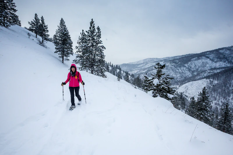 Photo by John Sieber
 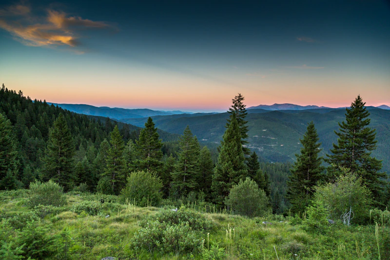 Wagon Mountain Road. Photo by John Sieber
 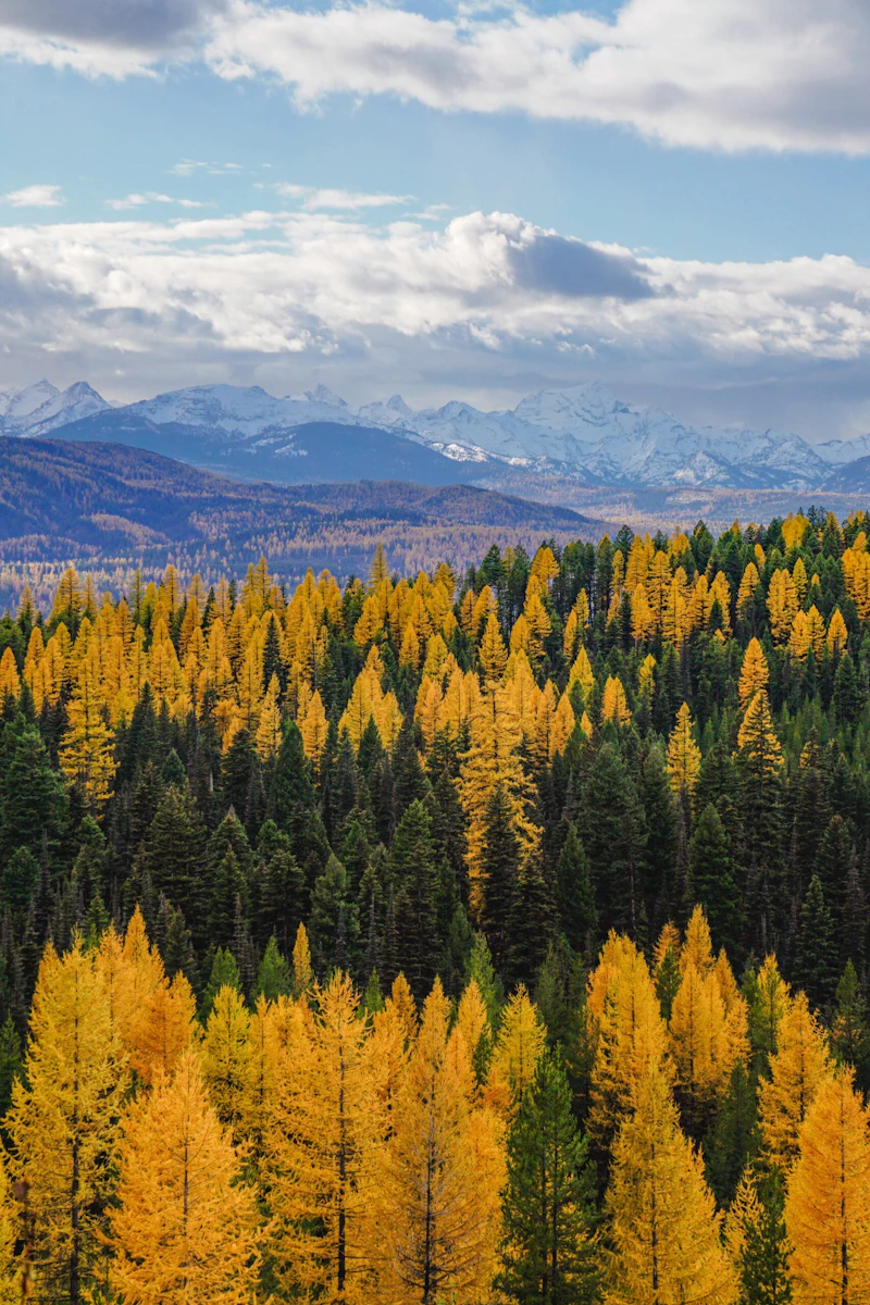 Photo by Gabe Brodoway
  Fly fishing Rock Creek. Photo by Kailey Blood
 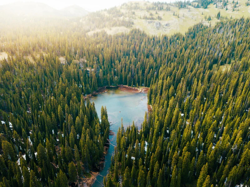 Photo by Jordan Lefler
 What is the History of the Lolo National Forest?
Archaeological evidence shows human presence in the region for at least 6,000 years, with some sites around the forest possibly older. Indigenous peoples who have called this land home include the Salish, Pend d’ Oreille, and Kootenai
The historic Lolo Trail, which passes through the forest, is also known as the Nez Perce Trail, where, during the Nez Perce War, Chief Joseph led his people over the pass to flee the U.S. Army. It’s also known for being part of the Lewis and Clark Expedition route.
The forest was established in 1906, combining several earlier reserves into Lolo National Forest. Today, the Confederated Salish and Kootenai Tribes use their ancestral homelands of the Lolo National Forest for berry picking, fishing, and gathering medicinal plants, among other practices.
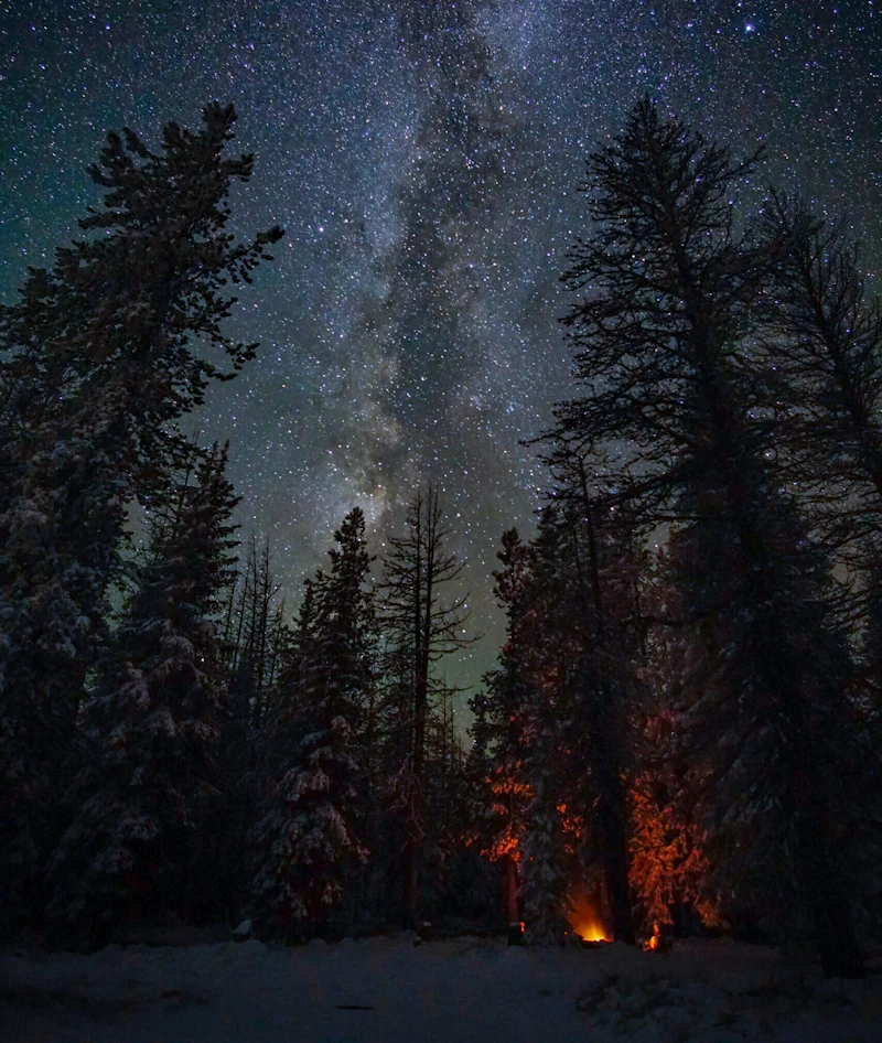
How to Get to the Lolo National Forest
From Missoula, the primary gateway city, U.S. Highway 12, an important historic and scenic route, crosses the forest’s southern edge. Interstate 90 runs east–west through the northern portion of the forest, connecting Missoula with smaller gateway towns such as Superior and Alberton, all of which offer trail access, camping areas, fishing spots along the Clark Fork River.
Visitors coming from the south, including from Hamilton or the Bitterroot Valley, can take U.S. Highway 93 north through the Lolo community to reach the forest’s southern districts and the Lolo Hot Springs area. From the north, Montana Highway 200 provides access from Thompson Falls and Plains into the forest’s northern mountains.
- Missoula, Montana: 2.5 to 3 hours by car
- Kalispell, Montana: 2.5 to 3 hours by car
- Spokane, Washington: 2 to 3 hours by car

Starting at Lolo Pass Visitor Center, the gravel route of Elk Meadows Road offers up some of the most breathtaking scenery of the famed Lolo Pass. The 32-mile drive—open to cars in the summer and snowmobiles in the winter—passes through the Bitterroot Mountains in the Nez Perce-Clearwater National Forest before reconnecting with the Lolo.
At 250-acre Girard Grove near Seeley Lake is one of the world’s largest trees, affectionately named Gus. To see the 1,000-year-old western larch. A mile-long loop, the Seth Diamond Interpretive Trail, takes visitors through the grove, along the lake’s shore, and passes Gus.
The 40-foot lookout tower in the Lolo National Forest stands as a historic symbol of Montana’s wildfire detection efforts and rugged wilderness heritage. Perched high among the pines, the tower offers panoramic views of the Bitterroot Mountains and St. Regis River. There’s also a hiking trail for visitors who want to explore the Eagle Creek area.
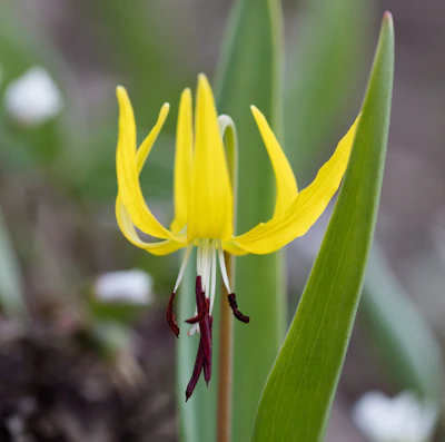 Glacier lilies This wildflower is among the first to bloom in the Lolo each spring, turning melting snowfields bright-yellow, attracting pollinators, and providing a food source to wildlife with its bulbs.
 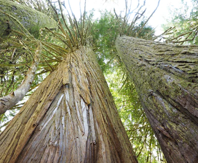 Western red cedar Towering up to 200 feet, this evergreen has aromatic bark and is one of the most majestic trees in the Lolo.
 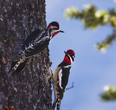 Red-naped sapsucker With its red crown and nape and black-and-white plumage, this woodpeck drills neat rows of wells in aspen, birch, and conifer bark to feed on the sap and the insects it attracts.
 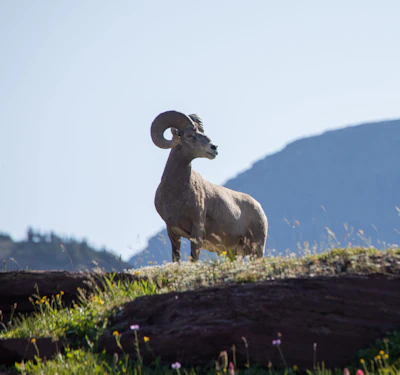 Bighorn sheep Known for its massive curled horns and climbing skills, this sheep can be found in the high elevation areas of the rugged alpine ridges.
 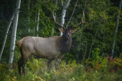 Elk This majestic animal, the second largest species in the deer family after moose, is most active during dawn and dusk and during fall rutting season.
 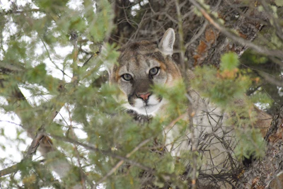 Mountain lion While there have been a few sightings, this big cat—also known as the cougar, puma, panther, or catamount—remains elusive in the forest. It primarily hunts for deer at dawn and dusk.
 Related Impact
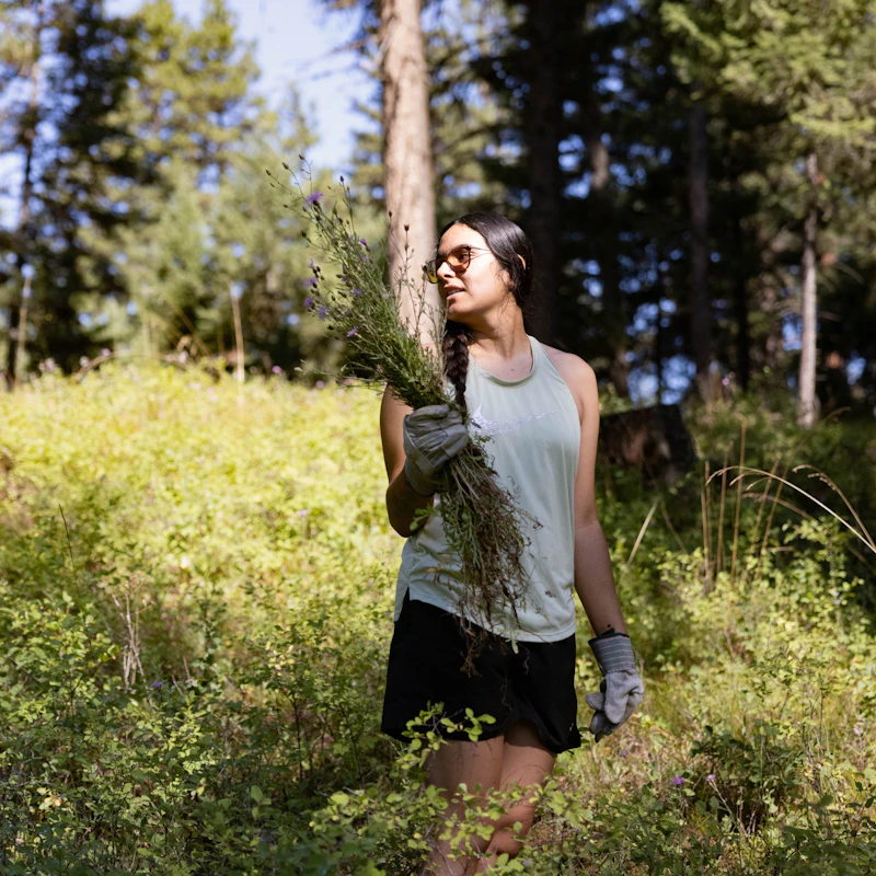
Cultivating Leaders in the Mission Mountains
A partnership-driven program connects youth on Montana’s Flathead Reservation with hands-on conservation work, heritage education, and pathways in natural resource careers.
What’s the Best First-Timer’s Adventure in the Lolo National Forest
If you make one stop in the Lolo National Forest, make it Lolo Pass. Sitting at an elevation of about 5,200 feet, it offers sweeping views of rugged mountains, dense forests, and alpine meadows. The pass follows the route once traveled by the Lewis and Clark Expedition and by the Nez Perce people. Today, it’s home to a visitor center with exhibits about its history.

Where to Find More Information on the Lolo National Forest
For more information or questions, visit https://www.fs.usda.gov/r01/lolo
Discover how communities, volunteers, and partners are shaping the future of our National Forests and Grasslands.
Erosion and wildfire had left Arizona's historic Highline Trail rutted and unsafe. After five years of work with the Tonto…
Forest restoration near Flagstaff is reducing wildfire risk for local communities and safeguarding the water supply for millions across the…
Colorado's 14ers draw thousands of visitors each year, and the pressure on these fragile alpine landscapes is growing. Here's a…
Visitors of all ages can explore forest trails and sparkling waters, discover wildlife and underwater habitats, and connect with Tahoe’s…
A partnership-driven program connecting youth on Montana’s Flathead Reservation with hands-on conservation work, heritage education, and pathways in natural resource…
Seeing the impact first hand on the Grand Mesa, Uncompaghre and Gunnison National Forests
Seven Years of Reopening Trails After the Eagle Creek Fire
Field Ranger Program Connects Diverse Communities to Forests in Southern California
Anna's family has been planting trees for 50 years. Now she is helping build a sustainable model to meet the…
Nature-based solutions are bringing life back to streams and wetlands in the Colorado River Watershed, securing water for people, wildlife,…
Our Forests Need Us Today.
Your donation powers critical, on-the-ground conservation—from wildfire recovery to watershed restoration—protecting forests for the future.

