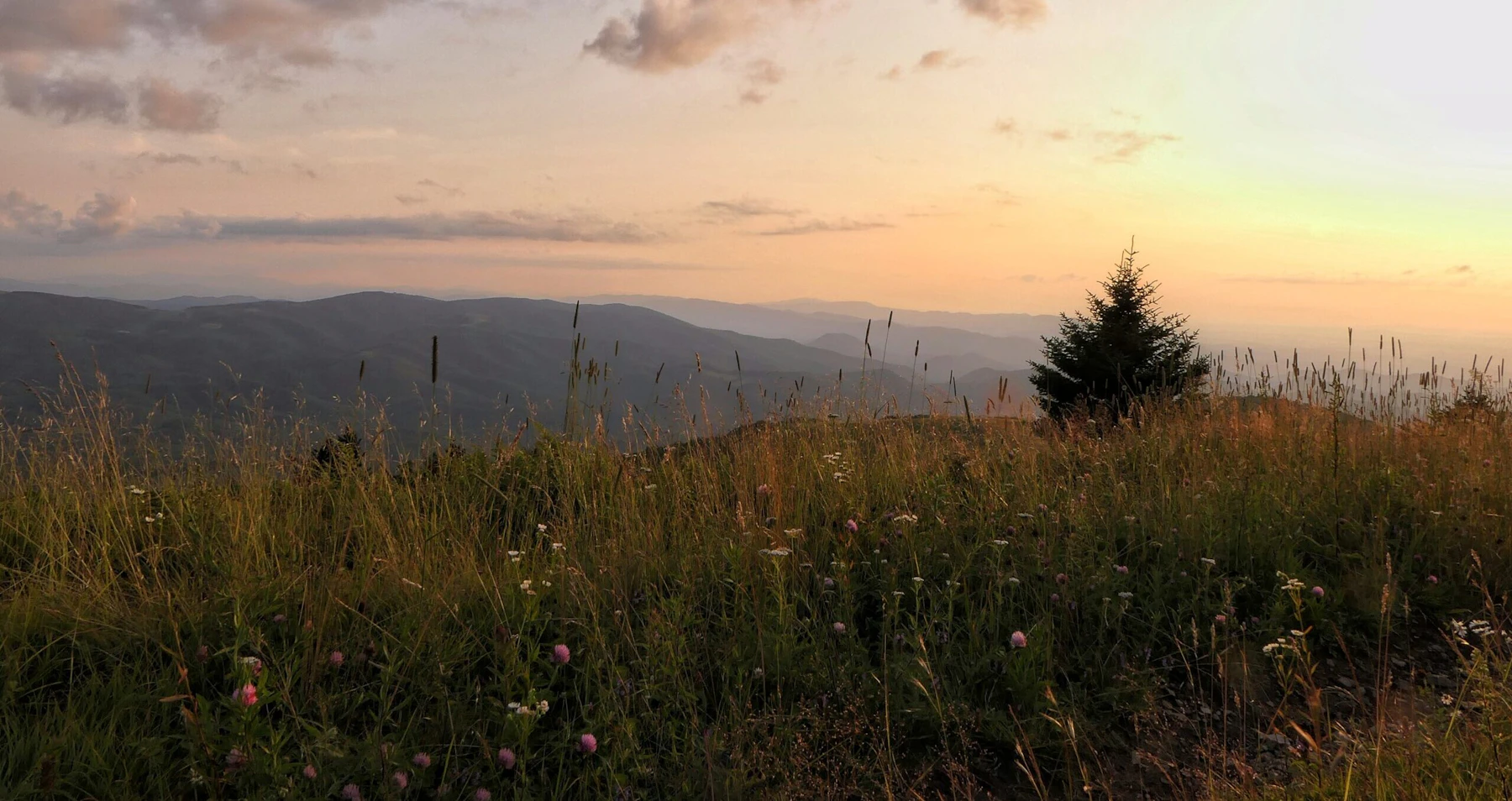

Discover the Cherokee National Forest at the heart of the Southern Appalachian mountain range, one of the world’s most diverse areas. Its 640,000 acres span rugged mountains, rich hardwood forests, and pristine waterways. The forest stretches from the cities of Chattanooga to Bristol and is divided into two sections by Great Smoky Mountains National Park, offering a much less crowded alternative with the same scenery.
Hike more than 700 miles of trails, including 150 miles of the Appalachian Trail and four other nationally designated trails. Enjoy world-class whitewater, premier trout fishing, scenic waterfalls along the forest’s many deep river gorges. Explore 11 wilderness areas, part of the largest tract of public land in Tennessee.
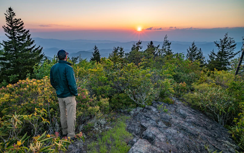 Unaka Mountain. Photo by Adam Bean
  Photo by Somer Pickel
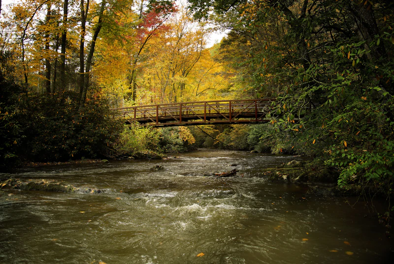
 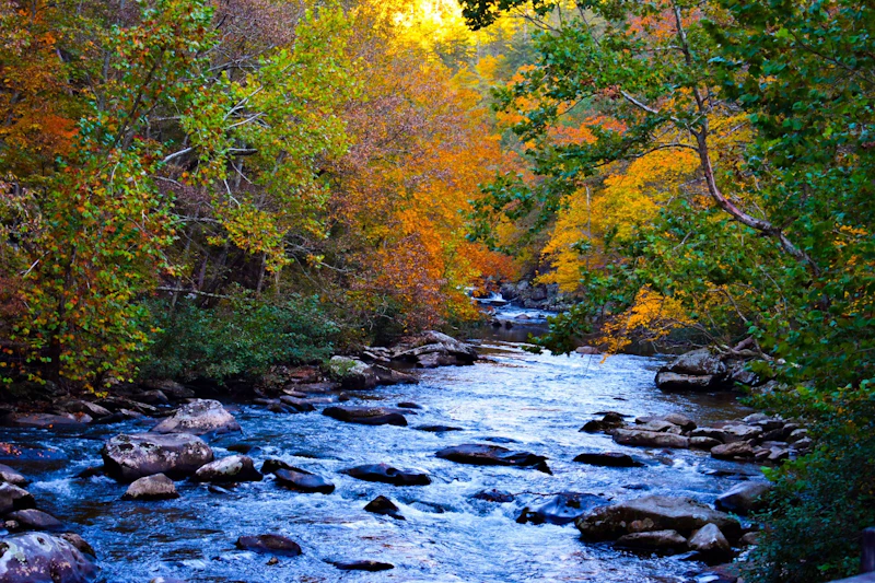 Tellico River. Photo by Gracie Bryant
 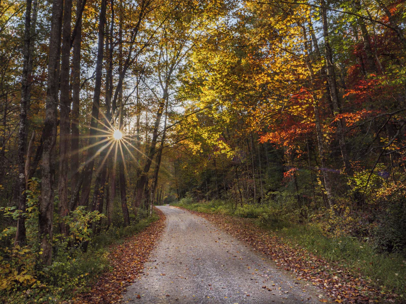 Spivey Cove campground. Photo by John Rudy
 What is the History of the Cherokee National Forest?
The land was originally inhabited by the Cherokee people, who lived, hunted, and traded throughout the region for centuries. Their rich heritage is still evident in the area’s place names, ancient trails, and sacred sites.
In the 1830s, the Cherokee Nation endured a forced migration, known as the Trail of Tears, from their ancestral lands in this area and across the southeast to present-day Oklahoma. This expulsion journey resulted in the deaths of thousands due to hunger, disease, and exhaustion.
Following colonization, the land was heavily logged, leading to widespread deforestation. In the early 20th century, the federal government began acquiring land to restore forests and protect watersheds, eventually forming the Cherokee National Forest. In the 1930s, the Civilian Conservation Corps played a major role building roads, trails, and recreation facilities still in use today.
The original purpose for their creation was to protect water quality and provide a continuous supply of timber. Today, the National Forest’s mission includes outdoor recreation, wildlife and fish habitat, water quality, minerals, wood products, and much more.
How to Get to the Cherokee National Forest
The Cherokee National Forest, located on the border of North Carolina, is within a day’s drive of almost half of the U.S. population. From the west, travelers can take Interstate 40 or Interstate 75, connecting through gateway towns like Knoxville and Chattanooga.
To access the northern forest, Highway 11W and Highway 25E enter through the towns of Johnson City and Kingsport. The southern section is reachable via Highway 64 and Highway 74, near the communities of Cleveland and Ocoee.
The northern part of the forest includes the Watauga and Unaka ranger districts, which features highlights like Iron Mountain, the Bald Mountains, Pigeon River, Watauga Lake, and the Appalachian Trail. The southern area includes the Tellico and Ocoee ranger districts, encompassing Ocoee River, Big Frog Mountain, and the Benton MacKaye Trail.
- Knoxville, Tennessee: 1.5 to 2 hours by car
- Asheville, North Carolina: 1.5 to 2 hours by car
- Chattanooga, Tennessee: 3 hours by car
- Charlotte, North Carolina: 3.5 hours by car

The Ocoee is considered one of the country’s best whitewater rivers, and even hosted whitewater events during the 1996 Olympics. A five-mile stretch of the river features Class III and IV rapids and incredible mountain scenery. Guided trips are available for all skill levels, with the Middle Ocoee popular with casual rafters and the Upper Ocoee with experienced paddlers.
Some 150 miles of the Appalachian Trail winds through the Cherokee National Forest. Stretching through the forest’s high ridges and scenic valleys, the Appalachian Trail offers stunning views, backcountry solitude, and access to highlights like Bald Mountain, Iron Mountain, and Unaka Mountain Bald.
One of the most stunning waterfalls in the region, the 90-foot high Bald River Falls is accessible via the Tellico River Road. For visitors who want more of an excursion, head out on the 5.6-mile out-and-back Bald River Gorge Day Hike, which starts at the main waterfall before following the river along a shaded gorge with more cascades.
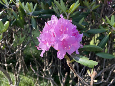 Catawba rhododendron This shrub, known for its vibrant pink-purple flowers, thrives in the high elevations areas of the forest, especially on balds and ridgelines.
 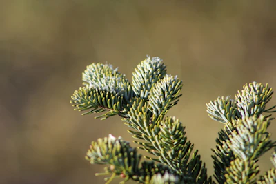 Fraser fir This iconic and rare Appalachian conifer, known for its fragrant needles, can be found on peaks across the forest. The endangered species faces threats from climate change and invasive pests.
 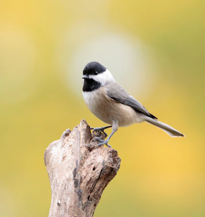 Carolina chickadee A common songbird, this species of chickadee can be distinguished by their black cap, white cheeks, and cheerful call. They travel in flocks and can often be spotted hanging upside down.
 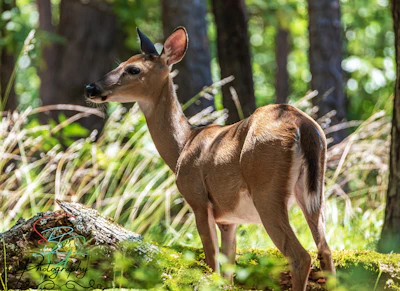 White-tailed deer With a red-brown coat that turns gray in the winter, this deer is frequently spotted throughout the forest. Bucks, or adult males, grow antlers annually, which they shed after mating season.
 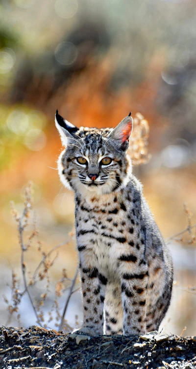 Bobcat Known for its tufted ears and spotted coats, this predator hunts rabbits, birds, and rodents throughout the forest. While seeing a bobcat is rare, visitors often spot their tracks.
 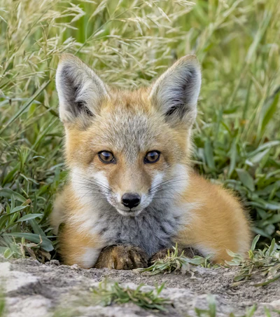 Red fox This elusive fox, known for its red coat and bushy, white-tipped tail, is mostly nocturnal, hunting for small mammals and birds after nightfall.
 Related Impact
Restoring Red Spruce in the Southern Appalachians
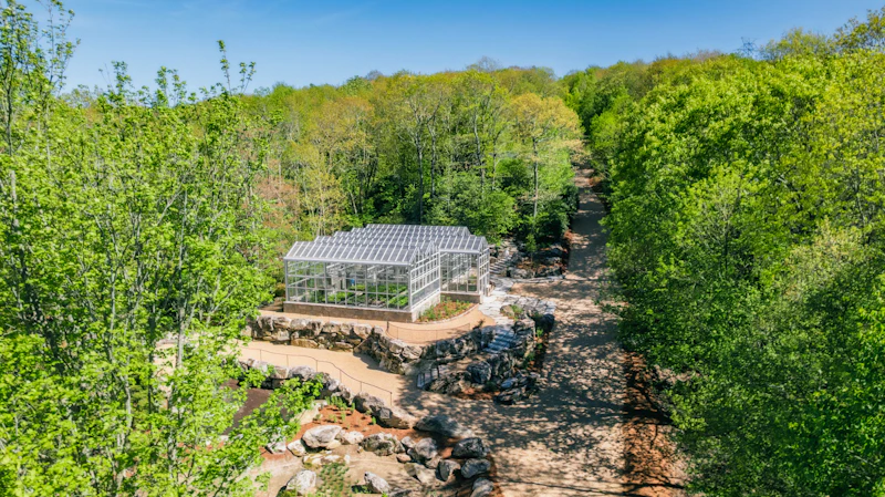
The National Forest Foundation and our partners are joining forces to protect the iconic “sky island” ecosystems of the Southern Appalachians by expanding the capacity for red spruce restoration with a new state-of-the-art greenhouse.
What’s the Best First-Timer’s Adventure in the Cherokee National Forest?
For access to the Cherokee National Forest’s major highlights, head out on the country’s first designated National Forest Scenic Byway, the Ocoee. The 26-mile byway starts in the Ocoee River Gorge, continues along the shores of Ocoee Lake, before topping out at Chilhowee Mountain, where you’ll enjoy views of the Appalachian mountains.
Where to Find More Information on the Cherokee National Forest?
For more information or questions, visit https://www.fs.usda.gov/r08/cherokee
Discover how communities, volunteers, and partners are shaping the future of our National Forests and Grasslands.
After years of damage, recovery, and reconstruction, the trail to Hanging Lake has been fully rebuilt, creating a more durable,…
Erosion and wildfire had left Arizona's historic Highline Trail rutted and unsafe. After five years of work with the Tonto…
Forest restoration near Flagstaff is reducing wildfire risk for local communities and safeguarding the water supply for millions across the…
Colorado's 14ers draw thousands of visitors each year, and the pressure on these fragile alpine landscapes is growing. Here's a…
Visitors of all ages can explore forest trails and sparkling waters, discover wildlife and underwater habitats, and connect with Tahoe’s…
A partnership-driven program connecting youth on Montana’s Flathead Reservation with hands-on conservation work, heritage education, and pathways in natural resource…
Seeing the impact first hand on the Grand Mesa, Uncompaghre and Gunnison National Forests
Seven Years of Reopening Trails After the Eagle Creek Fire
Field Ranger Program Connects Diverse Communities to Forests in Southern California
Anna's family has been planting trees for 50 years. Now she is helping build a sustainable model to meet the…
Our Forests Need Us Today.
Your donation powers critical, on-the-ground conservation—from wildfire recovery to watershed restoration—protecting forests for the future.

