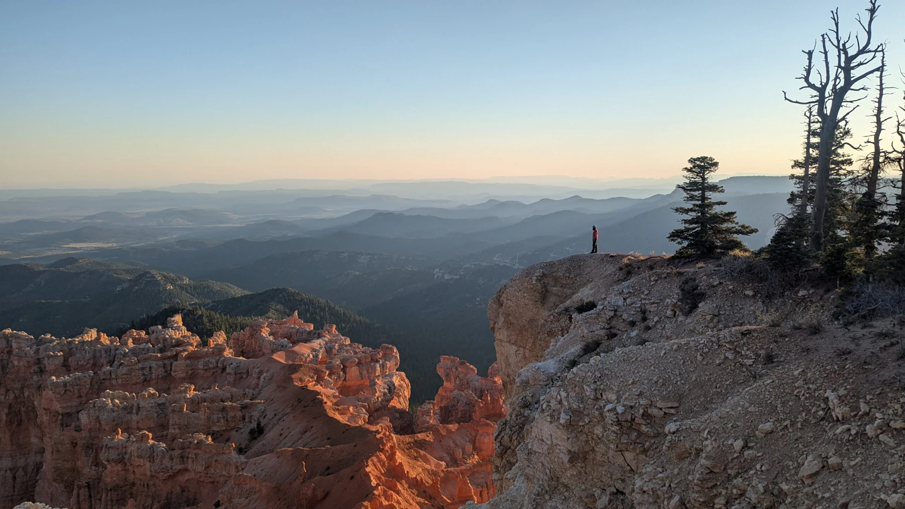

Discover the Dixie National Forest, the largest forest in Utah occupying two millions acres between the Great Basin and Colorado River. Adjacent to the Dixie are Bryce Canyon National Park and Cedar Breaks National Monument, all three of which feature the red-rock formations distinct to this region. The best example of this within the Dixie National Forest is Red Canyon Recreation Area.
The Dixie National Forest is divided into four geographic areas. High-altitude forests in gently rolling hills characterize the Markagunt, Pansaugunt, and Aquarius plateaus. Boulder Mountain, one of the largest high-elevation plateaus in the United States, is dotted with hundreds of small lakes 10,000 to 11,000 feet above sea level.
The forest has many climatic extremes. Precipitation ranges from 10 inches in the lower elevations to more than 40 inches per year near 11,307-foot Brian Head Peak. The forest has 83,000 acres of wilderness in three areas: Pine Valley, Box-Death Hollow, and Ashdown Gorge. Others who prefer more developed areas and less primitive conditions may enjoy motorized activities and activities in places easily accessible by car.
Recreational opportunities in the forest are highly diversified and include hiking, biking, and horseback riding. There’s also countless options for hooking trout at 500 miles of fishable streams and 90 lakes, while game hunting has traditionally been the major wildlife attraction in the forest.
There are 26 developed campgrounds in the forest, a number of which are located near lakes and reservoirs, such as Navajo Lake and Enterprise Reservoir, where plenty of boating and fishing opportunities are available.
In winter, the forest works with the state parks to maintain trails for skiing and snowmobiling. There are also more than a thousand miles of timber roads that can be used for these sports. Those seeking adventure and thrills can check out downhill skiing at Brian Head Resort, located within the Dixie National Forest.
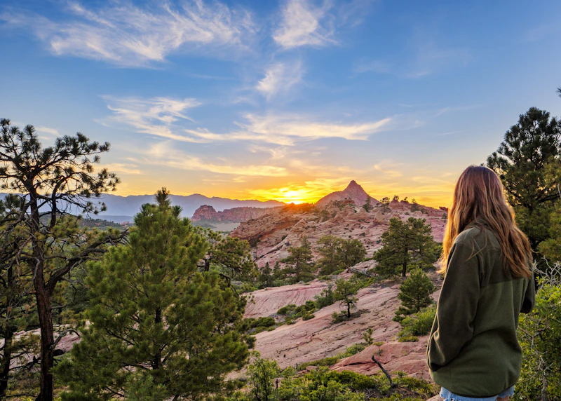 Photo by John Rudy
 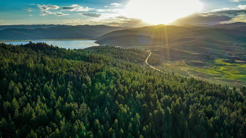 Photo by Cy McMains
  Thunder Mountain. Photo by Bri Sullivan
 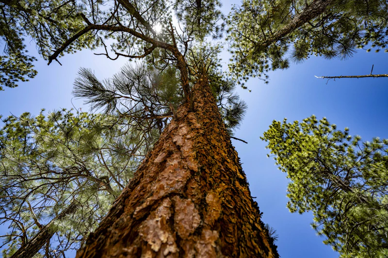 Photo by Preston Keres, courtesy of the U.S. Forest Service
 What is the History of the Dixie National Forest?
Long before it was established as a National Forest, the area was inhabited by the Ancestral Puebloans and later the Paiute tribes. The Southern Paiute people, in particular, have maintained a continuous connection to the land and its resources for generations.
European-American settlement began in the mid-1800s, when Mormon pioneers established communities in the region as part of the larger colonization effort led by Brigham Young. The name “Dixie” was the nickname that early settlers gave to the area.
In 1905, Dixie National Forest was officially established by the U.S. Forest Service to protect timber, watersheds, and grazing lands. Over the decades, management priorities expanded to include wildlife conservation, recreation, and cultural preservation.

How to Get to the Dixie National Forest
The key access points to the Dixie National Forest, in southern Utah, are the communities of Cedar City, St. George, Panguitch, and Escalante. St. George Regional Airport is located 70 miles south of the forest.
From the primary gateway city is Cedar City, located on Interstate 15, travelers can access the Cedar Mountain and Markagunt Plateau. To the west, St. George offers access to the forest’s lower elevation desert areas via Highway 18 or 9, near Zion National Park. In the eastern section, the designated scenic byway of Highway 12 runs through the forest near Bryce Canyon National Park and features spectacular views.
- St. George, Utah: 1 to 1.5 hours by car
- Las Vegas, Nevada: 3 to 3.5 hours by car
- Salt Lake City, Utah: 3.5 to 4 hours by car
- Flagstaff, Arizona: 4 to 4.5 hours by car

Considered a smaller—and less trafficked—Bryce Canyon, this sprawling recreation area has the same spectacular red-rock formations, breathtaking views, and hiking trails that wind throughout.
At over 11,000 feet, Boulder Mountain offers cool summer temperatures, high-elevation lakes, and excellent fishing. Campgrounds like Posey Lake and Lower Bowns offer remote camping with dark skies perfect for stargazing.
This challenging, 13-mile route in the rugged backcountry of Ashdown Gorge traces through pine forests, alpine meadows, and along a creek. It features views of the spectacular gorge and nearby formation Cedar Breaks and great wildlife-viewing with the change to spot elk and diverse bird species.
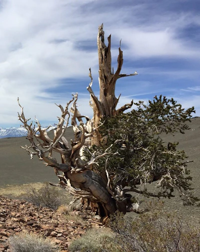 Bristlecone pine This gnarled species is among the oldest living trees, some two centuries old. It thrives in windswept areas above 10,000 feet and can be spotted near Boulder Mountain.
  Golden eagle With a wing span that can reach up to seven feet, this raptor builds long-standing nests on high cliffs and preys on small mammals across plateaus and canyonlands.
 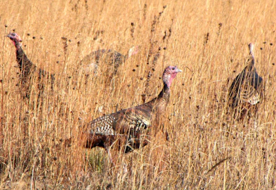 Wild turkey This large, ground-dwelling bird is often seen traveling in flocks, especially during fall and winter. Males are known for their distinctive gobbling calls and fanned tail displays during mating season.
 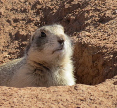 Utah prairie dog A threatened species found in high-elevation grasslands, this small mammal has reddish-brown fur, lives in colonies, and builds underground burrow systems.
 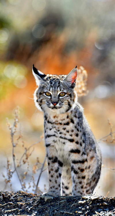 Bobcat This elusive predator, with tufted ears and spotted coats, hunts rabbits, birds, and rodents throughout the forest. While seeing a bobcat is rare, visitors often spot their tracks.
 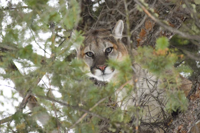 Mountain lion While there have been a few sightings, this big cat—also known as the cougar, puma, panther, or catamount—remains elusive in the Dixie National Forest. It primarily hunts for deer at dawn and dusk.
 Related Impact
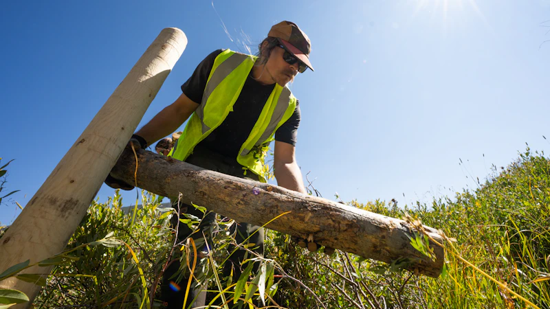
Restoring the Colorado River Watershed through Nature Based Solutions
The National Forest Foundation and our partners are taking action through process-based restoration techniques that work with nature to bring life back to streams and wetlands in the Colorado River Watershed, securing water for people, wildlife, and the future.
What’s the Best First-Timer’s Adventure in the Dixie National Forest?
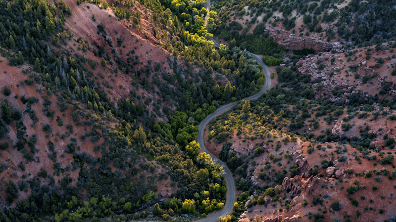
One of the most incredible drives in the U.S. is Highway 12, which passes through the Dixie National Forest between the towns of Panguitch and Torrey, offering dramatic views of red-rock cliffs, alpine forests, and sweeping plateaus. Along the way, stop at viewpoints, trailheads, and small towns like Escalante and Boulder.
Where to Find More Information on the Dixie National Forest
For more information or questions, visit https://www.fs.usda.gov/r04/dixie
Discover how communities, volunteers, and partners are shaping the future of our National Forests and Grasslands.
After years of damage, recovery, and reconstruction, the trail to Hanging Lake has been fully rebuilt, creating a more durable,…
Erosion and wildfire had left Arizona's historic Highline Trail rutted and unsafe. After five years of work with the Tonto…
Forest restoration near Flagstaff is reducing wildfire risk for local communities and safeguarding the water supply for millions across the…
Colorado's 14ers draw thousands of visitors each year, and the pressure on these fragile alpine landscapes is growing. Here's a…
Visitors of all ages can explore forest trails and sparkling waters, discover wildlife and underwater habitats, and connect with Tahoe’s…
A partnership-driven program connecting youth on Montana’s Flathead Reservation with hands-on conservation work, heritage education, and pathways in natural resource…
Seeing the impact first hand on the Grand Mesa, Uncompaghre and Gunnison National Forests
Seven Years of Reopening Trails After the Eagle Creek Fire
Field Ranger Program Connects Diverse Communities to Forests in Southern California
Anna's family has been planting trees for 50 years. Now she is helping build a sustainable model to meet the…
Our Forests Need Us Today.
Your donation powers critical, on-the-ground conservation—from wildfire recovery to watershed restoration—protecting forests for the future.

