

Discover the Colville National Forest, 1.5 million acres in northeastern Washington that encompasses the Kettle River, Selkirk Mountain range, and upper reaches of the Columbia River. The forest was first shaped more than 10,000 years ago by Ice Age glaciers that carved three major valleys of today’s Columbia River.
Three stretches of mountains run from north to south: the Okanogan, Kettle River, and Selkirk are considered the eastern edge of the Okanagan highlands and the foothills of the Rocky Mountains. These ranges contain 7,310-foot Abercrombie Mountain, one of the highest peaks in eastern Washington.
The forest also contains over 180 miles of trails for hiking, horseback riding, mountain biking, and cross-country skiing. Thirty-two campgrounds provide a wide array of overnight stays, from lakeside-developed camps to remote backcountry retreats. These campgrounds are a great place to start your wildlife-watching adventure.
Drive history-packed Sherman Pass Scenic Byway, go skiing at 49 Degrees North Ski Area, and go wildlife spotting in Salmo-Priest Wilderness.
 Meadow Creek Trail. Photo by Shelly Stevens
  Elk Creek Falls. Photo by Shelly Stevens
  Big Meadow Lake. Photo by Shelly Stevens
  Bead Lake Trail. Photo by Shelly Stevens
  Pend Oreille River trail. Photo by Joanie Christian
 What is the History of the Colville National Forest?
The landscape of Colville National Forest emerged from the melting ice about 10,000 years ago. Animals and plants followed the retreating glaciers northward, and humans were not far behind. The first Native Americans began hunting, fishing, and gathering in the area about 9,000 years ago.
Archaeologists estimate that the Colville Confederated Tribes and the Spokane Tribe caught more than 1,000 salmon a day at Kettle Falls during peak runs. Salmon congregated below this wide, low falls on their way upstream to spawn.
By 1826, American fur traders were living in Fort Colville, built near Kettle Falls. They brought in pigs and cattle, began farming around the fort, and limited Native American fishing access. By the late 1800s, the Native peoples were confined to reservations.
Kettle Falls and the salmon runs disappeared under the rising waters of Roosevelt Reservoir in the 1930s when Grand Coulee Dam was built. Around that time, miners and timber harvesters came to the area with varied success.
The forest was officially established in 1907. Today, the Colville National Forest is divided into management areas with different emphases, from timber management and wildlife needs to recreational opportunities.

How to Get to the Colville National Forest
The forest is located in northeastern Washington, near the Canadian border. The primary gateway town is Colville, accessible via Highway 395, which runs north-south through the region. From Spokane, the nearest major city and airport hub, it’s about a 90-minute drive north on 395 to reach Colville.
Other access points include the towns of Kettle Falls, Republic, and Newport. Republic is accessible via a scenic byway, or State Route 20, that cuts east-west through the forest and crosses Sherman Pass, the highest maintained pass in Washington.
- Spokane, Washington: 1.5 to 2 hours by car
- Missoula, Montana: 4 to 4.5 hours by car
- Yakima, Washington: 4.5 hours by car
- Seattle, Washington: 6 hours by car

On the west slopes of the Selkirk Mountains, this Wilderness Area contains old growth of red cedar, Douglas fir, and western hemlock. Spot grizzly and black bear, cougar, caribou, elk, deer, lynx, pine marten, and wolverine in the higher elevation meadows and crags.
This 88-mile National Forest Scenic Byway on Highway 20 between Republic and Kettle Falls is the most history-packed route on the Colville National Forest. From this twisting mountain highway, stop at the Kettle Falls Historical Center, Log Flume Heritage Site, and White Mountain Interpretive Site.
This resort near the town of Chewelah operates privately on National Forest land under a special-use permit. Billed as a comfortable, family ski area, it offers several chairlifts and more than 20 ski runs. Cross-country ski and mountain-bike trails provide alternatives to downhill skiing.
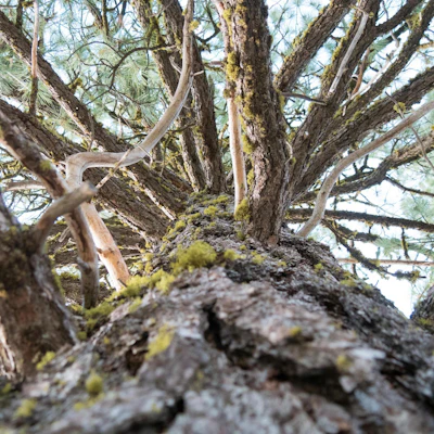 Lodgepole pine The tall and thin conifer plays an important part in regeneration after wildfire, as the resin in its cones melt—and seeds release—only when heated by fire.
 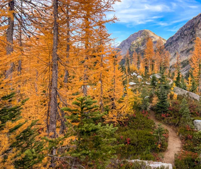 Western larch This unique deciduous conifer, which thrives in higher elevations, has needles that turn golden-yellow needles in fall.
 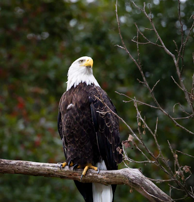 Bald eagle A large number of bald eagles, a protected species, winter along the major rivers in the forest, and can be spotted around Sullivan Lake and Pend Oreille River.
 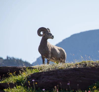 Bighorn sheep Known for its massive curled horns and climbing skills, this sheep can be found in the high elevation areas of the three mountain ranges.
 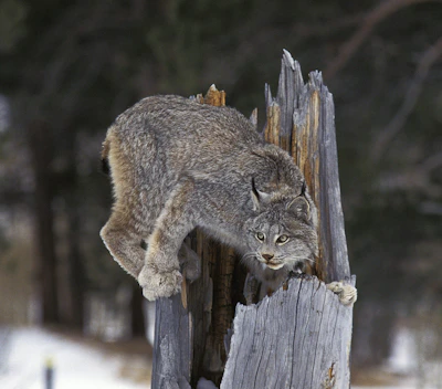 Canada lynx This elusive wild cat, known for its unique proportions—long legs and large, furry paws—relies on snowshoe hares. A translocation project backed by the Confederated Tribes of the Colville Reservation has introduced lynx to the forest.
 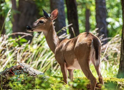 White-tailed deer With a red-brown coat that turns gray in the winter, this deer is frequently spotted throughout the forest. Bucks, or adult males, grow antlers annually, which they shed after mating season.
 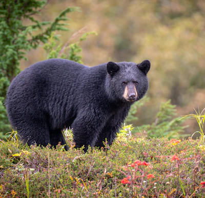 Black bear This medium-sized bear resides in the dense forests and open meadows of the forest, foraging for berries, insects, and small animals.
 Related Impact
Restoring the Columbia River Gorge National Scenic Area
Working hand-in-hand with the community and our partners, less than a decade after the devastating Eagle Creek Fire, nearly every mile of trail that was damaged has reopened.
What’s the Best First-Timer’s Adventure in the Colville National Forest?
To experience one of Colville National Forest’s newest attractions, head to the Newport-Sullivan Lake Ranger District to a new overlook that offers views of Peewee Falls and Boundary Lake. From the overlook, hike nine miles to Riverside Mine Scenic Overlook for a closer look at the 233-foot waterfall.

Where to Find More Information on the Colville National Forest
For more information or questions, visit https://www.fs.usda.gov/r06/colville
Discover how communities, volunteers, and partners are shaping the future of our National Forests and Grasslands.
Erosion and wildfire had left Arizona's historic Highline Trail rutted and unsafe. After five years of work with the Tonto…
Forest restoration near Flagstaff is reducing wildfire risk for local communities and safeguarding the water supply for millions across the…
Colorado's 14ers draw thousands of visitors each year, and the pressure on these fragile alpine landscapes is growing. Here's a…
Visitors of all ages can explore forest trails and sparkling waters, discover wildlife and underwater habitats, and connect with Tahoe’s…
A partnership-driven program connecting youth on Montana’s Flathead Reservation with hands-on conservation work, heritage education, and pathways in natural resource…
Seeing the impact first hand on the Grand Mesa, Uncompaghre and Gunnison National Forests
Seven Years of Reopening Trails After the Eagle Creek Fire
Field Ranger Program Connects Diverse Communities to Forests in Southern California
Anna's family has been planting trees for 50 years. Now she is helping build a sustainable model to meet the…
Nature-based solutions are bringing life back to streams and wetlands in the Colorado River Watershed, securing water for people, wildlife,…
Our Forests Need Us Today.
Your donation powers critical, on-the-ground conservation—from wildfire recovery to watershed restoration—protecting forests for the future.

