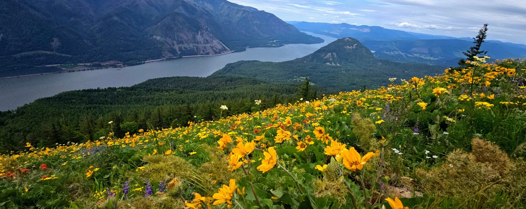
Explore the Columbia River Gorge National Scenic Area, a spectacular river canyon that’s 80 miles long and up to 4,000 feet deep. It cuts the only sea-level route through the Cascade Mountain Range, stretching from Portland to the Deschutes River.
The Gorge is best known for its dramatic landscapes—towering basalt cliffs, dense forests, and over 90 waterfalls, including the iconic Multnomah Falls, the second-tallest year-round waterfall in the country. The diversity of these landscapes, from western conifer forests to eastern grasslands, has to do with the area’s unique geology, which creates a rain shadow effect.
It is more than a natural wonder; the Gorge is a critical transportation corridor and is home to 75,000 people, resource dependent communities, farms, and schools. Over two million people
visit the Columbia River Gorge National Scenic Area every year, drawn to its endless hiking, biking, camping, and water-sport opportunities. The Gorge’s main hub of Hood River is known as one of the country’s best windsurfing spots.
 Photo by Jon Crays
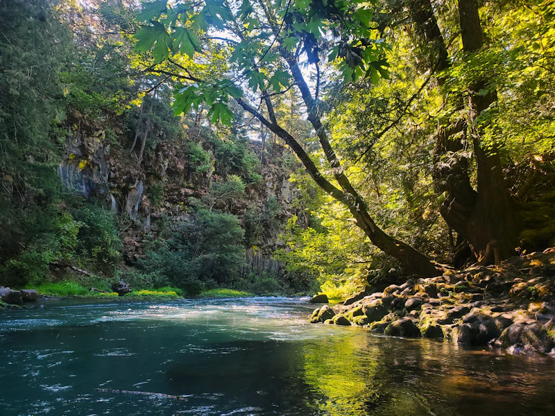 White Salmon River. Photo by the U.S. Forest Service
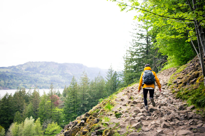 Photo by Jon Crays
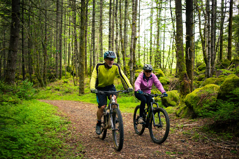 Wyeth Trail. Photo by Jon Crays
What is the History of the Columbia River Gorge National Scenic Area?
Long before it was designated as a scenic area, the Gorge was home to numerous Native American tribes, including the Chinook, Yakama, and Warm Springs peoples. These tribes and others thrived along the river for centuries, relying on and caring for its abundant natural resources. Salmon fishing, in particular, held particular spiritual and economic significance.
For many years there was concern about who should manage the Columbia River Gorge and in what way. A turning point came in 1986, when president Ronald Reagan signed into law the 292,500-acre Columbia River Gorge National Scenic Area. As prescribed by the act, the Forest Service consults with the Confederated Tribes of the Warm Springs, and Yakama Nation, Nez Perce Tribe and the Confederated Tribes of Umatilla Indian Reservation.
The National Scenic Area Act does not create a wilderness or park. Instead, it allows for existing rural and scenic characteristics to be retained, while it encourages compatible growth and development within urban areas. Today, the Columbia River Gorge Commission and the Forest Service co-manage the area, balancing conservation with community needs.
How to Get to the Columbia River Gorge National Scenic Area
The Columbia River Gorge is located along the border of Oregon and Washington. The primary access routes are Interstate 84, which runs east-west through the Oregon side of the Gorge, and State Route 14, on the Washington side.
Along I-84, key gateway towns include Troutdale, known as the “Gateway to the Gorge,” and Hood River, a popular base for outdoor recreation, dining, and local wineries. On State Route 14, visitors often base out of towns like Stevenson and White Salmon.
From Portland, Oregon, visitors can also take the Historic Columbia River Highway, or Route 30, for a more scenic drive with access to sites like Multnomah Falls and Vista House.
- Portland, Oregon: Half-hour by car
- Beaverton, Oregon: 1 hour by car
- Salem, Oregon: 1.5 to 2 hours by car
- Bend, Oregon: 2.5 hours by car
- Tacoma, Washington, 2.5 hours by car

One of the most popular sites in the Gorge is this two-tiered waterfall—the largest in Oregon—that plunges 620 feet down a basalt wall. To visit during peak season from late May through early September, purchase a timed-use permit. Booking a shuttle, bike tour, or traveling by public transit cancels the need for a permit.
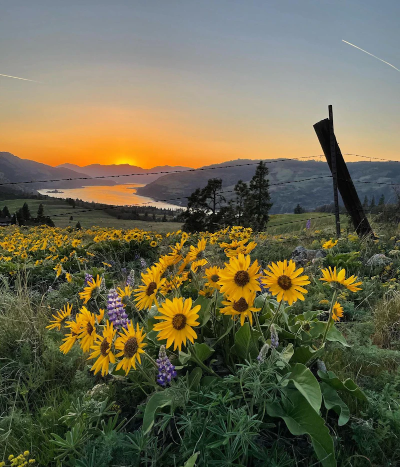
This is one of the Gorge’s most hiked trails for a reason: It offers incredible views, especially at the 2,948-foot summit, from where you can see Mount Defiance and Mount Hood on a clear day. The challenging 6.9-mile loop is especially popular during the spring wildflower bloom (permits are required during this season), when the balsamroot meadows bloom bright yellow.
Known as the “Windsurfing Capital of the World,” Hood River offers ideal wind conditions, calm bays for beginners, and a stunning backdrop. Several local schools provide lessons, gear rentals, and safety instruction tailored to all skill levels. Beginners can start in protected areas like the Event Site or The Hook, while experienced surfers can take to the main river.
 Balsamroot
This wildflower is native to the area and its bright yellow flowers that resemble sunflowers blanket the Gorge come spring, especially on Dog Mountain.
Balsamroot
This wildflower is native to the area and its bright yellow flowers that resemble sunflowers blanket the Gorge come spring, especially on Dog Mountain.
 Oregon white oak
This native tree species is found in drier, open areas on the eastern side of the Gorge. They are known for distinct gnarled branches and golden fall foliage.
Oregon white oak
This native tree species is found in drier, open areas on the eastern side of the Gorge. They are known for distinct gnarled branches and golden fall foliage.
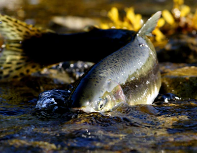 Chinook salmon
The largest of the salmon in the Columbia River, with adults averaging 22 pounds, though specimens up to 50 pounds have been spotted at the must-visit fish ladders at Bonneville Dam.
Chinook salmon
The largest of the salmon in the Columbia River, with adults averaging 22 pounds, though specimens up to 50 pounds have been spotted at the must-visit fish ladders at Bonneville Dam.
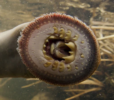 Pacific lamprey
This snake-like creature looks more like an eel than a fish, and can be found attached to rocks along the river using their suction-cup mouths.
Pacific lamprey
This snake-like creature looks more like an eel than a fish, and can be found attached to rocks along the river using their suction-cup mouths.
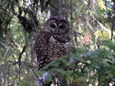 Northern spotted owl
This threatened species, known for its distinct white spots on its head, is the focus of much Forest Service research across the Gorge, having seen population declines linked to habitat loss.
Northern spotted owl
This threatened species, known for its distinct white spots on its head, is the focus of much Forest Service research across the Gorge, having seen population declines linked to habitat loss.
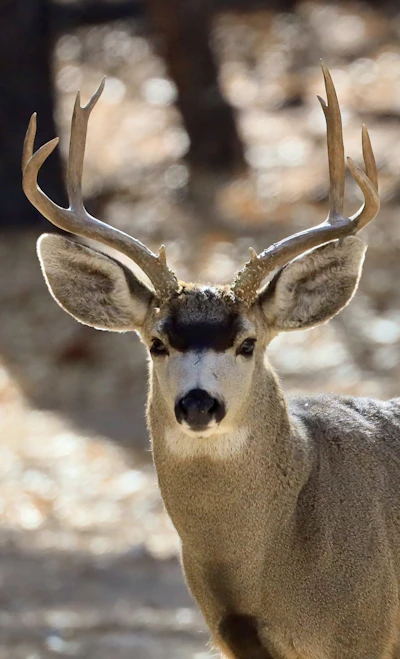 Mule deer
With a stocky build, black-tipped tail, and a brown coat that turns gray in the winter, this deer feeds on shrubs, grasses, and acorns and prefers high elevation areas.
Mule deer
With a stocky build, black-tipped tail, and a brown coat that turns gray in the winter, this deer feeds on shrubs, grasses, and acorns and prefers high elevation areas.
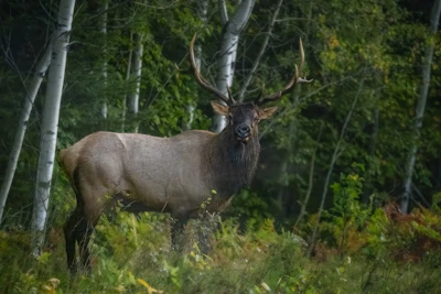 Elk
This majestic animal, the second largest species in the deer family after moose, is most active during dawn and dusk and during fall rutting season.
Elk
This majestic animal, the second largest species in the deer family after moose, is most active during dawn and dusk and during fall rutting season.
Related Impact
Restoring the Columbia River Gorge National Scenic Area
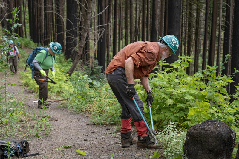
Working hand-in-hand with the community and our partners, less than a decade after the devastating Eagle Creek Fire, nearly every mile of trail that was damaged has reopened.
What’s the Best First-Timer’s Adventure in the Columbia River Gorge National Scenic Area?
For an experience that combines all of the Columbia River Gorge’s breathtaking features into a single hike, head out on the Eagle Creek Trail. The 3.8-mile out-and-back route hugs a basalt cliffside through a slot canyon filled with waterfalls, including the spectacular Punch Bowl Falls.

Where to Find More Information on the Columbia River Gorge National Scenic Area
For more information or questions, visit https://www.fs.usda.gov/r06/columbiarivergorge
Discover how communities, volunteers, and partners are shaping the future of our National Forests and Grasslands.
The National Forest Foundation works with partners across Northern Colorado to restore forests, reduce wildfire risk, and care for the…
After years of damage, recovery, and reconstruction, the trail to Hanging Lake has been fully rebuilt, creating a more durable,…
Erosion and wildfire had left Arizona's historic Highline Trail rutted and unsafe. After five years of work with the Tonto…
Forest restoration near Flagstaff is reducing wildfire risk for local communities and safeguarding the water supply for millions across the…
Colorado's 14ers draw thousands of visitors each year, and the pressure on these fragile alpine landscapes is growing. Here's a…
Visitors of all ages can explore forest trails and sparkling waters, discover wildlife and underwater habitats, and connect with Tahoe’s…
A partnership-driven program connecting youth on Montana’s Flathead Reservation with hands-on conservation work, heritage education, and pathways in natural resource…
Seeing the impact first hand on the Grand Mesa, Uncompaghre and Gunnison National Forests
Seven Years of Reopening Trails After the Eagle Creek Fire
Field Ranger Program Connects Diverse Communities to Forests in Southern California
Our Forests Need Us Today.
Your donation powers critical, on-the-ground conservation—from wildfire recovery to watershed restoration—protecting forests for the future.

