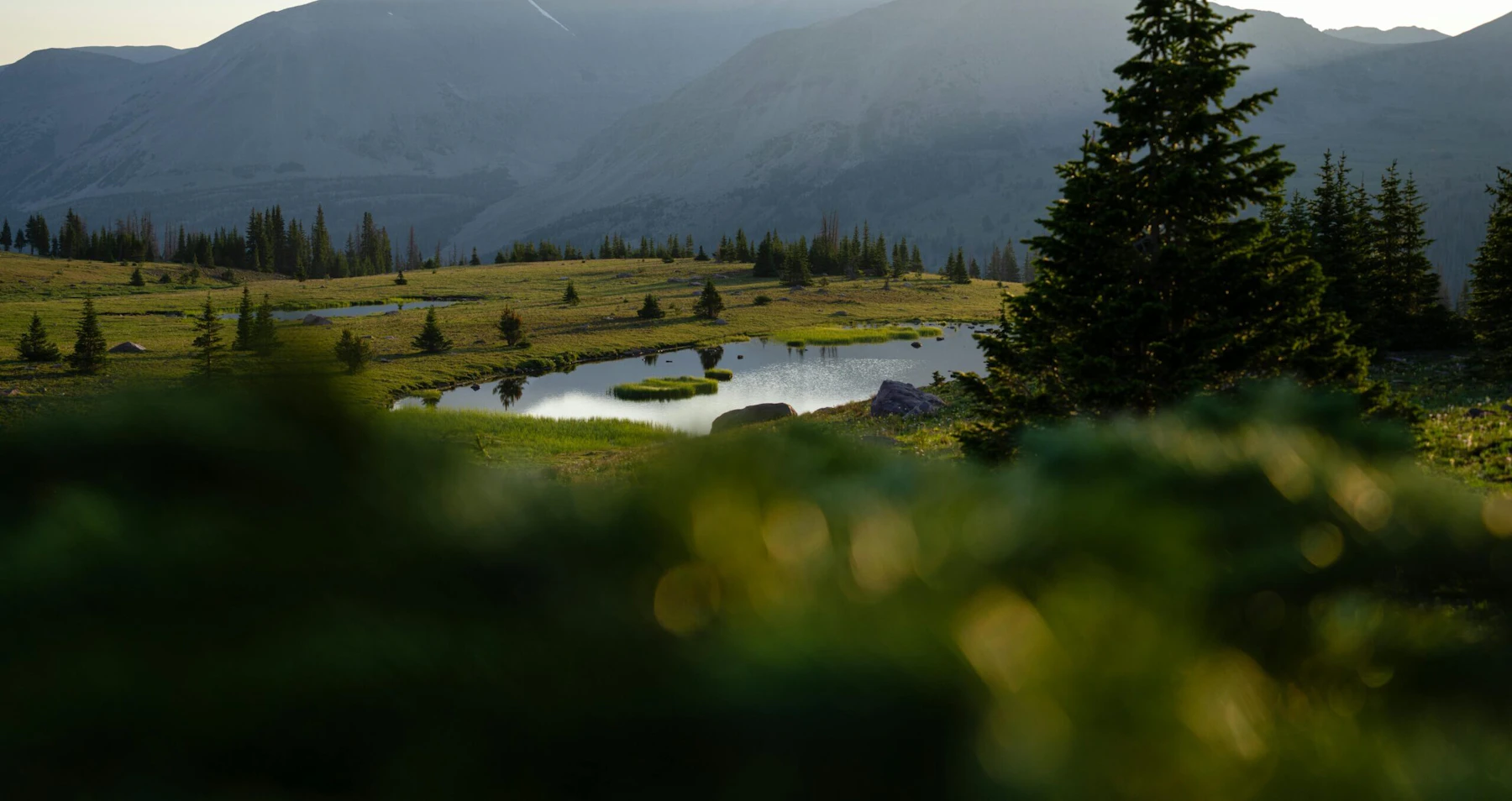
Discover the Uinta-Wasatch-Cache National Forest, nearly 2.2 million acres of mountain ranges and deep canyons in northern Utah and southwestern Wyoming. One of the forest’s defining features is the Uinta Mountain Range, the highest east-west mountain range in the continental United States. Rugged peaks rise above 13,000 feet, dotted with hundreds of glacial lakes.
The High Uintas Wilderness is one of nine Wilderness Areas in the forest that offers backpackers access to high-altitude meadows, clear lakes, and some of the most remote terrain in Utah. The wilderness includes 13,528-foot Kings Peak, the highest point in the state.
The Cache portion of the forest, centered around Logan Canyon, is celebrated for its limestone cliffs, wildflower-filled meadows, and access to Bear Lake. To the west, the Wasatch Range forms a dramatic backdrop to the Salt Lake Valley; its western side, known as the Wasatch Front, is the largest population center in the state.
Over one million people live in close proximity to the forest, which receives an average of nine million visits annually, making it one of the most popular National Forests in the country. Big Cottonwood, Little Cottonwood, and American Fork Canyons are among the most popular destinations.
More than 1,700 miles of trails draw hikers, mountain bikers, and horseback riders. The High Uintas’ lakes and stretches of the Logan, Weber, Ogden and Provo rivers feature world-class fishing and paddling. In the winter, the forest attracts just as many visitors for its deep, dry powder. Along with hosting five famed ski areas, including Alta and Snowbird, the forest opens 700,000 acres to non-motorized winter activities, as well as vast areas for snowmobiling.
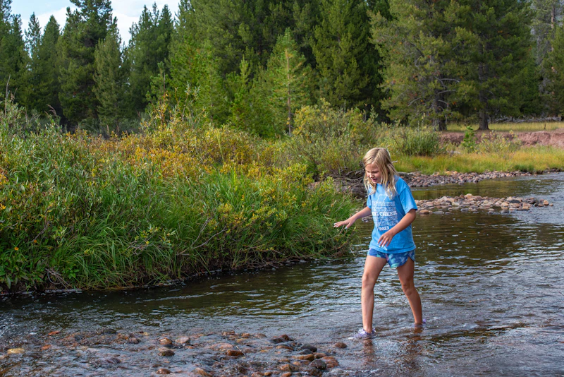 Christmas Meadows. Photo by Elizabeth Hastings
 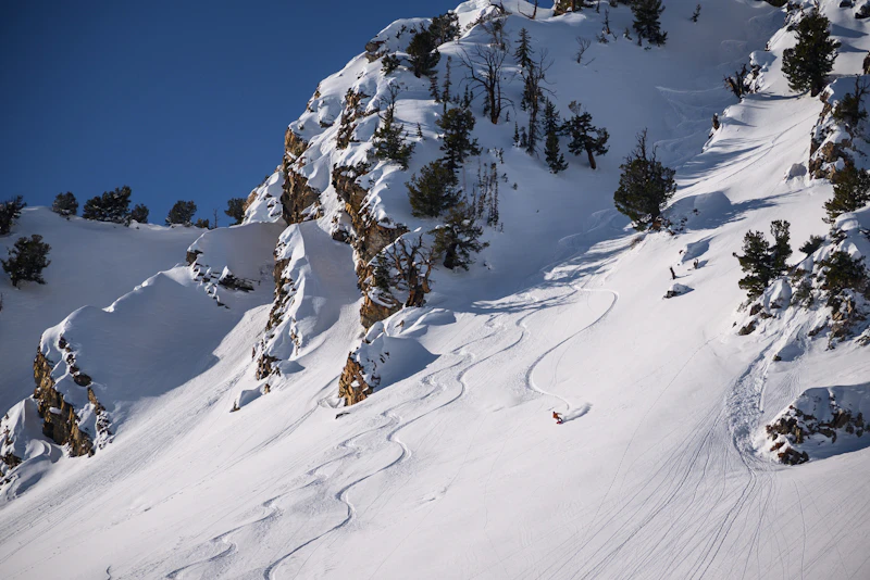 Mt. Raymond. Photo by Bradford Schaub
 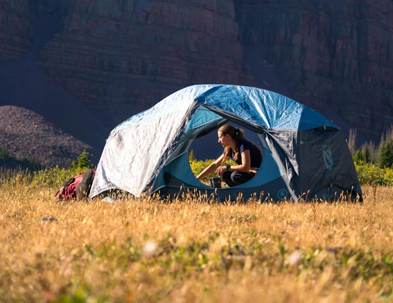 Red Castle camping. Photo by Alex-Moliski
 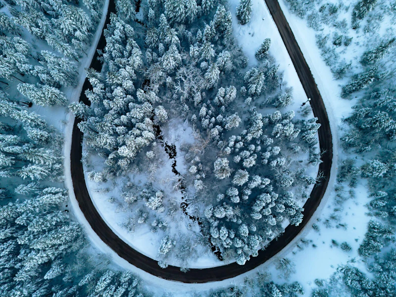 American Fork canyon. Photo by Danica Whiting
 What is the History of the Uinta-Wasatch-Cache National Forest?
The Wasatch National Forest was established first, in 1906, to safeguard the steep slopes above Utah’s growing communities. The Uinta National Forest followed in 1897 under earlier forest reserve designations, later gaining national forest status. Cache National Forest was established in 1908. In 2007, the three forests were administratively combined into the Uinta–Wasatch–Cache National Forest.
Long before it became a federally managed forest, the region was home to Indigenous peoples, including the Ute, Shoshone, and Goshute. The names “Uinta” and “Wasatch” come from the Ute language, meaning “pine forest” or “pine tree,” and “mountain pass” or “low place in high mountains.” “Cache” is believed to have come from French fur trappers, meaning “to hide.”
How to Get to the Uinta-Wasatch-Cache National Forest
For the Wasatch Range near Salt Lake City, Interstate 80 and Interstate 15 connect to well-traveled canyon roads. Further north, the Ogden area provides access to the forest via State Route 39, which winds up Ogden Canyon toward reservoirs and trailheads.
To reach the Uinta Mountains,U.S. Highway 40 connects the Salt Lake and Park City region to gateway communities of Duchesne and Vernal. From Highway 40, State Route 35 and State Route 150, Mirror Lake Highway, offer direct entrances into the High Uintas.
Northern segments of the forest near Logan are accessed via U.S. Highway 89, which travels up Logan Canyon toward Bear Lake. For visitors coming from Wyoming, routes near Evanston connect easily to the forest’s eastern Uintas.
- Salt Lake City, Utah: Half-hour to 1 hour by car
- Provo, Utah: Half-hour to 1 hour by car
- Pocatello, Idaho: 2.5 to 3 hours by car

Of the forest’s four scenic drives, this 37-mile route through Mount Nebo Wilderness sets itself apart for the sheer breadth of beauty it offers. Experience rugged mountain beauty and stunning overlooks of surrounding valleys, a scene that’s especially spectacular when the leaves change during the fall.
Little Cottonwood Canyon is famed for its granite slabs, cracks, and boulders, offering classic routes with clean lines and technical movement. Nearby Big Cottonwood Canyon provides quartzite cliffs with steep walls. In American Fork Canyon, find limestone caves and overhanging routes.
In the Uinta Mountains, broad plateaus and open meadows create ideal terrain for cross-country skiing. The Mirror Lake Highway, closed to vehicles in winter, becomes a popular corridor for Nordic skiers who want sweeping views and deep snowpacks.
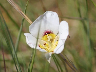 Sego lily In the late spring and early summer, this wildflower—Utah’s state flower—blooms three-petaled white flowers, marked with yellow or purple centers.
 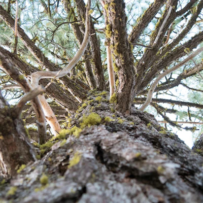 Lodgepole pine This tall conifer, whose name comes from its traditional use by Indigenous peoples for constructing tipis and lodges, is one of the most common trees found in the forest.
 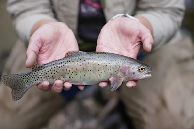 Bonneville cutthroat Known for its distinctive red-orange slash marks on the lower jaw, this native trout is a prized catch for anglers.
  Golden eagle With a wingspan of up to seven feet, this powerful raptor can be spotted above open meadows, canyon rims, and high ridges as it searches for prey.
 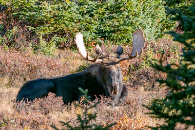 Moose Growing up to six feet tall and weighing up to 1,600 pounds makes these herbivores easy to spot, especially near lakes and rivers.
 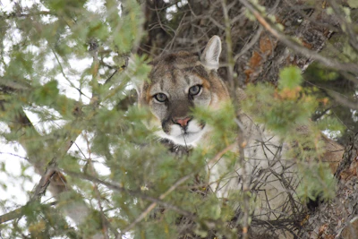 Mountain lion This solitary and elusive cat, also known as cougar or puma, primarily hunts for deer at dawn and dusk.
 Related Impact
Restoring the Colorado River Watershed through Nature Based Solutions
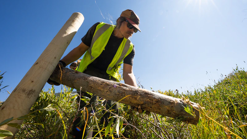
The National Forest Foundation and our partners are taking action through process-based restoration techniques that work with nature to bring life back to streams and wetlands in the Colorado River Watershed, securing water for people, wildlife, and the future.
What’s the Best First-Timer’s Adventure in the Uinta-Wasatch-Cache National Forest
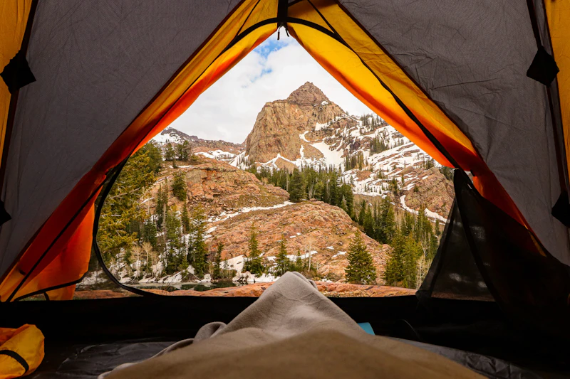
For a short but rewarding trail that offers epic mountain scenery, hike to the top of 11,943-foot Bald Mountain from 10,715-foot Bald Mountain Pass along Mirror Lake Highway. Starting at the pass means the elevation gain has largely been covered, though this 1.3-mile trail is quite a steep climb. At the top, enjoy panoramic views filled with too many glacial lakes to count.
Where to Find More Information on the Uinta-Wasatch-Cache National Forest
For more information or questions, visit https://www.fs.usda.gov/r04/uinta-wasatch-cache.
Discover how communities, volunteers, and partners are shaping the future of our National Forests and Grasslands.
Erosion and wildfire had left Arizona's historic Highline Trail rutted and unsafe. After five years of work with the Tonto…
Forest restoration near Flagstaff is reducing wildfire risk for local communities and safeguarding the water supply for millions across the…
Colorado's 14ers draw thousands of visitors each year, and the pressure on these fragile alpine landscapes is growing. Here's a…
Visitors of all ages can explore forest trails and sparkling waters, discover wildlife and underwater habitats, and connect with Tahoe’s…
A partnership-driven program connecting youth on Montana’s Flathead Reservation with hands-on conservation work, heritage education, and pathways in natural resource…
Seeing the impact first hand on the Grand Mesa, Uncompaghre and Gunnison National Forests
Seven Years of Reopening Trails After the Eagle Creek Fire
Field Ranger Program Connects Diverse Communities to Forests in Southern California
Anna's family has been planting trees for 50 years. Now she is helping build a sustainable model to meet the…
Nature-based solutions are bringing life back to streams and wetlands in the Colorado River Watershed, securing water for people, wildlife,…
Our Forests Need Us Today.
Your donation powers critical, on-the-ground conservation—from wildfire recovery to watershed restoration—protecting forests for the future.

