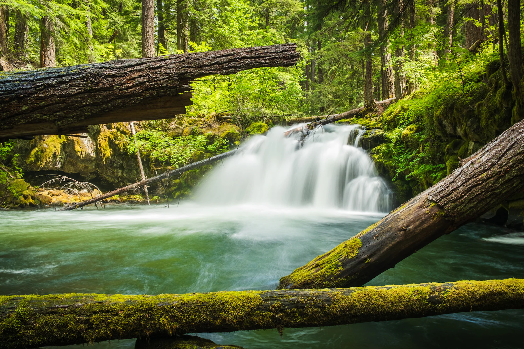
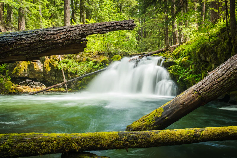
Experience the Umpqua National Forest, nearly one million acres on the western slopes of the Cascade Mountains in Oregon. The forest is named after the Umpqua River, which flows through the region. The Umpqua is next-door to Crater Lake National Park, featuring a similar landscape with more variety of recreation.
Explosive geologic events, particularly the eruption of Mt. Mazama, which formed Crater Lake nearly 7,000 years ago, have shaped the distinctive landscape of the Umpqua National Forest. The geologic history provides spectacular scenery as well as an abundance of natural and cultural resources.
The forest contains three Wilderness Areas: Boulder Creek, Rogue-Umpqua Divide, and Mt. Thielsen. An abundance of waterfalls, including the 272-foot Watson Falls on the North Umpqua Highway, is one of the forest’s defining features and a common reward for hikers, mountain bikers, and horseback riders. More than 530 miles of trails include 30 miles of the Pacific Crest Trail.
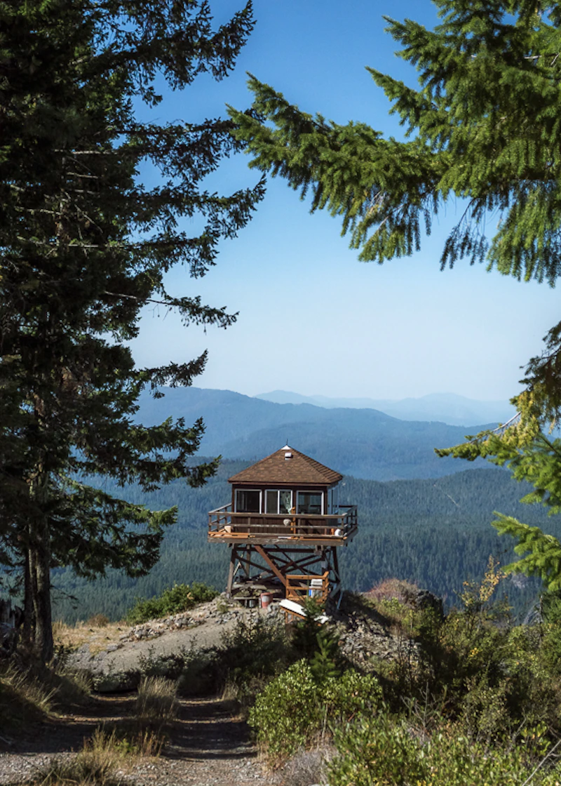
With more than 50 developed campgrounds, four recreation resorts, and six historic rental cabins and lookouts, the Umpqua is ideal for longer stays. The North Umpqua and Rogue Rivers are prized for fishing and paddling. In winter, cross-country skiing and snowmobiling are popular, particularly in higher elevation areas such as the Diamond Lake area.
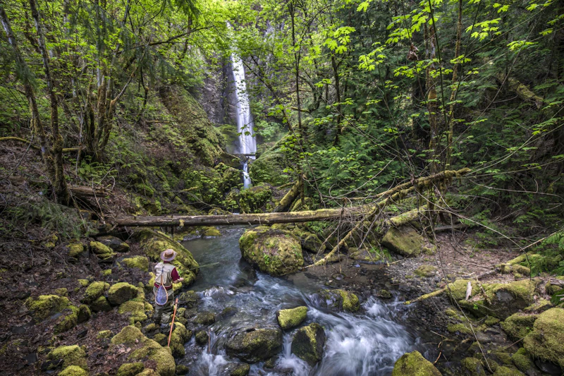 Slide Creek Falls. Photo by Phil Reedy
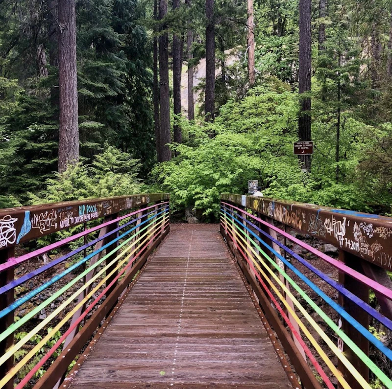 Photo by Alyssa Forsyrh
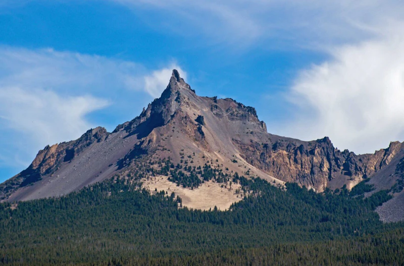 Mt. Thielsen. Photo by Jackie Dyer
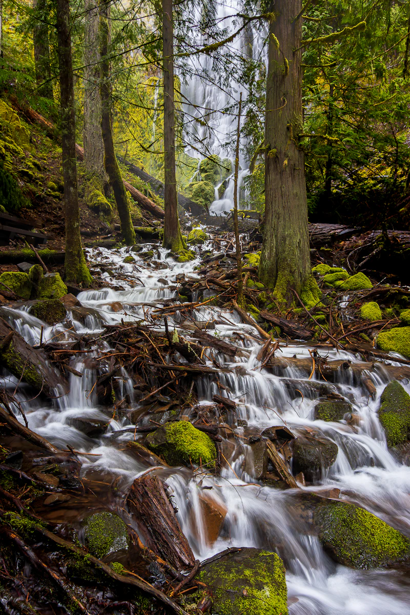 Moon Falls. Photo by Sarah Barry
What is the History of the Umpqua National Forest?
The Umpqua National Forest is on the traditional homelands of the Yoncalla Kalapuyans, the Southern Molalla, and the Upper Umpqua, now part of three federally recognized tribes: The Cow Creek Band of Umpqua Tribe of Indians, The Confederated Tribes of Grand Ronde, and the Confederated Tribes of Siletz Indians.
In the 1850s, Europeak -Americans came to the area to mine for gold and take advantage of the Donation Land Claims Act. In 1907, what was originally the Cascade Forest Reserve was divided into a number of National Forests: Mt. Hood, Willamette, Rogue River, and Umpqua.
After the road connecting Roseburg and Diamond Lake was completed in 1940, it took another 25 years to become a major east-west route. With the new route in place, logging increased in the upper reaches of the Forest.
Intensive logging took place for decades, especially in the 1980s and early 1990s. The Northwest Forest Plan was adopted in 1994, which shifted the focus of the Forest Service and its partners to protecting key species, improving forest health, and restoring the watershed.
How to Get to the Umpqua National Forest
From the west, Interstate 5 is the main north-south corridor in Oregon, connecting towns like Roseburg, Canyonville, or Canyon City to the forest. U.S. Highway 138 runs east-west through the forest, connecting Roseburg to the North Umpqua River and the Diamond Lake area.
For northern portions of the forest, Oregon Route 138 and Oregon Route 230 connect smaller towns like Canyonville and Dillard. From the east, Oregon Route 230 or U.S. Highway 97, passing through towns such as Chemult and the outskirts of Crater Lake National Park.
- Bend, Oregon: 2.5 to 3 hours by car
- Eugene, Oregon: 2.5 to 3 hours by car
- Medford, Oregon: 2.5 to 3 hours by car
- Corvallis, Oregon: 3 to 3.5 hours by car
- Portland, Oregon: 4 to 4.5 hours by car

Surrounded by the scenic Cascade Mountains, this 3,000-acre lake offers opportunities for kayaking, boating, and fishing for rainbow and brooks tour during warmer months. In winter, the area around Diamond Lake transforms into a hub for snowmobiling, cross-country skiing, and snowshoeing.
This 272-foot waterfall is the third highest in the state, creating a powerful cascade over basalt cliffs along the North Umpqua River Valley. A short but steep 0.8-mile hike through forests of Douglas-fir and western red cedar brings you to the base.
This world-class fly-fishing river is famed as much for its scenic beauty as its healthy populations of steelhead, chinook, and cutthroat trout. Some of the best access is near the Steamboat Inn, which sits along a “fly-fishing only” section of the Wild and Scenic River.
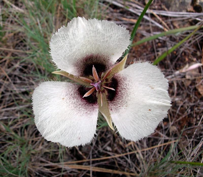 Umpqua mariposa lily
This endangered native wildflower produces a creamy white flower with a purple botch at its base and thieves in open meadows or along forest edges.
Umpqua mariposa lily
This endangered native wildflower produces a creamy white flower with a purple botch at its base and thieves in open meadows or along forest edges.
 Oregon white oak
This threatened native hardwood, with its deeply lobed leaves, is making a comeback on the Umpqua thanks to restoration efforts.
Oregon white oak
This threatened native hardwood, with its deeply lobed leaves, is making a comeback on the Umpqua thanks to restoration efforts.
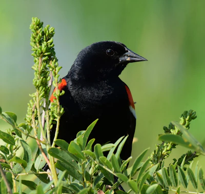 Red-winged blackbird
With an all-black body except for bright red wings, this songbird is highly social, often forming large flocks and defending territories during breeding season.
Red-winged blackbird
With an all-black body except for bright red wings, this songbird is highly social, often forming large flocks and defending territories during breeding season.
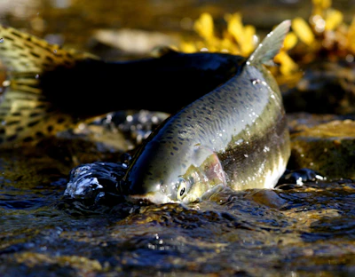 Salmon
The North Umpqua River supports chinook, coho, and steelhead populations, which hatch and spawn in its freshwater streams, spending a few years in the Pacific in between.
Salmon
The North Umpqua River supports chinook, coho, and steelhead populations, which hatch and spawn in its freshwater streams, spending a few years in the Pacific in between.
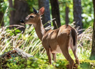 White-tailed deer
With a red-brown coat that turns gray in the winter, this deer is frequently spotted throughout the forest. Bucks, or adult males, grow antlers annually, which they shed after mating season.
White-tailed deer
With a red-brown coat that turns gray in the winter, this deer is frequently spotted throughout the forest. Bucks, or adult males, grow antlers annually, which they shed after mating season.
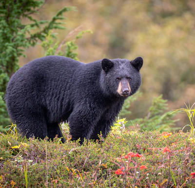 Black bear
This medium-sized bear resides in the dense woodlands and open meadows of the forest, foraging for berries, insects, and small animals.
Black bear
This medium-sized bear resides in the dense woodlands and open meadows of the forest, foraging for berries, insects, and small animals.
Related Impact
Reforestation on the Umpqua
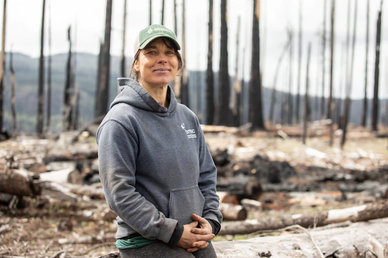
Anna’s family has been planting trees for 50 years. Now she is helping build a sustainable model to meet the Forest’s future post-fire reforestation needs.
What’s the Best First-Timer’s Adventure in the Umpqua National Forest
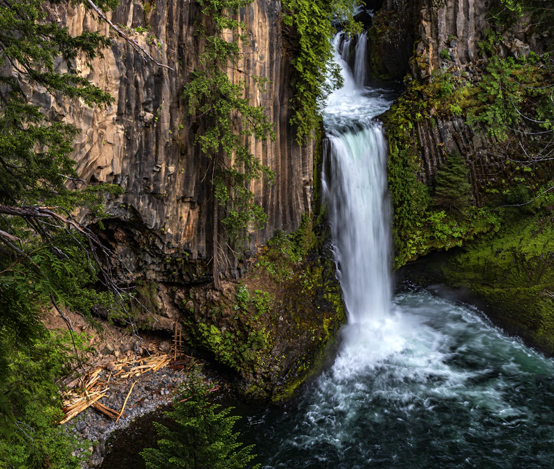
For an easy way to experience Umpqua’s waterfall splendor, head to Toketee Falls. An easy 0.6-mile loop trail winds through old-growth forest before reaching a viewpoint for the 120-foot waterfalls, which runs over basalt formations.
Where to Find More Information on the Umpqua National Forest
For more information or questions, visit https://www.fs.usda.gov/r06/umpqua.
Discover how communities, volunteers, and partners are shaping the future of our National Forests and Grasslands.
The National Forest Foundation works with partners across Northern Colorado to restore forests, reduce wildfire risk, and care for the…
After years of damage, recovery, and reconstruction, the trail to Hanging Lake has been fully rebuilt, creating a more durable,…
Erosion and wildfire had left Arizona's historic Highline Trail rutted and unsafe. After five years of work with the Tonto…
Forest restoration near Flagstaff is reducing wildfire risk for local communities and safeguarding the water supply for millions across the…
Colorado's 14ers draw thousands of visitors each year, and the pressure on these fragile alpine landscapes is growing. Here's a…
Visitors of all ages can explore forest trails and sparkling waters, discover wildlife and underwater habitats, and connect with Tahoe’s…
A partnership-driven program connecting youth on Montana’s Flathead Reservation with hands-on conservation work, heritage education, and pathways in natural resource…
Seeing the impact first hand on the Grand Mesa, Uncompaghre and Gunnison National Forests
Seven Years of Reopening Trails After the Eagle Creek Fire
Field Ranger Program Connects Diverse Communities to Forests in Southern California
Our Forests Need Us Today.
Your donation powers critical, on-the-ground conservation—from wildfire recovery to watershed restoration—protecting forests for the future.

