Umpqua National Forest
The Umpqua National Forest in southwestern Oregon is nestled on the westside of the Cascade Mountains.
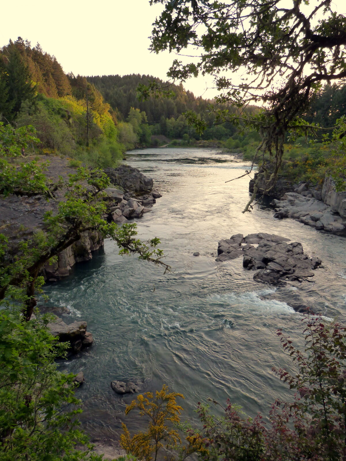
Explosive geologic events – particularly the eruption of Mt. Mazama, which formed Crater Lake nearly 7,000 years ago, have shaped the distinctive landscape on the 984,602-acre Umpqua National Forest. The geologic history provides spectacular scenery as well as an abundance of natural and cultural resources. Visitors discover a diverse place of thundering waters, high mountain lakes, heart-stopping rapids, and peaceful ponds.
An abundance of waterfalls, including the 272-foot Watson Falls on the North Umpqua Highway, characterizes the Forest. The Boulder Creek Wilderness, 19,100 acres, is entirely within the Forest boundaries. The Umpqua shares two other wilderness areas with other Forests: Rogue-Umpqua Divide Wilderness, 26,350 acres, and Mt. Thielsen Wilderness, 26,593 acres.
Several distinct geologic provinces come together in the Umpqua National Forest providing a wide spectrum of habitat for a wide diversity of plants and wildlife. The Forest is home to 18 fish species, including winter steelhead, Chinook and coho salmon, sea-run cutthroat trout, and Pacific lamprey. The Forest abounds with 66 mammal species, 236 bird species, and 27 reptile and amphibian species. Anadromous, or sea-going fish, enjoy 359 miles of streams with thousands more miles of streams covering the forest landscape.
History of the Area
The Umpqua National Forest is on the traditional homelands of the Yoncalla Kalapuyans, the Southern Molalla, and the Upper Umpqua who have carried out their life-sustaining practices in the Umpqua Basin since time immemorial. These Indigenous peoples are now part of three federally recognized tribes: The Cow Creek Band of Umpqua Tribe of Indians, The Confederated Tribes of Grand Ronde, and the Confederated Tribes of Siletz Indians.
In the 1850s, Euro-Americans came to the area to mine for gold and take advantage of the Donation Land Claims Act. To make way for the white settlers, the U.S. Government forcibly removed Native Americans from their homelands and placed them on reservations. White settlers attacked those who refused to leave their homelands. Despite this history, many Cow Creek tribal members still live in the Umpqua Basin today. Learn more about the story of the Cow Creek Tribe at their website, and read a detailed account of Umpqua Basin Tribal History at NDNHistory Research.
The Umpqua National Forest had its genesis on March 2, 1907, in the setting aside of acreage in the Coast Range in Douglas County. Two days later, Congress renamed all of the forest reserves as National Forests. The Forest Service broke up the Cascade Forest Reserve on July 1, 1908, into what became the Mt. Hood, Willamette, Umpqua, and Rogue River National Forests.
On the Umpqua, Forest Service staff began building trails, constructing bridges, fighting fire, monitoring grazing, and erecting lookouts. Logging and mining began in 1925. The Civilian Conservation Corps shaped part of the Forest by building roads, bridges and recreation facilities in the 1930s. After the road connecting Roseburg and Diamond Lake was completed in 1940, it took another 25 years to become a major east-west route. With the new route in place, logging increased in the upper reaches of the Forest.
Intensive logging took place for decades, especially in the 1980s and early 1990s. The Northwest Forest Plan was adopted in 1994, which shifted the focus of the Forest Service and its partners to protecting key species, improving forest health, and restoring the watershed.
Umpqua Adventures
Spend a night or two on the Umpqua National Forest! The Forest has 54 developed campgrounds with nearly 800 campsites, and six historic cabins and lookouts available for rent. You can explore the Forest on 350 miles of multi-use trails and hundreds of miles of roads maintained for car travel.
Interested in something more exhilarating? Try mountain biking the North Umpqua Trail. Thrill-seekers can go cat skiing on Mount Bailey or raft the exciting North Umpqua River.
Wilderness
The Umpqua National Forest has three different Wilderness Areas. Small waterfalls and rapids connect the series of quiet pools that make up Boulder Creek, a tributary of the North Umpqua River, and the namesake for the Boulder Creek Wilderness, a low-lying and small wilderness that is accessible by trail all year.
Glacial activity majestically carved the Mount Thielsen Wilderness where Mount Thielsen rises 9,182 feet to a spire-shaped summit sometimes referred to as the "Lightning Rod of the Cascades."
The Rogue Umpqua Divide Wilderness is located in southwest Oregon, ten miles west of Crater Lake National Park, and offers 100 miles of trails, providing loop opportunities and ridgetop vistas.