

Explore the Eldorado National Forest, nearly 800,000 acres nestled in the dramatic central Sierra Nevada of California and bordering Nevada. From low foothills of oak forests to the 10,000-foot Round Top, on the crest of the Sierra Nevada, the Eldorado is dizzying in its range of scale and the diversity of adventure.
The Eldorado National Forest is the heart of a vast wilderness: bordered by the Tahoe National Forest to the north, the Lake Tahoe Basin National Forests to the east, the Humboldt-Toiyabe National Forest to the southeast, and the Stanislaus National Forest to the south.
Water is a major resource of the Eldorado National Forest. The mountainous topography is broken by the steep canyons formed by the Mokelumne, Cosumnes, American, and Rubicon rivers. The average acre receives more than 50 inches of rainfall a year and the annual runoff is about 29 inches.
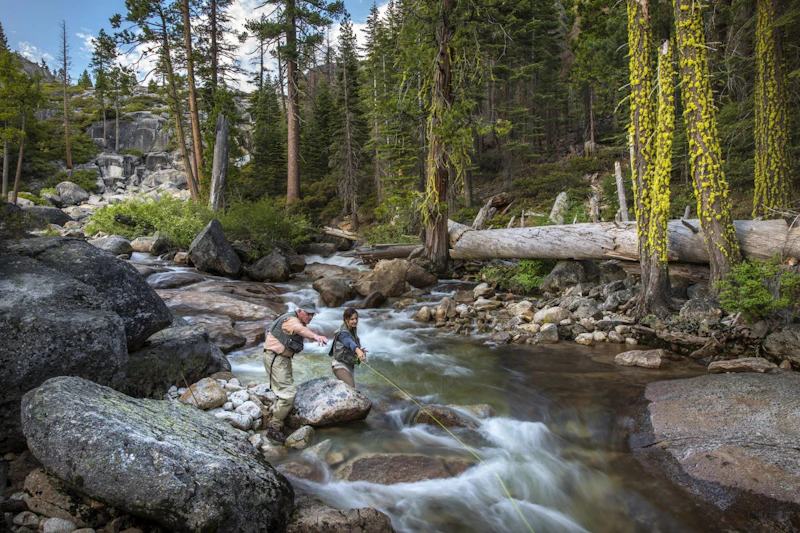
In addition, water provides an abundance of recreation. The forest is also home to 297 lakes and reservoirs and more than 600 miles of fishable streams in four major drainage systems: the Middle Fork of the American River, including the Rubicon; the South Fork of the American River; the Cosumnes River and the North Fork of the Mokelumne River.
Hike, bike, or horseback ride along more than 400 miles to get the best sense of the scale of this varied terrain. If rough and rugged is more your thing, the forest features two Wilderness Areas, the Mokelumne and the Desolation. For easier access, the Eldorado has more than 70 day-use and overnight recreation facilities, including five rental cabins.
Whether you prefer the serenity of a backcountry ski, the speed of the downhill runs, or the power of the snowmobile, there’s plenty of adventure to be had in the winter months.
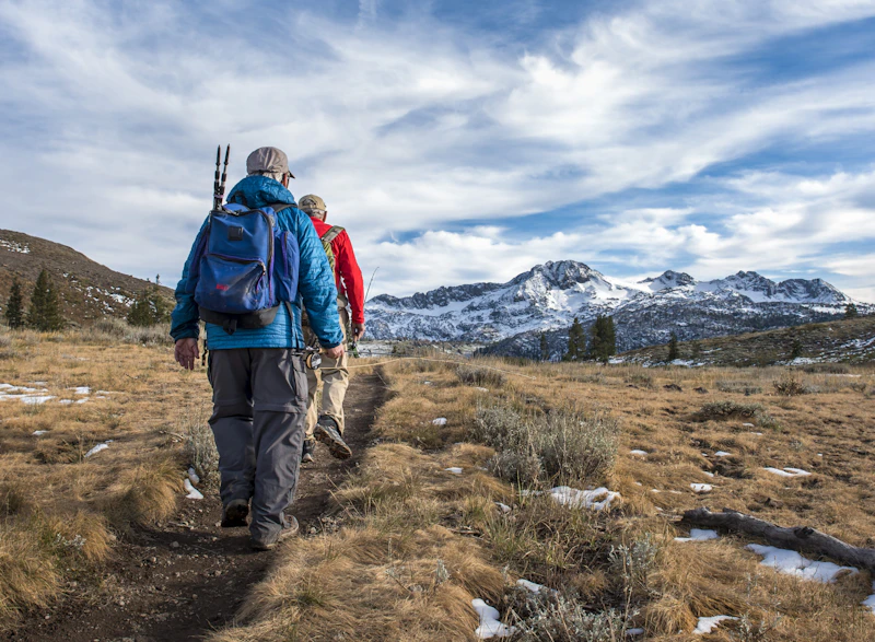 Pacific Crest Trail. Photo by Phil Reedy
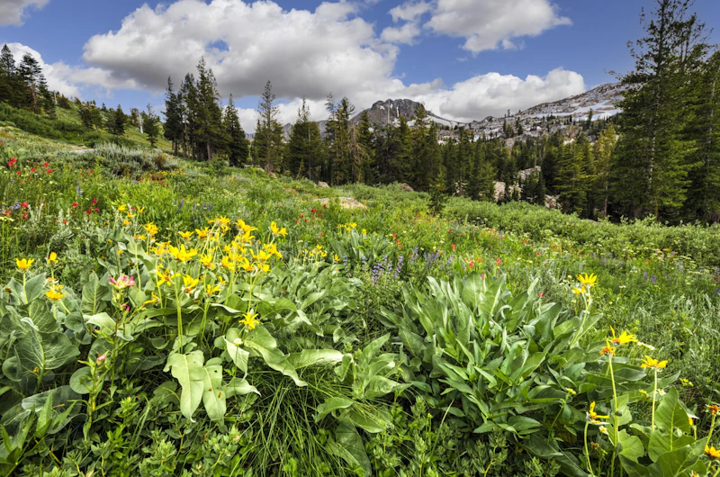 Carson Pass. Photo by Phil Reedy
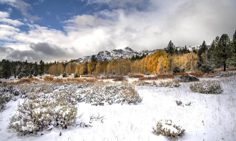 Photo by Phil Reedy
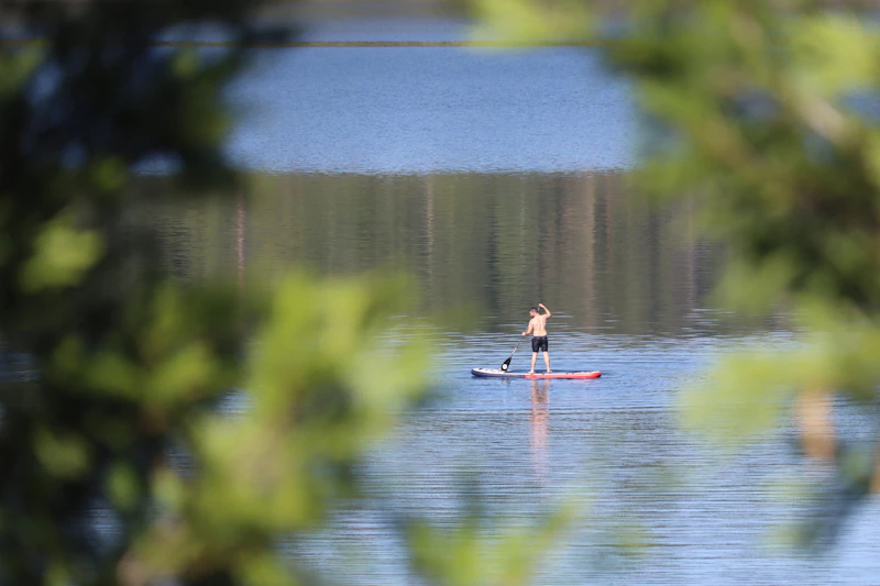 Photo by Kristina Lewis
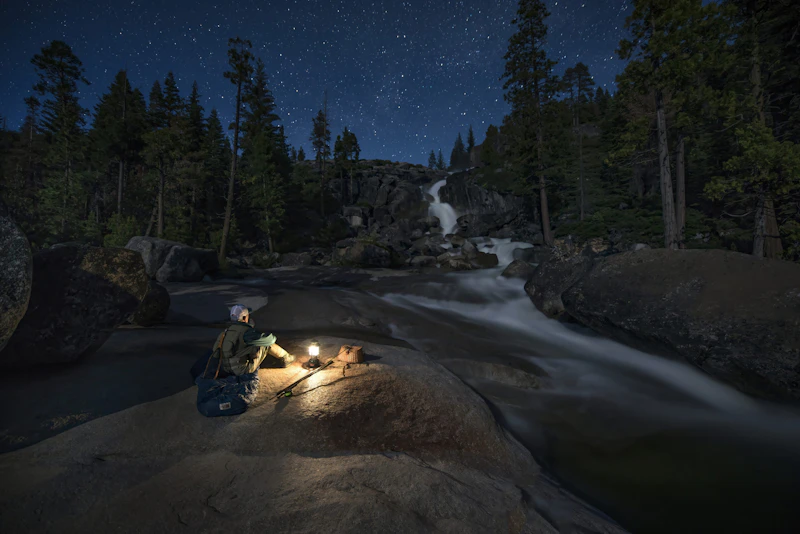 Photo by Phil Reedy
What is the History of the Eldorado National Forest?
For centuries, Native American tribes, including the Nisenan (Southern Maidu), Washoe, and Miwok peoples, established seasonal migration and trade routes across this region.
European exploration began in the early 1800s, and the area underwent major change in the middle of the century as a result of thousands of settlers arriving during the California Gold Rush.
In response to the environmental damage, the U.S. government established Eldorado National Forest in 1910. Throughout the 20th century, forest management evolved to balance resource extraction with conservation.

How to Get to the Eldorado National Forest
Located in the central Sierra Nevada region of California, east of Sacramento and west of Lake Tahoe, the Eldorado National Forest is accessed by Highway 50, the primary east-west throughway. This highway links up to the town of Placerville, one of the Eldorado’s main gateways and a good base for exploration. The town of Pollock Pins is also on Highway 50 and connects a number of trails and campgrounds.
From the north, California State Route 49 links to Highway 50. For travelers coming from the eastern destinations Reno or Lake Tahoe, Highway 50 provides direct access into the forest’s eastern sections. Those coming from southern California or the Central Valley can take Interstate 5 or Highway 99 north to Sacramento, then transfer to Highway 50.
- Sacramento, California: 1 to 1.5 hours by car
- San Francisco, California: 2.5 to 3 hours by car
- San Jose, California: 3 to 3.5 hours by car
- Fresno, California: 3.5 to 4 hours by car

One of the Sierra Nevada’s most popular destinations for climbing, this granite cliff band features more than 250 developed routes that range from easy bouldering to high-grade pitches. It’s located just off Highway 50, has a nearby campground, and offers spectacular views of the landscape.
This 22-mile motorcycle, ATV, and 4×4 road is an off-roader’s dream, with unique features, including rock formations and dramatic changes in elevation, that turn a backcountry drive into a high-adrenaline ride. It starts in the town of Georgetown and ends near Lake Tahoe, passing parts of the Eldorado, Tahoe, and Lake Tahoe Basin national forests.
In the Eldorado’s stunning Desolation Wilderness is Lake Aloha, an otherworldly granite basin with bright-blue water. To reach it, hike a 12-mile roundtrip trail via Echo Lakes Trailhead, near Lake Tahoe’s southern shore. The route features multiple lakes and Desolation’s quintessential granite landscape.
 Incense cedar
Towering up to 150 feet, this evergreen is known for its reddish bark, aromatic wood, and scale-like leaves. It is one of the more common tree species found in Eldorado’s mixed conifer forests.
Incense cedar
Towering up to 150 feet, this evergreen is known for its reddish bark, aromatic wood, and scale-like leaves. It is one of the more common tree species found in Eldorado’s mixed conifer forests.
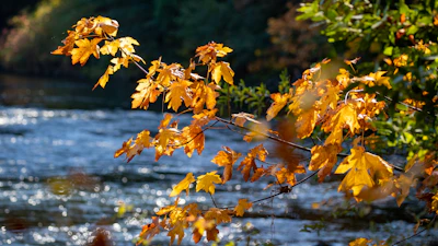 Big-leaf maple
Known for its massive leaves—reaching over a foot wide—this deciduous tree thrives in shaded canyons and along waterways. It glows bright yellow and gold come fall.
Big-leaf maple
Known for its massive leaves—reaching over a foot wide—this deciduous tree thrives in shaded canyons and along waterways. It glows bright yellow and gold come fall.
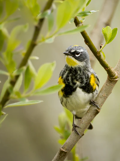 Yellow-rumped warbler
One of the most common songbirds in the Eldorado, this migratory bird is known for its bright yellow rump and crown.
Yellow-rumped warbler
One of the most common songbirds in the Eldorado, this migratory bird is known for its bright yellow rump and crown.
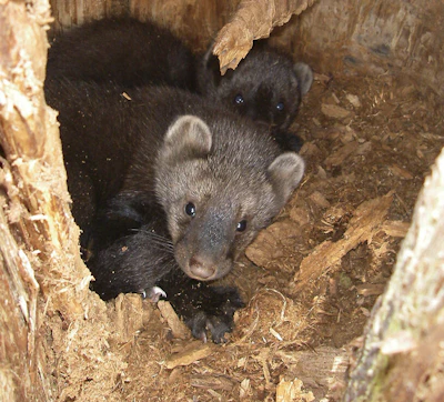 Fishers
This weasel-like mammal is an agile climber and skilled hunter, relying on small mammals and birds as food sources. Conservation efforts are working to restore its populations, which declined as a result of habitat loss and trapping.
Fishers
This weasel-like mammal is an agile climber and skilled hunter, relying on small mammals and birds as food sources. Conservation efforts are working to restore its populations, which declined as a result of habitat loss and trapping.
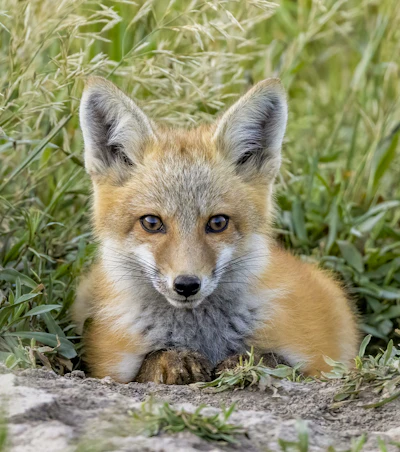 Red fox
With bright red coats and bushy tails, this small predator feeds on everything from insects to small mammals, and is most active at dawn and dusk.
Red fox
With bright red coats and bushy tails, this small predator feeds on everything from insects to small mammals, and is most active at dawn and dusk.
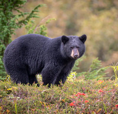 Black bears
Typically shy and solitary, this medium-sized bear avoids humans but is active during spring and fall when it forages heavily to prepare for winter hibernation.
Black bears
Typically shy and solitary, this medium-sized bear avoids humans but is active during spring and fall when it forages heavily to prepare for winter hibernation.
Related Impact
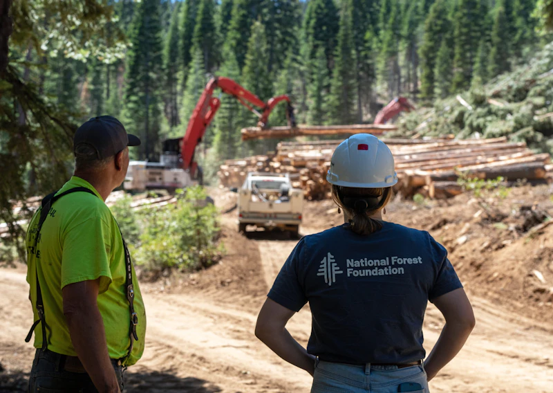
Creating a Fire Resilient Truckee
The largest, most destructive wildfires in California’s history have occurred in the last ten years. Everything is at stake for mountain communities like Truckee.
What’s the Best First-Timer’s Adventure in the Eldorado National Forest?
Hike an easy four-mile round-trip trail through granite outcrops and pine forest to the spectacular Bassi Falls, a 109-foot waterfall that leads to various swimming pools. It’s a great introduction to the Sierras for more casual hikers.
Where to Find More Information on the Eldorado National Forest
For more information or questions, visit https://www.fs.usda.gov/r05/eldorado
Discover how communities, volunteers, and partners are shaping the future of our National Forests and Grasslands.
The National Forest Foundation works with partners across Northern Colorado to restore forests, reduce wildfire risk, and care for the…
After years of damage, recovery, and reconstruction, the trail to Hanging Lake has been fully rebuilt, creating a more durable,…
Erosion and wildfire had left Arizona's historic Highline Trail rutted and unsafe. After five years of work with the Tonto…
Forest restoration near Flagstaff is reducing wildfire risk for local communities and safeguarding the water supply for millions across the…
Colorado's 14ers draw thousands of visitors each year, and the pressure on these fragile alpine landscapes is growing. Here's a…
Visitors of all ages can explore forest trails and sparkling waters, discover wildlife and underwater habitats, and connect with Tahoe’s…
A partnership-driven program connecting youth on Montana’s Flathead Reservation with hands-on conservation work, heritage education, and pathways in natural resource…
Seeing the impact first hand on the Grand Mesa, Uncompaghre and Gunnison National Forests
Seven Years of Reopening Trails After the Eagle Creek Fire
Field Ranger Program Connects Diverse Communities to Forests in Southern California
Our Forests Need Us Today.
Your donation powers critical, on-the-ground conservation—from wildfire recovery to watershed restoration—protecting forests for the future.

