What began as a preliminary characterization at an orphaned hard rock mine in Illinois Gulch, a prominent drainage of the Upper Blue River, ultimately morphed into a collaborative effort to remove mine waste from the Illinois Gulch flow path on the White River National Forest.
The 2014-15 study conducted by Trout Unlimited (TU) and EPA (Environmental Protection Agency) identified several sites in Illinois Gulch that were prominent contributors of impaired water quality. Sampling identified the Mountain Pride mine as a significant source of zinc and cadmium loads that exceeded both acute and chronic aquatic life standards.
The Mountain Pride site was unique in that part of the property lies in the White River National Forest, and part of the site is privately owned. Because of the mixed land ownership at Mountain Pride, a removal action would require permissions from the U.S. Forest Service (USFS) and the EPA. Additionally, the National Forest Foundation’s Ski Conservation and Forest Stewardship Fund grant opportunity provided critical funding that afforded TU the ability to remove toxic mine waste from the Illinois Gulch flow path.
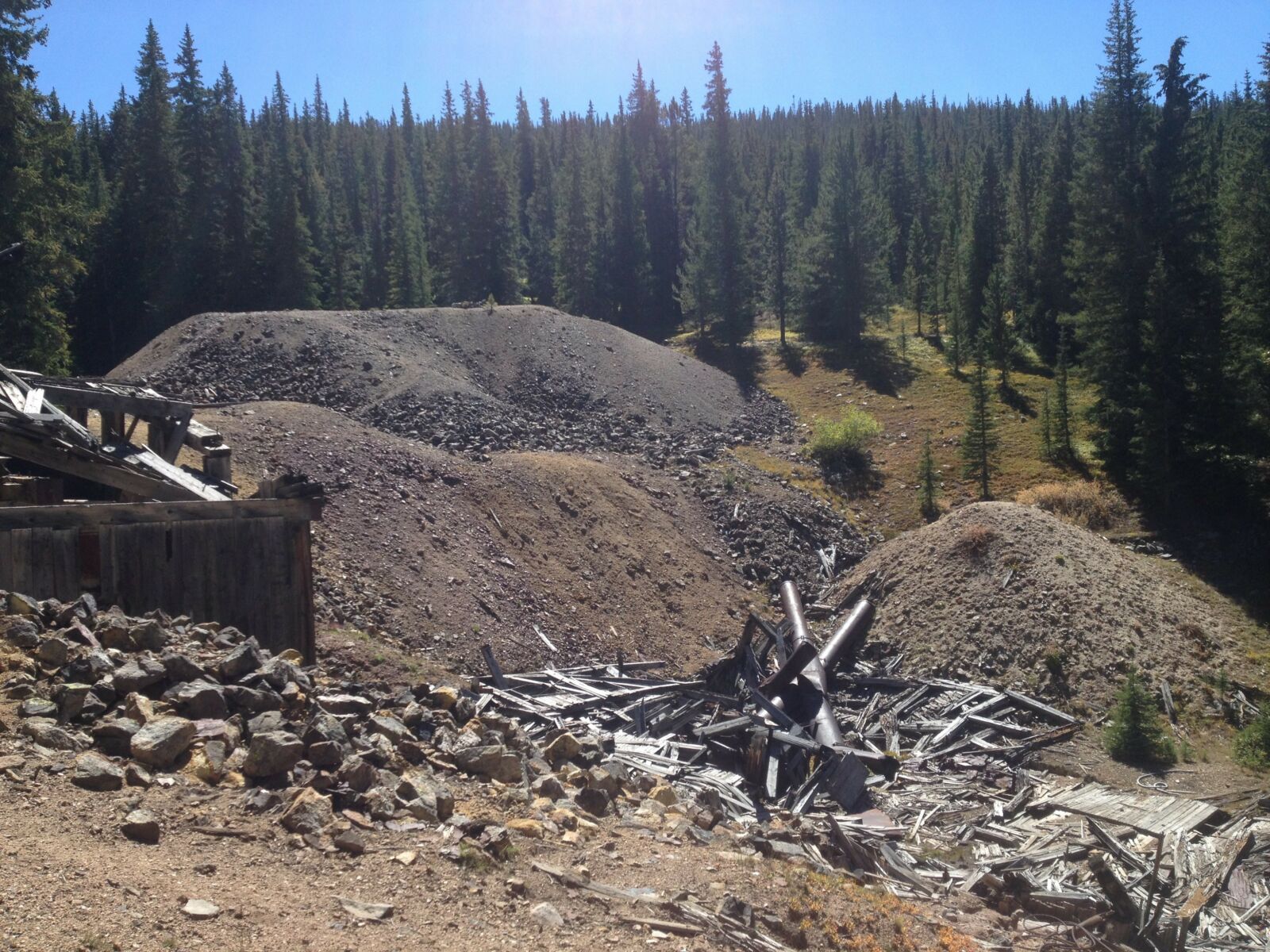
Mountain Pride Mine site pre-reclamation. Illinois Gulch used to flow into the mine dump (large gray pile), flow subsurface through mine waste, and resurface at the collapsed Mill structure at the bottom of the photo. (Figure 1)
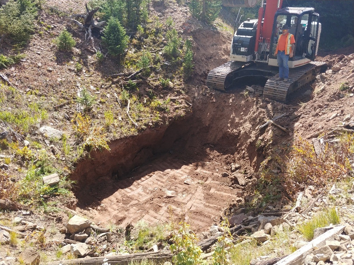
The on-site repository was constructed at the base of the dry slope, away from existing mine waste and in a location that is least likely to interact with surface water. (Figure 2)
Construction at Mountain Pride began in late August of 2018. It was determined early in the process that due to the level of exceedances of zinc and cadmium, the waste rock and tailings piles (Figure 1) would need to be removed from Illinois Gulch and consolidated on-site. The stream channel would be rerouted and armored to avoid erosion or future surface water interaction with the on-site repository. In total, 3,200 cubic yards of mine waste was capped and re-vegetated (Figure 2), and 400 feet of stream channel was constructed (Figure 3), which now directs Illinois Gulch around the historic hard rock mine site.
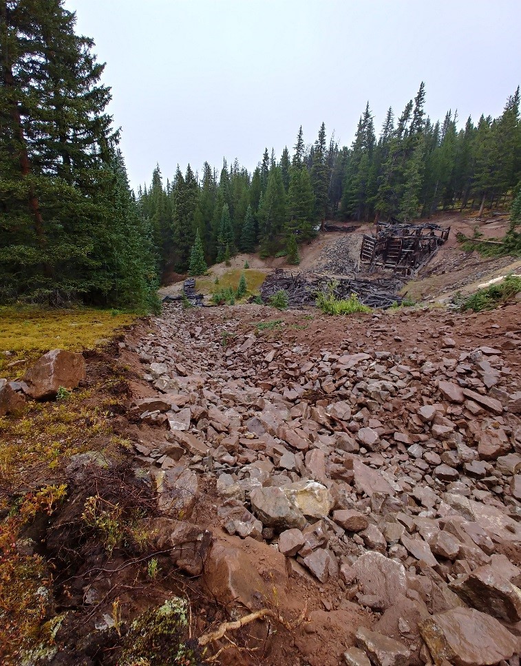
The completed stream channel with the Mountain Pride Mill in the background. TU planted an assortment of riparian vegetation along the channel margin to help stabilize soils and to one day shade the creek and reduce evapotranspiration. (Figure 3)
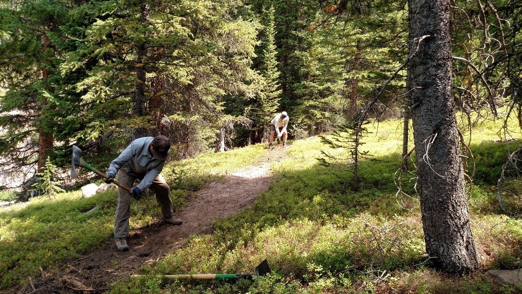
Prior to reclamation, the popular mountain bike trail Pinball Alley ran directly through the site. Riders used a historic mining structure as bridge to avoid metal laden ponds of water. Because part of the scope of the removal action was to reduce human health hazards, the mountain bike trail was rerouted above the site prior to construction.
In total, TU, USFS, Breckenridge, and Summit County Open Space realigned 1,035 feet of trail to the existing trail sections. Today, outdoor enthusiasts of all types enjoy the trail and the hope is that trails users will soon be unable to recognize that impacts of the historic land use.