History
On April 25, 2017, the Cactus Fire ignited on the Lower Salt River, approximately four miles northeast of Mesa, Arizona. The fire affected a total of 818 acres in four days, severely burning 232 acres of an area dominated by the invasive plant species, salt cedar. The Cactus Fire exposed the role that changes to ecosystem function can play in altering fire behavior, such as water regulation and the introduction of invasive plant species. When dense vegetation stands become dry or die, they represent large amounts of highly flammable material. While the Cactus Fire decimated a large portion of the landscape in this heavily recreated area, it also opened the door to the potential for an ecological restoration project.
Immediately following the fire, resource managers began experimenting with ways to control the regeneration of salt cedar within the fire’s burn scar while also exploring the capabilities of reaching the ground water table, which would provide the opportunity to revegetate the area with native species. What began as a three-acre experimental plot quickly gained momentum and in 2018 grew to become what is known as the Lower Salt River Restoration Project (LSRRP).
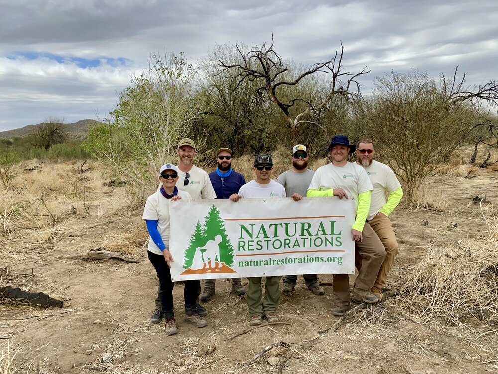
The LSRRP is comprised of partnerships between the National Forest Foundation, The Boeing Company, Arconic Foundation, Tonto National Forest, Northern Arizona University, EcoCulture, Audubon Southwest, Arizona Department of Forestry and Fire Management, Salt River Project, Intel, City of Phoenix, City of Scottsdale, Natural Restorations, Wild West Water Delivery, Isaac’s Ant Foundation. This collaborative group of project partners aim to accomplish the overarching goal of reducing invasive vegetation and planting native species along the Lower Salt River.
Removal and Replanting
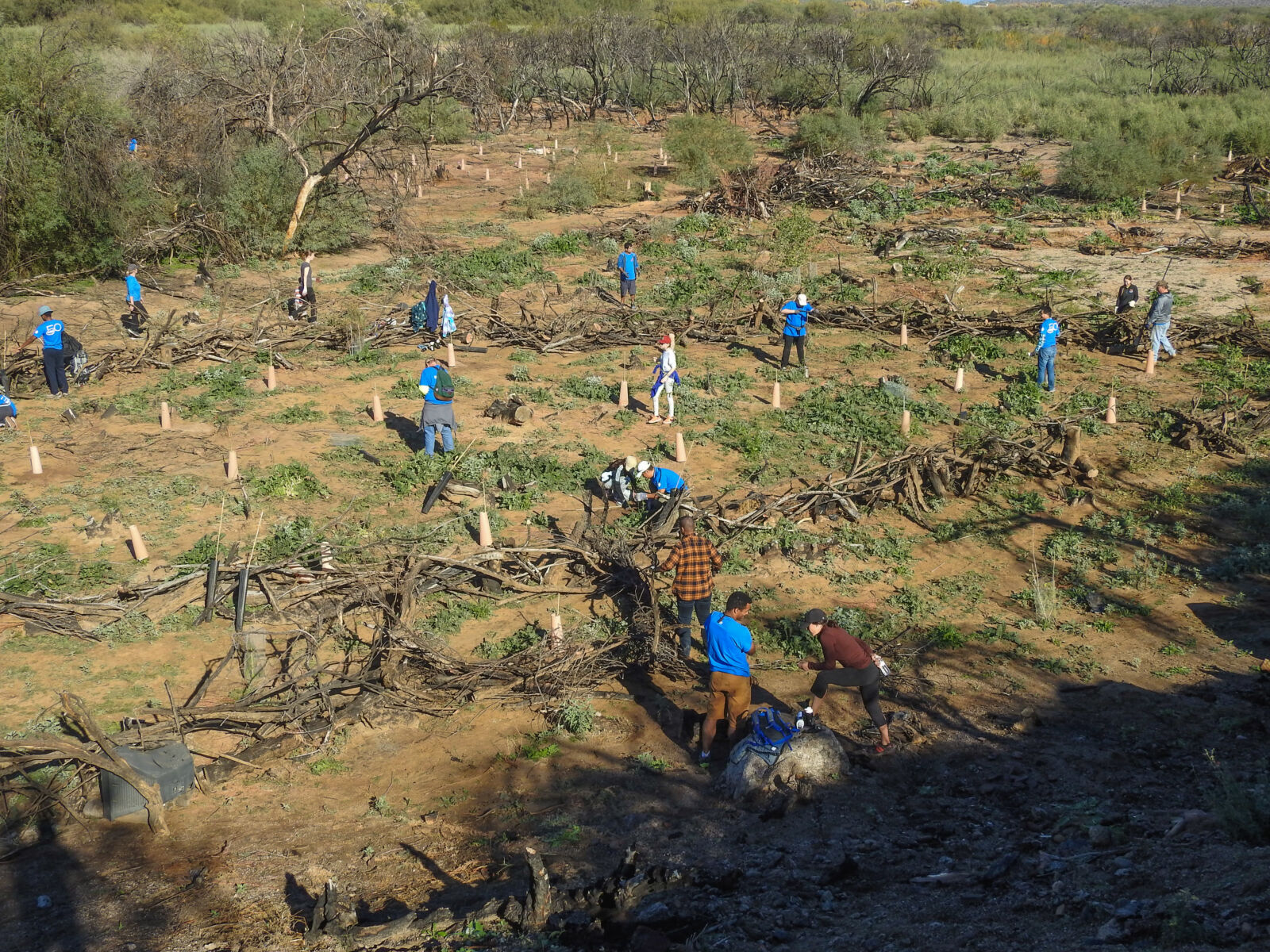
The removal process has been historically accomplished by utilizing Arizona Department of Forestry and Fire Management Department of Corrections crews. These 20 person crews utilize chainsaws and brush cutters to remove the invasive vegetation. After removal, restoration specialists apply a water-labeled herbicide mixture using the “cut-stump” technique. This technique is a targeted application to the cambium layers of the cut vegetation, which reduces the overall herbicide footprint within the project site.
Replanting efforts are achieved through active and natural assisted restoration. Both methods rely on an initial strategy of treating and removing invasive plant populations. Active restoration then comes in the way of planting thousands of native riparian tree species (Populus fremontii, Salix gooddingii, Salix exigua, Prospis velutina, Prosopis pubescens, and Parkinsonia spp.). Genetic material is collected from the Lower Salt River and regions in similar elevation, with slightly warmer climates, with the goal of producing trees adapted to the warming temperatures of the environment. These trees are then grown in a Northern Arizona University greenhouse for up to a year before finding their way back to the Lower Salt River. This replanting effort also provides opportunities for volunteers to assist. Through several volunteer days, the LSRRP has brought together hundreds of volunteers to aid in replanting efforts.
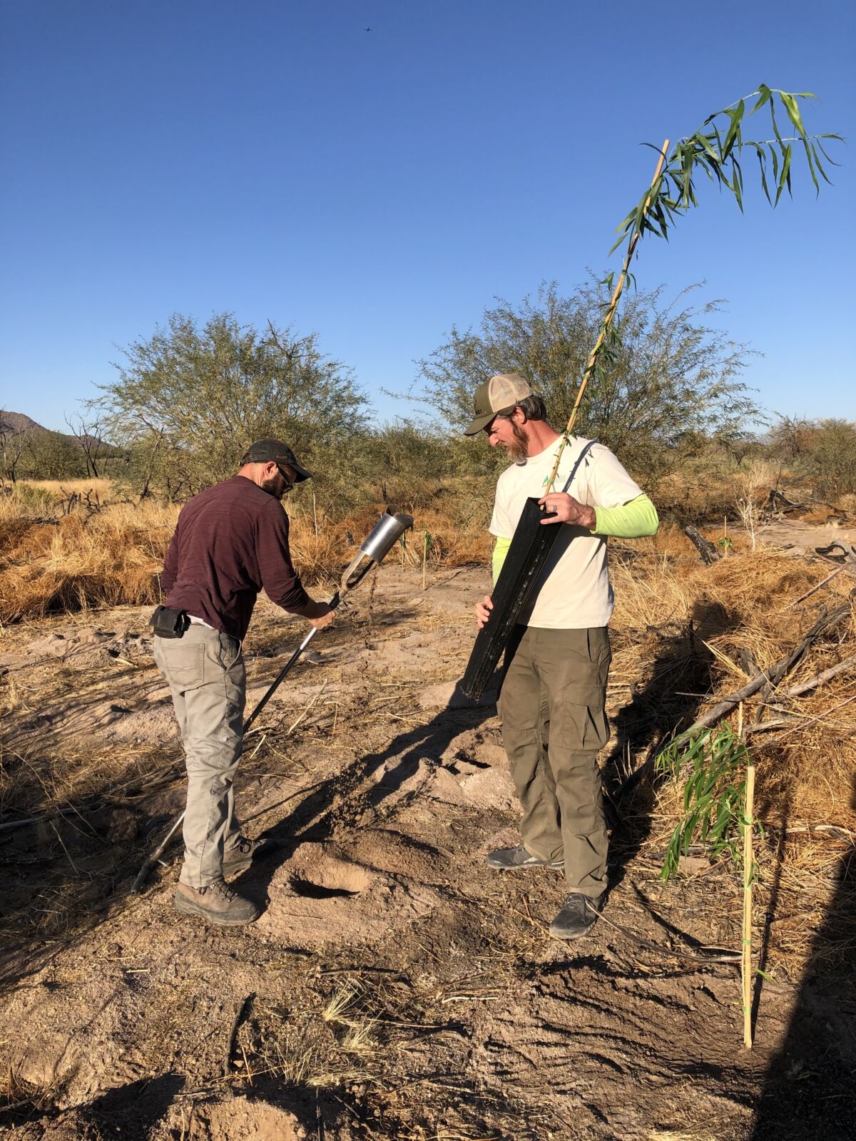
Restoration specialists utilize various types of rooted and pole planting material on the LSRRP. Along the riverbank, where there is access to shallow groundwater, we plant native riparian tree species and primarily use D-40 pots (1.0-foot pots) and D-60 pots (1.5-foot pots). These types of rooted material have yielded high survivorship in Phases 1 and 2 of the project. We are also experimenting with SC-10 pots (10-inch pots) in areas that are along the streambank. Survivorship of these 10-inch plantings will be analyzed in the fall of 2021.
On the upper terrace of the project area, closer the Bush Highway, we utilize D-40’s, D-60’s, and long pots (approximately 3.0-foot pots). Mesquites and palo verdes can be successfully planted using D-40’s, D-60’s and long pots. Riparian species planted on the upper terrace are solely long pots and must be augured down to the groundwater table. We have been successful at locating areas where groundwater can be reached at 4-5-feet below ground surface (bgs). All trees are backfilled and watered to remove air pockets that could otherwise cause root rot.
The last type of planting material used on the LSRRP are willow pole plantings (Goodding’s and coyote). Our current method includes soaking the harvested poles (up to 6-feet in length) for 14 days and performing a fresh, angled cut before pushing them into the ground. At least 50% of the pole must be placed into the ground to create contact with groundwater. Not only are these poles in groundwater, but by pushing them into the soil we are creating an air-pocket free zone that encourages root development. This method has yielded great results and survivorship will be evaluated in the fall of 2021.
Natural assisted restoration relies on the recruitment of native plant species as a result of our influence on the ground. By removing the constant competition of invasive plants, native species begin to recolonize areas on their own. Together, these methods are helping to conserve riparian habitat critical to the Southwest and Lower Salt River Recreation Area.
Monitoring
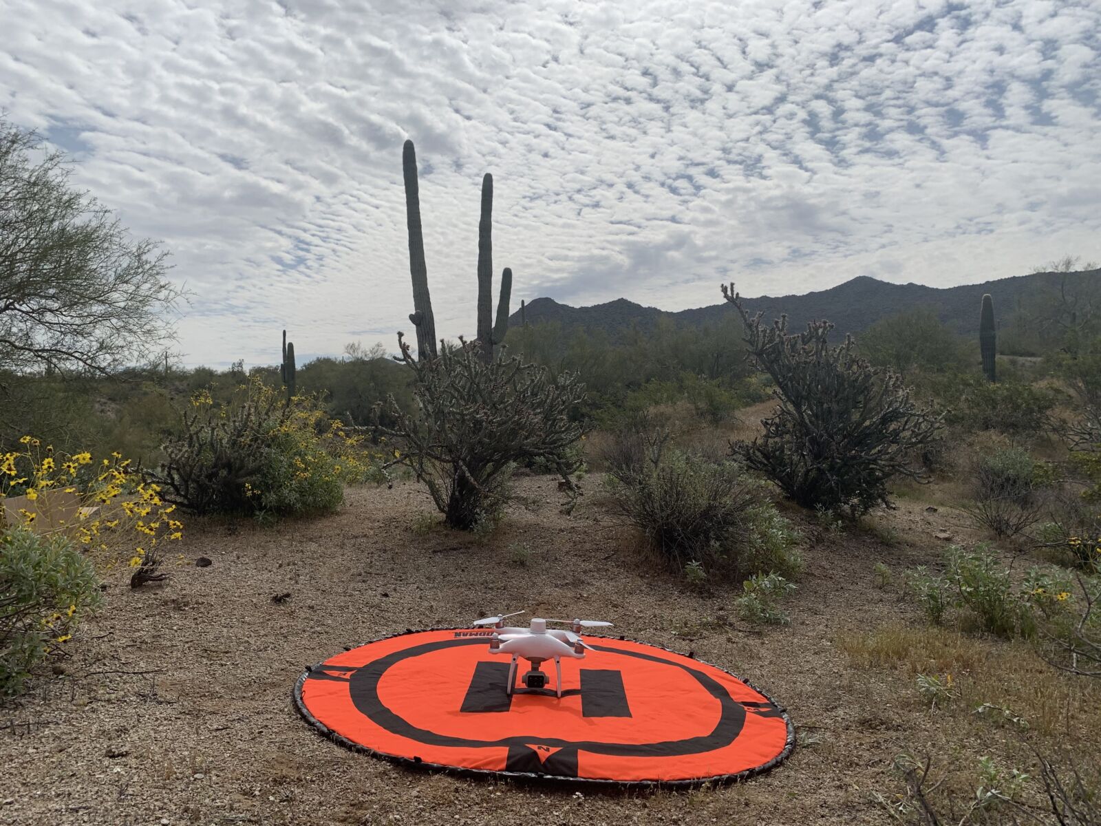
Currently, monitoring efforts are being completed via remote sensing. Drone imagery is captured biannually to help track vegetation populations across the landscape. We are then able to use this imagery in a Geographic Information Systems (GIS) setting to map species across the project. In doing so, we are working towards an overarching goal of vegetation classification through machine learning. These monitoring efforts tie into our educational outreach program, Green Drone AZ, which was created through our ongoing partnership with The Boeing Company. More information about this program can be found at GreenDroneAZ.com.
Our Progress
Since the initiation of the LSRRP in 2018, Phases I and 2 have treated approximately 200 acres of riparian habitat within the Cactus Fire footprint. Phases 3 and 4 of the LSRRP are planned commence in the fall of 2021 and will bring the project footprint to Phon D Sutton Recreation Area. This restoration project will continue to improve the riparian habitat along the Lower Salt River for wildlife and recreationists alike. We are extremely thankful for our dedicated partners and volunteers who have made this vision possible. More information about the LSRRP can be found at LSRRP.com.