

Explore the Deschutes National Forest, nearly 1.6 million acres of Cascade Mountains in central Oregon. It’s one of the most popular forest destinations in the Pacific Northwest, attracting eight million visitors annually. It spans diverse and scenic landscapes, including volcanic peaks, lakes, rivers, and dense conifer forests.
Among its iconic natural landmarks is Mount Bachelor, a year-round destination, offering plenty of hiking trails to traverse in the summer, and excellent skiing and snowboarding in the winter. The Deschutes contains four Wilderness Areas, which center around notable peaks of the Cascade Mountains: Diamond Peak, Mount Jefferson, Mount Washington, and Three Sisters.
The forest also contains the Newberry National Volcanic Monument, a spectacular landscape of ancient lava flows, cinder cones, and obsidian fields that showcase the area’s dramatic geological history and offer activities like caving.
Hundreds of hiking, biking, and horseback riding trails pass through the Deschutes, including more than 100 miles of the Pacific Coast Trail.
There are more than 125 developed and listed campgrounds on the Deschutes and Ochoco National Forests, ranging from large well-developed campgrounds with more than a 100 campsites to backcountry options for those looking for a wilder adventure.
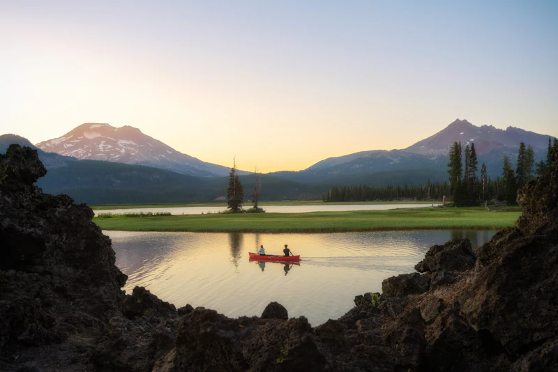 Photo by Scott Malagold
 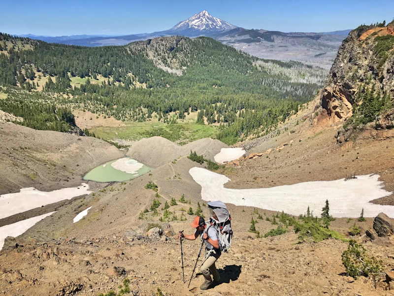 Photo by Anna Yarbrough
 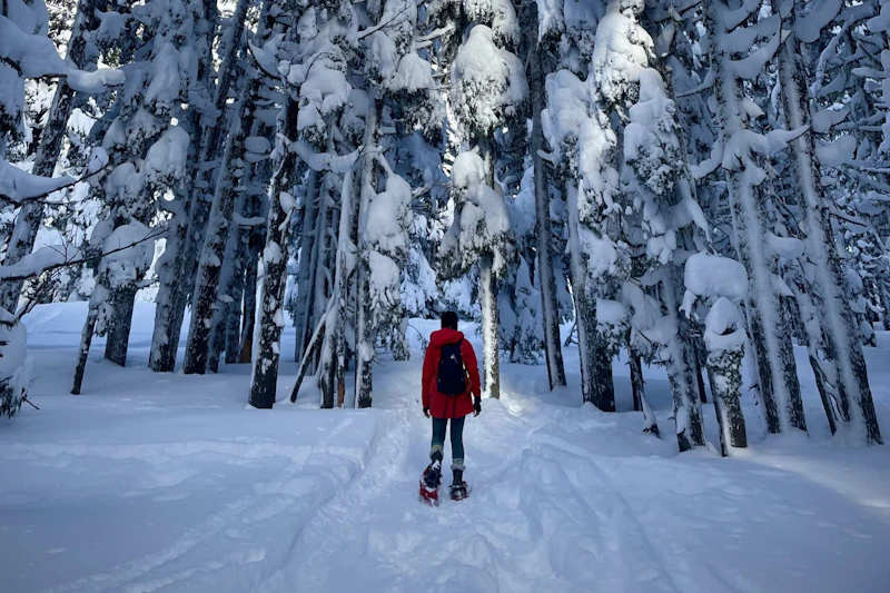 Snowshoeing Tumalo Mountain. Photo by Porsche Vann
 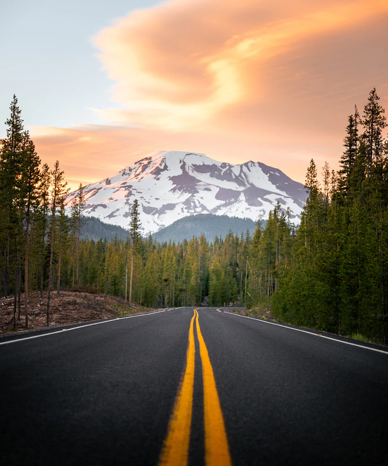 The South Sister. Photo by Finn Howard
 What is the History of the Deschutes National Forest?
Since their creation as parts of the Cascade Forest Reserve in 1893 and Blue Mountains Forest Reserve 1906, the Deschutes and nearby Ochoco National Forest have played an important role in central Oregon’s economic and social history.
The area that now encompasses the forest was home to several Indigenous groups, including the Warm Springs, Wasco, and Paiute peoples. European-American exploration began in the early 19th century with fur traders and settlers arriving via the Oregon Trail. The late 1800s saw increased logging and development, which began altering the natural environment.
The forest was officially established in 1908, named after the Deschutes River, which flows through the region. The Deschutes and Ochoco were major suppliers of timber during the decades when mills formed the core of central Oregon’s economy and today are a destination for millions of people each year.
How to Get to the Deschutes National Forest
The adventure capital of Bend is the primary gateway to the Deschutes National Forest. Reached by Highway 97, which runs north-south through central Oregon, Bend is an ideal base for exploring the forest.
From the north, travelers can take Highway 20 west from The Dalles or east from Corvallis, which provides access to the northern parts of the forest. To the south, Interstate 84 connects to highways leading to Bend and the forest. Other nearby towns like Sisters and Sunriver also provide access.
The nearest airport is Roberts Field-Redmond Municipal Airport (RDM) in the city of Redmond, 40 miles north.
- Bend, Oregon: Half-hour by car
- Eugene, Oregon: 1 to 3 hours by car
- Corvallis, Oregon: 2.5 to 3 hours by car
- Salem, Oregon: 3 to 3.5 hours by car
- Portland, Oregon: 3.5 to 4 hours by car

This well-maintained network of singletrack, located just outside Bend in the Deschutes National Forest, is one of the most popular mountain biking trailheads in the Pacific Northwest. Experience beginner trails like Marvin’s Garden or more advanced options like Lair and Voodoo.
This 9,000-foot mountain is a major destination for skiing, snowboarding, snowshoeing, and Nordic skiing. With over 400 inches of annual snowfall and 4,000 acres of terrain, it’s one of the top winter destinations in the Pacific Northwest.
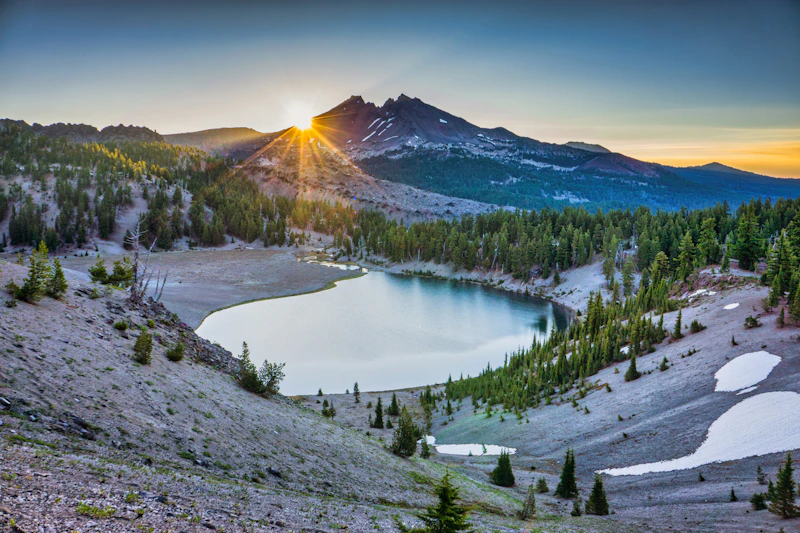
One of the most scenic hikes in the forest, this nine-mile trail winds past waterfalls, meadows, lava flows, and three lakes, ending at beautiful Green Lakes beneath South Sister. It’s especially stunning in summer when wildflowers are in bloom.
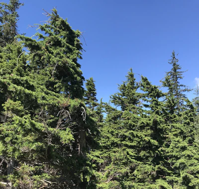 Mountain hemlock This slender, spire-like conifer thrives in the snowy landscapes of the Cascade Range and plays a key role in stabilizing soil and retaining moisture in alpine environments.
 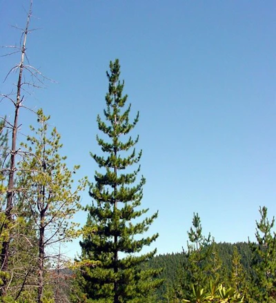 Western white pine Known for its long, soft needles and slender cones, this conifer can reach heights of over 150 feet. Its population has declined due to white pine blister rust, a non-native fungal disease.
 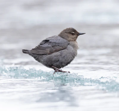 American dipper This unique songbird, recognized by its gray color and bobbing motion, is found in mountain streams, where it can be spotted diving and walking underwater to feed on aquatic insects and small invertebrates.
 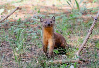 Pine marten A weasel-like mammal that thrives in dense coniferous forests, this marten has a slender body and bushy tail that helps it climb to hunt.
 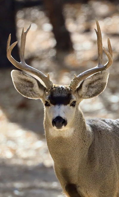 Mule deer With a stocky build, black-tipped tail, and a brown coat that turns gray in the winter, this deer feeds on shrubs, grasses, and acorns and prefers high elevation areas.
 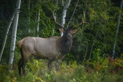 Elk This majestic animal, the second largest species in the deer family after moose, is most active during dawn and dusk and during fall rutting season.
 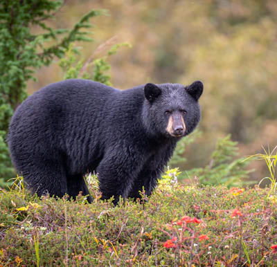 Black bear This medium-sized bear resides in the dense forests and open meadows of the forest, foraging for berries, insects, and small animals.
 Related Impact
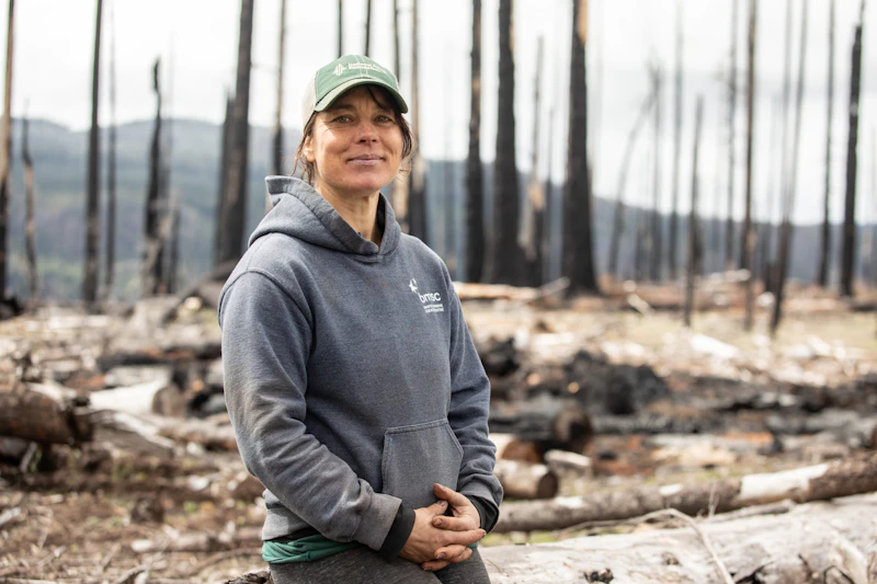
Reforestation on the Umpqua
Anna’s family has been planting trees for 50 years. Now she is helping build a sustainable model to meet the Forest’s future post-fire reforestation needs.
What’s the Best First-Timer’s Adventure in the Deschutes National Forest?
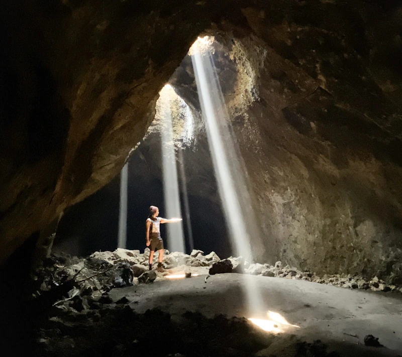
Explore a self-guided tour of Lava River Cave, Oregon’s longest lava tube, in Newberry National Volcanic Monument, located within Deschutes National Forest. Formed roughly 80,000 years ago by flowing lava from nearby volcanic eruptions, the cave is reached via a 55-step descent and stretches for nearly a mile. Purchase a timed reservation ticket and visit between late spring and early fall.
Where to Find More Information on the Deschutes National Forest
For more information or questions, visit https://www.fs.usda.gov/r06/deschutes
Discover how communities, volunteers, and partners are shaping the future of our National Forests and Grasslands.
The National Forest Foundation works with partners across Northern Colorado to restore forests, reduce wildfire risk, and care for the…
After years of damage, recovery, and reconstruction, the trail to Hanging Lake has been fully rebuilt, creating a more durable,…
Erosion and wildfire had left Arizona's historic Highline Trail rutted and unsafe. After five years of work with the Tonto…
Forest restoration near Flagstaff is reducing wildfire risk for local communities and safeguarding the water supply for millions across the…
Colorado's 14ers draw thousands of visitors each year, and the pressure on these fragile alpine landscapes is growing. Here's a…
Visitors of all ages can explore forest trails and sparkling waters, discover wildlife and underwater habitats, and connect with Tahoe’s…
A partnership-driven program connecting youth on Montana’s Flathead Reservation with hands-on conservation work, heritage education, and pathways in natural resource…
Seeing the impact first hand on the Grand Mesa, Uncompaghre and Gunnison National Forests
Seven Years of Reopening Trails After the Eagle Creek Fire
Field Ranger Program Connects Diverse Communities to Forests in Southern California
Our Forests Need Us Today.
Your donation powers critical, on-the-ground conservation—from wildfire recovery to watershed restoration—protecting forests for the future.

