Mt. Hood National Forest
Mt. Hood National Forest extends south from the Columbia River Gorge across more than sixty miles of forested mountains, lakes and streams to Olallie Scenic Area, a high lake basin under the slopes of Mt. Jefferson.
Overview
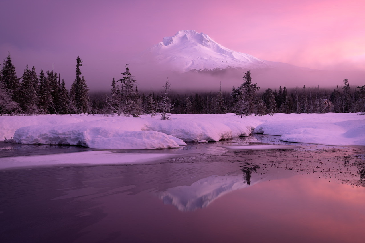
The iconic Mt. Hood, the tallest mountain in Oregon, dominates the landscape of this National Forest. From the summit at 11,249 feet, the forest slopes down in all directions into varied and unique landscapes. The northern side of the mountain borders the Columbia Gorge National Scenic Area, the western slopes are thick with coniferous trees and lush undergrowth, and the eastern side of the mountain is noticeably drier as you descend into central Oregon.
Located twenty miles east of Portland, Oregon, and the northern Willamette River valley, the Mt. Hood National Forest encompasses 1,067,043 acres. Glaciers cover more than five square miles near the top of the mountain and are estimated to contain more than 300 million cubic meters of snow and ice, although historic photos show the rapid loss of these glaciers that has occurred over the last century. Streams flowing down the mountain collect into larger rivers, which in turn provide drinking water for more than 1 million people in the Portland area.
History
The name Wy’east is often described as the Native American name for Mt. Hood, although there is little evidence to understand exactly which tribe or group of tribes used this term. Many different Indigenous cultures lived around the mountain or nearby, and it probably had various names in multiple different languages. The current name, Mt. Hood, was coined by British explorers in 1792 who named the mountain after Samuel Hood, an Admiral in the Royal Navy.
What is now the Mt. Hood National Forest was once inhabited by the Multnomah, Chinook, Wasco, Tenino, and Molalla peoples, among others. Trade routes connected tribes from the mountain's western side with those who lived farther inland. Today, the Warm Springs Indian Reservation borders the eastern side of Mt. Hood National Forest.
As with many other National Forests in Oregon, Mt. Hood was originally part of the Cascade National Forest, designated in 1908. Then in 1911 and again in 1924, the Forest Service divided the forest and readjusted the boundaries, leading to what we know today as the Mt. Hood National Forest.
Recreation
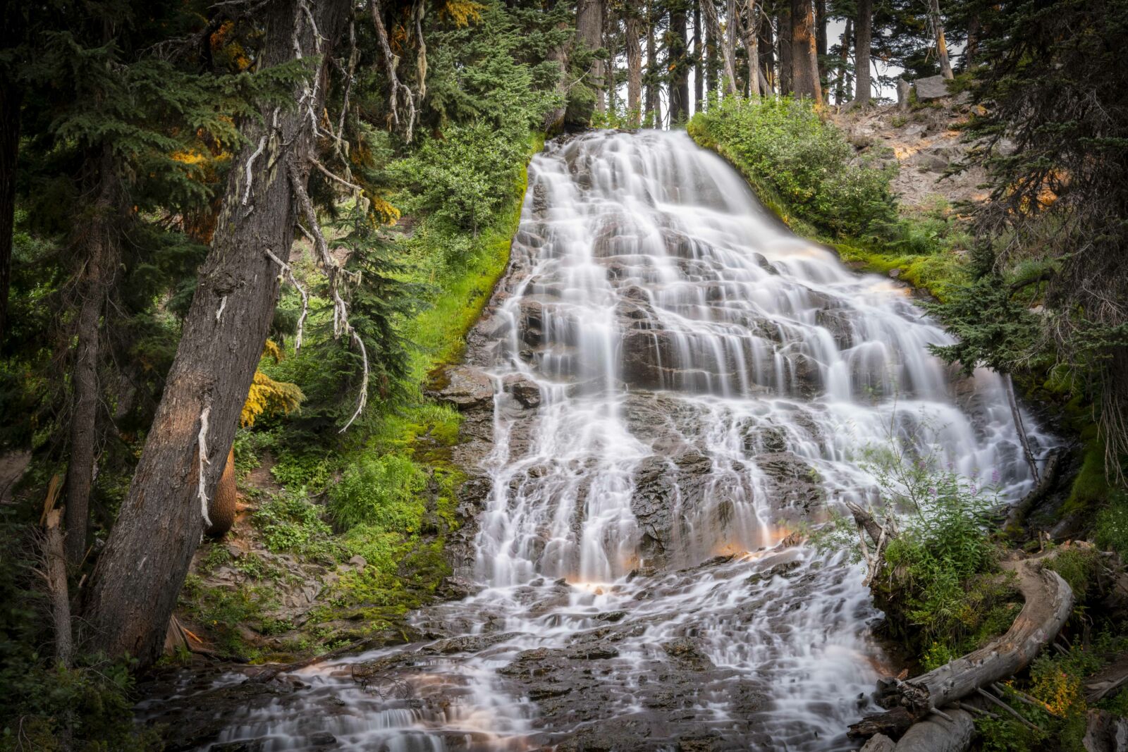
This forest is a mecca for outdoor recreation. Visitors come to fish, camp, boat, and hike. Throughout the warmer months, berry picking and mushroom foraging are popular. In fall, you can hunt, and in winter, when the snow comes - and it really comes! - you can ski or participate in other winter sports, such as snowshoeing or snowmobiling, or bring the family to cut a Christmas tree!
The Mt. Hood National Forest has around 1,000 miles of trails to explore and more than 60 campgrounds. Five commercial ski areas operate on the mountain's slopes, and there are also less-developed areas for cross-country skiing, sledding, and snowmobiling.
Climbing Mt. Hood is a challenging adventure for seasoned mountaineers, but for those with the experience and the equipment, the views from the top of Oregon are unmatched.
Wilderness
There are 311,448 acres of designated Wilderness on the Forest, making up almost one-third of the total area. The largest is the Mt. Hood Wilderness, which includes the mountain's peak and upper slopes. Others include Badger Creek, Salmon-Huckleberry, Clackamas, Lower White River, Roaring River, Hatfield, and Bull-of-the-Woods. While not a true Wilderness, the Olallie Scenic Area is a lightly-roaded lake basin that provides a primitive recreational experience.