Grand Mesa, Uncompahgre and Gunnison National Forests
The Grand Mesa, Uncompahgre and Gunnison National Forests are a combination of separate National Forests located on the western slope of the Colorado Rockies.
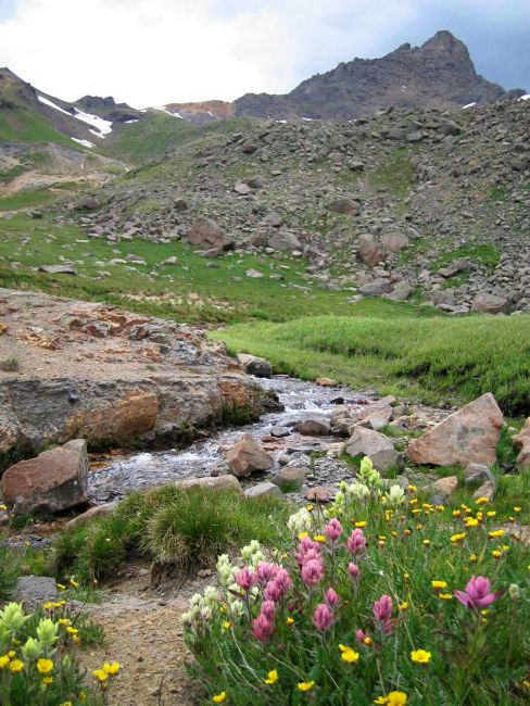
These three combined Forests cover 3,161,912 acres of public land in the central and southern Rocky Mountains, an area that lies south of the Colorado River and west of the Continental Divide with some of the most spectacular scenery in the Rockies.
The Forests vary in elevation from 5,800 feet above sea level in Roubideau Creek Canyonto 14,309 feet on Uncompahgre Peak.
The Forests include spectacular features like the 355 foot high Bridal Veil falls; the Grand Mesa with more than 300 lakes, one of the world's largest flat top mountains; and Alpine Tunnel, once the highest railroad tunnel in North America.
The Grand Mesa, Uncompahgre and Gunnison National Forests include ten designatedWilderness areas, which together make up nineteen percent of the three-million acre Forests. You can camp in these areas, or other, more developed campgrounds. Fishingand hiking are other great activities available on these forests.