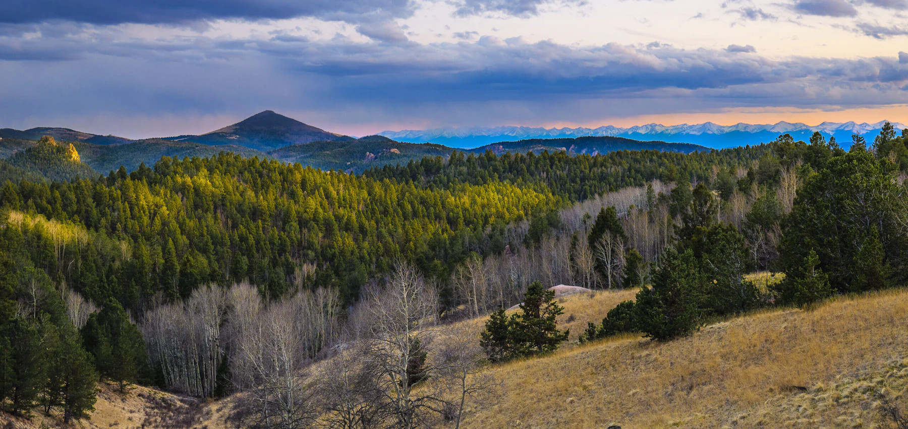
Discover the Pike and San Isabel National Forests & Cimarron and Comanche National Grasslands, three million acres across Colorado and western Kansas. This collection represents perhaps the most diverse of all National Forests, from the soaring peaks of the Continental Divide to the wind-sculpted prairies of the Great Plains.
In Colorado, the Pike and San Isabel National Forests encompass more than a million acres of rugged alpine terrain, dense conifer forests, and clear mountain lakes. The forests are home to 19 of Colorado’s famed “Fourteeners,” including 14,115-foot Pikes Peak, one of the most visited mountains in the world.
These snow-capped peaks feed numerous lakes and rivers, which provide paddling, boating, and fishing. Hundreds of miles of trails offer hiking, biking, horseback riding, and off-highway vehicle use. From remnants of mining towns to early homesteads, many historic sites offer glimpses into Colorado’s cultural past.
The Pike and San Isabel National Forests contain all or parts of nine Wilderness Areas, each with its own character. For the winter sports enthusiasts, the San Isabel Forest has three ski areas: Monarch Mountain, Cooper, and Cuchara Mountain Park. Cross-country skiing is popular in many undeveloped areas.
In contrast, the Cimarron and Comanche National Grasslands, in southwestern Kansas and southeastern Colorado, protect rare prairie ecosystems that once stretched unbroken across the continent. The grasslands contain unique geological and archaeological sites, including dinosaur tracks, Santa Fe Trail ruts, and remnants of early ranching history.
 Photo by Callie Matuschka
 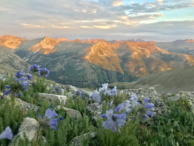 Photo by Justin Kulacz
  Climber at Monitor Rock. Photo by Jie Huang
 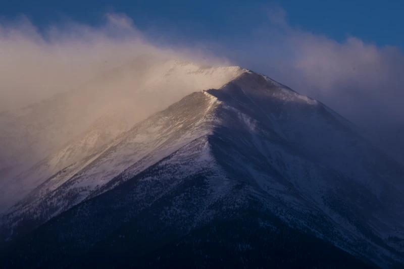 Photo by Kellon Spencer
  Approaching the summit of Pikes Peak. Photo by Scott Anderson
 What is the History of the Pike and San Isabel National Forests & Cimarron and Comanche National Grasslands?
Tribes such as the Ute, Cheyenne, Arapaho, Kiowa, and Comanche traveled, hunted, and traded across these regions, leaving a legacy visible in archaeological sites and trails. By the mid-1800s, these areas became hubs of mining and homesteading during the Colorado Gold Rush, while the plains grasslands supported large cattle operations.
In 1891, President Benjamin Harrison established the Pikes Peak Timberland Reserve. Over time, additional reserves were designated, eventually combined to form the Pike and San Isabel National Forests in 1902. The establishment of the Cimarron and Comanche National Grasslands resulted from the ecological disaster of the Dust Bowl.
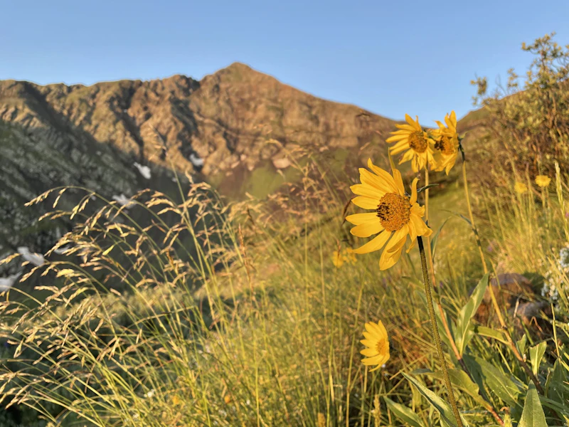
How to Get to the Pike and San Isabel National Forests & Cimarron and Comanche National Grasslands
The Pike and San Isabel National Forests can be accessed from the towns of Colorado Springs, Pueblo, Cañon City, Salida, Buena Vista, and Fairplay. From the Front Range, Interstate 25 serves as the primary north–south corridor, connecting to U.S. Highway 24, Highway 50, and Highway 285, all of which lead into different parts of the forests.
The Cimarron National Grassland, located in southwestern Kansas, is primarily accessed via U.S. Highway 56 and U.S. Highway 160, with Elkhart serving as its main gateway town. The Comanche National Grassland in southeastern Colorado is reached via U.S. Highway 350 from Trinidad and Highway 160 from La Junta or Springfield.
- Colorado Springs, Colorado: Half-hour by car to Pike and San Isabel National Forests; 4 to 4.5 hours by car to Cimarron and Comanche National Grasslands
- Denver, Colorado: 1 hour by car to Pike and San Isabel National Forests
- Amarillo, Texas: 2 to 2.5 hours by car to Cimarron and Comanche National Grasslands
- Wichita, Kansas: 4 to 4.5 hours to Cimarron and Comanche National Grasslands

In 2024, the Forest Service purchased parcels of land containing 134 fossilized dinosaur footprints. The area, considered the longest continuous trackway in the world, is in the Comanche National Grassland, where the 17.6-mile Picket Wire Canyon Trail traces the tracks, along with prehistoric rock art and remnants of an old cattle ranch.
Reached via the 1.4-mile Devil’s Head Trail, this lookout tower, at 9,748 feet, has been active since 1912 and is the last full-time lookout in Colorado. Visit the tower for a look at the state’s conservation history and for epic views of the Rockies.
This hidden gem in the Pike and San Isabel National Forests is set below the dam of the Eleven Mile Reservoir. The narrow granite-walled gorge, carved by the South Platte River, is a world-class fly-fishing destination. Several campgrounds provide easy access to the river and surrounding trails.
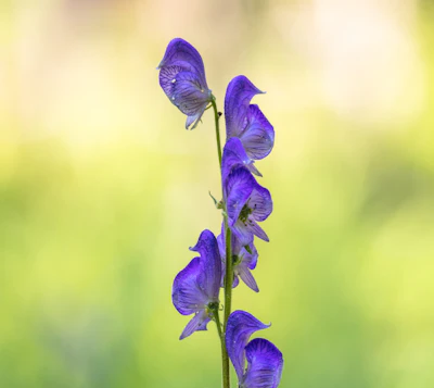 Columbian monkshood This wildflower grows tall stalks topped with deep violet, helmet-shaped blossoms in mid to late summer.
 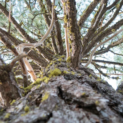 Lodgepole pine The tall and thin conifer plays an important part in regeneration after wildfire, as the resin in its cones melt—and seeds release—only when heated by fire.
 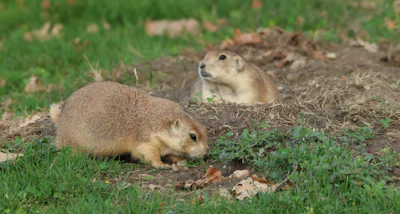 Prairie dog This social rodent lives in large underground colonies and helps aerate soil and promote the growth of native grasses.
 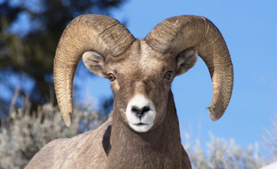 Bighorn sheep Known for its massive curled horns and climbing skills, this sheep can be found in the high elevation areas of the Rockies.
 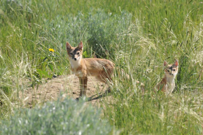 Swift fox This small fox is known for its speed, reaching up to 30 miles per hour, and dens in grasslands with sparse vegetation.
 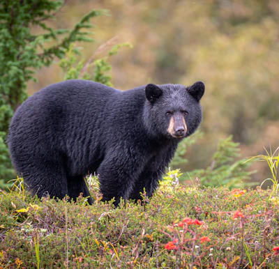 Black bear This medium-sized bear resides in the dense forests and open meadows of the forest, foraging for berries, insects, and small animals.
 Related Impact
The Great American Outdoors Act in Colorado
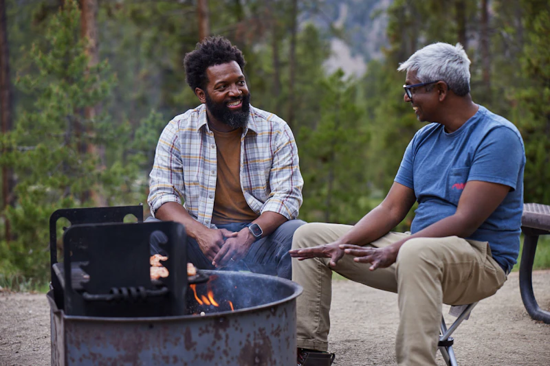
Discover the impact of The Great American Outdoor Act on communities in Colorado with Baratunde Thurston, host of the PBS show America Outdoors.
What’s the Best First-Timer’s Adventure in the Pike and San Isabel National Forests & Cimarron and Comanche National Grasslands
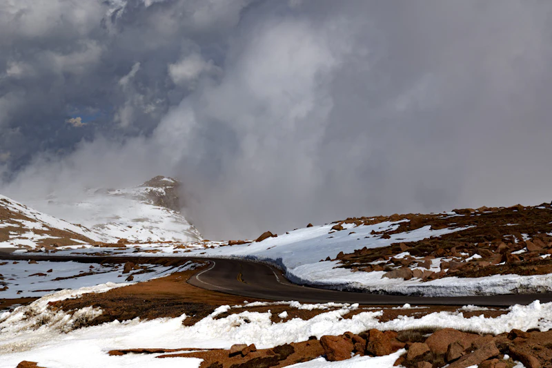
There are many ways to summit 14,115-foot Pikes Peak, also called America’s Mountain: drive the Pikes Peak Highway, ride the historic Cog Railway from Manitou Springs, or embark on a challenging hike via the 13-mile one-way Barr Trail, gaining 7,400 feet in elevation. From the top, you’ll see across the Rockies and Great Plains.
Where to Find More Information on the Pike and San Isabel National Forests & Cimarron and Comanche National Grasslands
For more information or questions, visit https://www.fs.usda.gov/r02/psicc.
Discover how communities, volunteers, and partners are shaping the future of our National Forests and Grasslands.
The National Forest Foundation works with partners across Northern Colorado to restore forests, reduce wildfire risk, and care for the…
After years of damage, recovery, and reconstruction, the trail to Hanging Lake has been fully rebuilt, creating a more durable,…
Erosion and wildfire had left Arizona's historic Highline Trail rutted and unsafe. After five years of work with the Tonto…
Forest restoration near Flagstaff is reducing wildfire risk for local communities and safeguarding the water supply for millions across the…
Colorado's 14ers draw thousands of visitors each year, and the pressure on these fragile alpine landscapes is growing. Here's a…
Visitors of all ages can explore forest trails and sparkling waters, discover wildlife and underwater habitats, and connect with Tahoe’s…
A partnership-driven program connecting youth on Montana’s Flathead Reservation with hands-on conservation work, heritage education, and pathways in natural resource…
Seeing the impact first hand on the Grand Mesa, Uncompaghre and Gunnison National Forests
Seven Years of Reopening Trails After the Eagle Creek Fire
Field Ranger Program Connects Diverse Communities to Forests in Southern California
Our Forests Need Us Today.
Your donation powers critical, on-the-ground conservation—from wildfire recovery to watershed restoration—protecting forests for the future.

