Gila National Forest
Located in New Mexico, the Gila National Forest has spectacular scenery ranging from high cool mountains with aspen and douglas fir to warm semi-arid lowlands with juniper, oak and cactus. It is one of the more remote and least developed National Forests in the southwest.
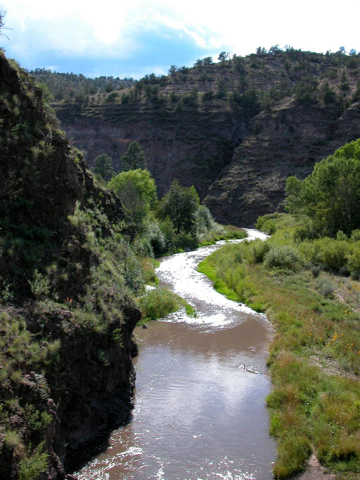
Every National Forest offers its own unique beauty. The Gila's beauty is in its diversity of rugged mountains, deep canyons, meadows, and semi-desert country. Elevations range from 4,200 to 10,900 feet and cover four of the six life zones.
Flora and fauna are diverse. Ocotillo and cactus are found in the lower elevations, and juniper, pine, aspen, and spruce-fir forests are plentiful in the high mountains.
Wildlife such as the black bear, mountain lion, elk, deer, antelope, bighorn sheep, and wild turkey inhabit the Forest while the bald eagle, peregrine falcon, and the red-tailed hawk soar in the wind.
A wide array of bird fauna is found on the Gila National Forest. Approximately 337 bird species have been sighted. The numerous species of birds is related to the diverse ecological habitat found on the Gila and its location on a migratory flight path. The Birding page provides a downloadable checklist of birds found in the Forest.
Another unique beauty of the Gila National Forest is its Wilderness Areas: The Gila, Aldo Leopold, and Blue Range. The Gila National Forest includes more Wilderness Areas than any other National Forest in the Southwest.
The Gila offers a number of recreation activities. There are hundreds of miles of hiking trails, a number of interpretive sites and trails, picnic grounds, primitive and developed camping grounds. If you are looking for a more primitive recreation experience, the Gila is the place to be.
Summer activities include camping, rafting, hiking, mountain biking, fishing, hunting, and horseback riding, while winter activities include some cross-country skiing and snowshoeing.
A number of hot springs occur within the boundaries of the Gila National Forest. The temperature of the water in each spring varies as well as the size of the pool(s) formed by the spring. Often the springs occur in close proximity to streams and rivers.
One of the best ways to see the diverse Forest scenery is by automobile. A number of roads leading through the Forest have been designated as part of the Scenic Byways.
Make sure you visit the Gila Cliff Dwellings National Monument. The Gila Cliff Dwellings is a trailhead for five different trails. The monument includes a Visitors Center. The park offers a glimpse of the homes and lives of Indians who lived there from the late 1270s through the early 1300s.
The surroundings today probably look very much like they did when the cliff dwellings were inhabited. Archelogists have identified 46 rooms at the Gila Cliff Dwellings.
Enjoy the Quemado Lake Recreation Area, which includes the man-made trout lake with two ADA fishing piers, two boat ramps, seven developed campgrounds, one primitive campground, and links to more than seven miles of hiking trails. The lake is nestled between piñon-juniper woodlands and pine forests at an elevation of 7860 feet.
Popular theory says that the word Gila was derived from a Spanish contraction of Hah-quah-sa-eel, a Yuma Indian word meaning "running water which is salty." The naming of the Gila National Forest is indicative of its interesting history and beauty.
The Gila National Forest boasts a rich history of the Mogollon and Apache Indians, Spaniards, Mexicans, ranchers, prospectors and miners.