Coronado National Forest
The Coronado National Forest covers 1,780,000 acres of southeastern Arizona and southwestern New Mexico.
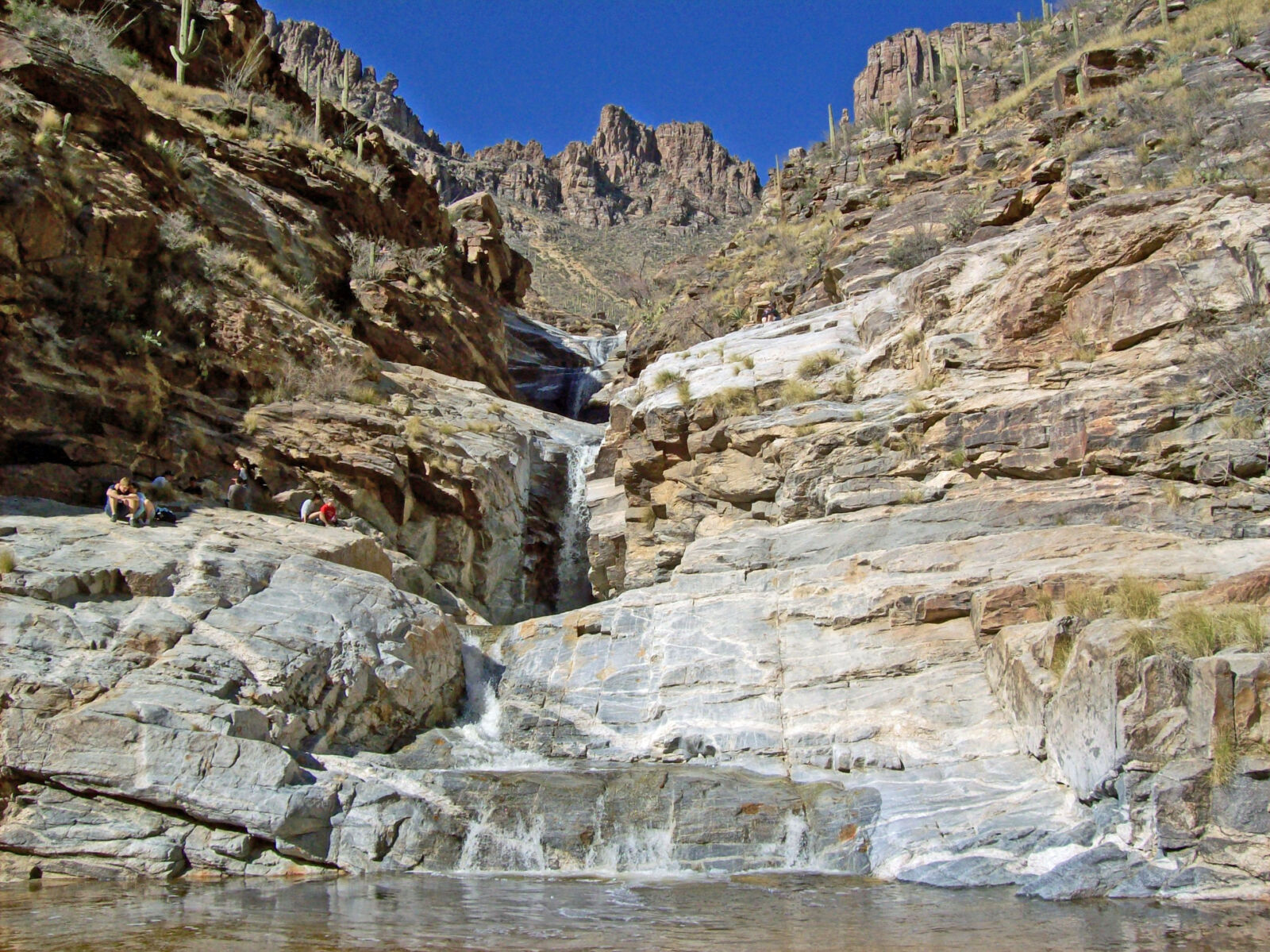
Elevations in the Coronado National Forest range from 3,000 feet to 10,720 feet in twelve widely scattered mountain ranges or "sky islands" that rise dramatically from the desert floor, supporting plant communities as biologically diverse as those encountered on a trip from Mexico to Canada.
The extreme elevation and habitat variations of the Sky Islands result in greater diversity of plants and wildlife than on most other Forests in the nation. Some of the more than 576 species of mammals, birds, reptiles and amphibians that call the Coronado National Forest their home are found on no other National Forest.
The Coronado National Forest has eight Wilderness Areas, among which are some of the most biologically diverse in the nation. At least one Wilderness can be found in each Ranger District; the Chiricahua in the Douglas District, the Pajarita and Mt. Wrightson in the Nogales District, Pusch Ridge and Rincon Mountain in the Santa Catalina District, Galiuroand Santa Teresa in the Safford District, and Miller Peak in the Sierra Vista District.
Views are spectacular from these mountains, and visitors may experience all four seasons during a single day's journey, wandering through the desert among giant saguaro cactus and colorful wildflowers in the morning, enjoying lunch beside a mountain stream or lake, and playing in the snow later in the afternoon.
Recreation activities that can be enjoyed on the Coronado are nearly as diverse as the people who come to visit. The most popular ones are hiking, camping, birding, horseback riding, picnicking, sightseeing, driving Scenic Roads, and visiting historic areas.
Fishing and boating are also available, but limited in this arid land, while opportunities for the fast-growing sport of mountain biking are growing. Winter sports are possible in the higher elevations; Mt. Lemmon Ski Valley is the most southern ski area in the United States.
The sight of rocky outcroppings and stony hoodoos is enough to take a rock climber's breath away! The Santa Catalina Ranger District has a wealth of rock climbingopportunities with over one thousand established routes within a short hike of the Santa Catalina Highway.
Backcountry touring using motorized Off-Highway Vehicles is increasingly popular and the Coronado has trail maps of designated areas.
The Coronado has a few caves that you can explore with permission or permit. The Onyx Cave and Cave of Bells offer a fascinating underground wilderness experience.
Late in the 19th century, the east slope of the Santa Rita Mountains bustled with the activity of hundreds of miners. Gold had been discovered in 1874, in what became known as the Greaterville mining district. It proved to be the largest and richest placer deposit in southern Arizona. An old mining camp, Kentucky Camp, is located on the Coronado, and cabins are available as rental properties.
The Forest was named for Francisco Vasquez de Coronado, who journeyed in 1540 to the Zuni and Hopi villages through part of what is today the Coronado National Forest. Learn more about the rich heritage of the Coronado.