Plumas National Forest
Situated in the Sierra Nevada, just south of the Cascade Range, the Plumas National Forest is versatile in its land features and enhanced by a pleasant climate.
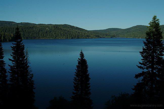
Outdoor enthusiasts are attracted year round to the Plumas National Forest's many streams and lakes, beautiful deep canyons, rich mountain valleys, meadows, and lofty peaks.
The Middle Fork of the Feather River was one of the first nationally-designated Wild and Scenic Rivers. Any part of the river in this canyon may be rugged and difficult to access. In the wild zone, precipitous cliffs, waterfalls, and huge boulders discourage most people trying to float or hike. While the scenic zones are less rugged, they still require great preparation and caution.
The Feather River Scenic Byway is a treasure awaiting discovery. This 130-mile route features incomparable natural beauty and diversity in terrain, landscape, and wildlife habitat. The canyon is an awesome gorge carved by the river through granite, into conifer trees, and high mountain meadows.
Feather Falls National Recreation Trail and Campground is a wonderful destination for camping, hiking, and enjoying the beauty of the Falls.
The Plumas National Forest offers a vast array of recreational activities and close to 300 miles of trails suited for every taste and ability. The Forest offers handy recreation guidesto plan and enjoy your visit.
Camping options range from lakeside campgrounds to remote mountain stream hideouts. Campground elevations vary from a couple thousand feet above the valley floor to more than 7,000 feet in elevation. Particular caution with weather should be taken for sites above 4,000 feet in elevation.
The Plumas National Forest Recreational Areas have outstanding combinations of outdoor recreation opportunities. Special attractions include: Antelope Lake Recreation Area, Bucks Lake Recreation Area, Davis Lake Recreation Area, Little Grass Valley Sly Creek, andFrenchman Lake.
The Forest is home to the Bucks Lake Wilderness Area, where elevations range from 2,000 feet in the Feather River Canyon to 7,017 feet at Spanish Peak. The terrain includes gentle slopes, steep canyons, and sheer cliffs.
The Pacific Crest Trail spans 2,650 miles from Mexico to Canada. About 75 miles extends across the Plumas National Forest, crossing two major canyons. Elevations range from 2400 to 7000 feet.
The Forest has been used by humans for at least 8,000 years, and has an interesting history. It was the homeland of the Mountain and Konkow Maidu Indians. Washo and Paiute also lived along the Forest's current eastern boundaries. The ruggedness of the area discouraged exploration until the Gold Rush. Spanish exploration in the early 1800's was limited to the Sacramento Valley. The Hudson Bay Fur Company, however, had entered the Plumas Region by the early 1830's.
Gold miners spread into the area by 1850. Although Indians had known about the Sierra's lowest pass for centuries, James Beckwourth, an African American mountain man, did not formally "discover" it until 1851. Immigrants and miners soon began moving through the pass and into the area. Gold camps and towns sprang up almost overnight as miners searched for that elusive metal.